
Clara Lane in Southfield, Michigan
Clara Lane in Southfield is a two-lane, asphalted residential street. It runs in an east-west direction starting from American Drive and crosses Franklin Road. Clara Lane also exists in Benzie County and Oceana County.
- Road Type
- residential street
- Lanes
- 2
- Route
- east-west
Image
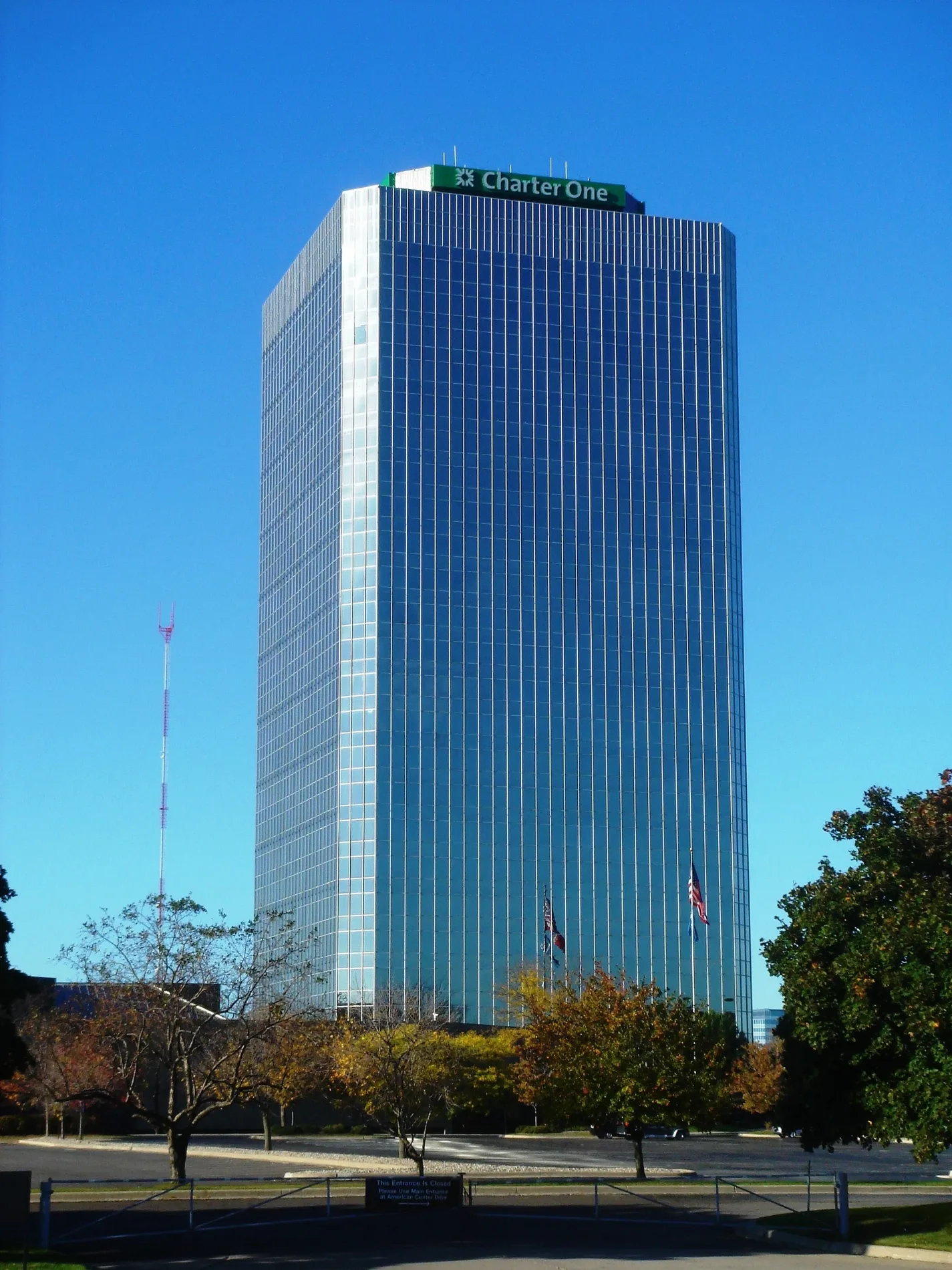
Restaurants
Bus stops
Streets nearby
Walter P Reuther Freeway0.2 mi
American DriveAmerican / 27777 (EB), American / Hantz Bank (EB), American / Hantz Bank (WB), American / Hantz Group (WB), American / Veoneer (NB), American / Veoneer (SB), American / 11 Mile NS (SB), American / 11 Mile (NB)
0.3 mi
Centre Drive0.3 mi
Lockdale Street0.3 mi
Case Avenue0.3 mi
John C Lodge Freeway0.3 mi
Beck Road0.4 mi
West 11 Mile RoadHenry Ford Medical Center - Southfield, 11 Mile / Knob in the Woods (EB), 11 Mile / Carnegie Park Apts (EB), 11 Mile / Berkshire (WB), 11 Mile / Harvard (WB), 11 Mile / Noah's Marketplace (WB), 11 Mile / VPA (WB), 11 Mile / Corporate (EB), 11 Mile / Lahser (EB), Dollar Tree, Dollar General, 11 Mile / Inkster NS (WB), 7-Eleven, Palace Party Shoppe, Exposed Barbershop, 11 Mile / Central Park NS (EB), 11 Mile / Stanford (EB), 11 Mile / Stanford (WB), 11 Mile / Carnegie Park Apts NS (WB), 11 Mile / Federal Mogul (WB), 11 Mile / Inkster (EB), CVS Pharmacy, Mobil, Mobil Mart, 11 Mile / Arlington (WB), 11 Mile / Arlington (EB)
0.5 mi
Franklin RoadSunoco, Franklin / Center (SB), Franklin / Telegraph (NB), Franklin / Muerland (SB), Franklin / Muerland (NB), Franklin / Swanson (NB), Franklin / Coral Gables NS (NB), Franklin / Coral Gables (SB), Franklin / Village Club Apts (SB), Franklin / Regal Towers (NB), Franklin / Regency Office Park (NB), Franklin / Regal Towers (SB)
0.5 mi
Telegraph RoadBP Shop, Telegraph / Franklin (SB), Telegraph / 10 Mile (SB), Telegraph / Swanson (SB), Sunoco, Telegraph / Farmbrook (SB), Telegraph / Paige Toyota (NB), Honda Tamaroff, Nissan Tamaroff, Popeyes, Telegraph / Northwestern Service Drive (NB), Chipotle, Great Expressions Dental, LensCrafters, Be Nails, Chick-fil-A, Telegraph / Garner (SB), Marathon, BP, Tesla Service, Southfield Center Party Store, Hayes Market, Telegraph / 12 Mile (SB), Foot Locker, Blaze Pizza, Sam's Shoe Service, Shish Kabob, Flaming Wok, Telegraph / Tim Horton's (SB), Kerby's Koney Island, Telegraph / Civic Center (NB), Telegraph / 10 Mile (NB), Gordon Food Service, Telegraph / 10 Mile NS (NB), McDonald's, Telegraph / 24307 (SB), Telegraph / Garner (NB), Telegraph / 9 Mile (SB), Telegraph / Norcrest (NB), Alpha21, Telegraph / 21400 (NB), Telegraph / SHAW (NB), Telegraph / Sargent (SB), Wendy's, Telegraph / Hazelhurst (SB), Telegraph / Link NS (SB), Lachman and Company, Belle Tire, Telegraph / 12 Mile (NB), Telegraph / 9 Mile (NB)
0.5 mi
Northwestern Service Drive0.5 mi
Coral Gables Street0.6 mi
Wellington Street0.6 mi
Tiffany Drive East0.6 mi
Galleria Officentre0.6 mi
West 12 Mile Road12 Mile / Red Leaf (WB), 12 Mile / Red Leaf (EB), 12 Mile / Streamwood (WB), 12 Mile / Streamwood (EB), Akiva Hebrew Day School, 12 Mile / Bermuda (WB), 12 Mile / Murray Crescent (WB), 12 Mile / Murray Crescent (EB), 12 Mile / Monterey (EB), 12 Mile / Wildbrook (WB), 12 Mile / Ivanhoe (EB), 12 Mile / Briarbank (WB), 12 Mile / Brooks (WB), 12 Mile / Walnut Grove (EB), 12 Mile / Northwestern (WB), 12 Mile / Case (WB), 12 Mile / Dufty NS (EB), 12 Mile / Pointe O Woods (WB), 12 Mile / Credit Acceptance (EB), 12 Mile / Franklin Hills (WB), 12 Mile / Franklin Hills (EB), 12 Mile / Diamond Plaza (WB), 12 Mile / Franklin (EB), 12 Mile / Lakes Apartments (WB), 12 Mile / Pebblecreek Parkway (WB), 12 Mile / San Marino (EB), 12 Mile / San Marino (WB), 12 Mile / Telegraph Drop-Off (EB), 12 Mile / Northwestern (EB), 12 Mile / Northwestern NS (WB), 12 Mile / Bell NS (EB), 12 Mile / Franklin River (EB), Mr. Kabob Xpress Grille & Catering, Five Guys, 12 Mile / Telegraph (WB), AT&T, BP, 12 Mile / Sutherland (EB), 12 Mile / Everett (WB), 12 Mile / Fairfax (EB), K&A Party Store, 12 Mile / Westbrook (WB), 12 Mile / Heritage (EB), 12 Mile / Evergreen (WB), 12 Mile / Ranchwood (EB), 12 Mile / Stellamar (WB), 12 Mile / Shiraz Law Firm (EB), 12 Mile / Lockdale (EB), 12 Mile / Bloomfield (WB), 12 Mile / Rock Creek (WB), 12 Mile / Rock Creek (EB), Sharon Stewart PC, Rodolfo Farhy, MD, FACC, FAHA, 12 Mile / Greenfield (WB), 12 Mile / Pierce NS (WB), 12 Mile / Guy (EB), 12 Mile / Southfield (EB), Marathon, E-Z Petroleum, 12 Mile / Bermuda (EB), 12 Mile / Bell (WB), 12 Mile / Lahser (EB), 12 Mile / Lahser (WB), 12 Mile / Dufty (WB), 12 Mile / Telegraph (EB), 12 Mile / Inkster (EB), 12 Mile / Evergreen NS (WB), Shell, Stop & Go, 12 Mile / Evergreen (EB), CVS Pharmacy, Tim Hortons, 12 Mile / Southfield (WB), Red Olive Family Restaurants, Lathrup Village Convenience, Jimmy John's, Donut Bar & Coffee, 12 Mile / Glasgow (EB), 12 Mile / Case (EB), Mobil, 12 Mile / Telegraph NS (WB), 12 Mile / Lathrup (WB), Exxon
0.6 mi
Wellington Road East0.6 mi
Pendleton Drive0.6 mi
Village Road0.7 mi
Animal shelters nearby
Almost Home Animal Haven of Southfield250 ft
Apartment buildings nearby
Village Club on Franklin0.2 mi
Buildings nearby
Comcast0.1 mi
Car dealerships nearby
Meade Lexus0.3 mi
Glassman Subaru0.6 mi
Glassman Hyundai0.6 mi
Glassman Kia0.6 mi
Southfield Chrysler Dodge Jeep Ram0.6 mi
Commercial areas nearby
Regency Office Park350 ft
Hantz Group0.3 mi
Southfield Crossing0.4 mi
Fast food restaurants nearby
Wendy's0.6 mi
Taco Bell0.6 mi
Fire stations nearby
Fire Station No. 40.6 mi
Hotels nearby
Ramada Southfield0.3 mi
Hilton Garden Inn0.3 mi
Marvins Garden Inn0.4 mi
Industrial areas nearby
Road Commission for Oakland County500 ft
Southfield Department of Public Works0.2 mi
Motels nearby
Red Roof Inn0.3 mi
Office buildings nearby
American Center0.3 mi
Residential areas nearby
Village Club Apartments0.2 mi
Tel-Twelve Place Apartments0.3 mi
Regal Towers Apartments0.5 mi
Tiffany Square Condominium0.6 mi
Franklin Village0.6 mi
Retail areas nearby
Tel-Twelve Mall0.5 mi
Streams nearby
Pernick Creek0.6 mi
Warehouses nearby
Glassman Car Warehouse0.6 mi
Other nearby
Brooks Substation0.5 mi
 Public transit map Southfield Legend
| Railway | |
| Bus | |
| Streetcar |
 Bicycle map Southfield Legend
| Bike path | |
| Bike lane on roadway | |
| Cycling allowed on bus lane | |
| Bicycle street | |
| Open to cyclists | |
| Open to cyclists, good path | |
| Cycling prohibited | |
| Cobblestone |
| Long-distance bike route | (depending on scale) | |
| Long-distance bike route |
 Pedestrian map Southfield Legend
| Path |
| Long-distance hiking trail | (depending on scale) | |
| Long-distance hiking trail | ||
| Pedestrians prohibited |