
Erne in Bun
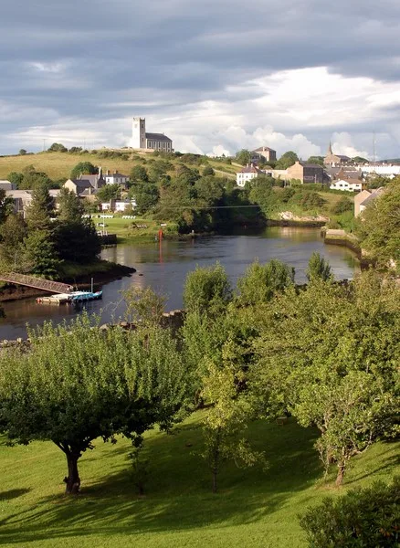
Erne in County Cavan, Bun is a river. Erne also exists in Putiaghan Lower, Quivvy, Corleggy, Portruan and Dernaglush. Ⓦ.
- Waterway Type
- river
Image
Roads nearby
Bun Lane500 m
Putiaghan Road700 m
Putiaghan Upper700 m
Bun Bessbrook Road900 m
Bessbrook Lane950 m
Cavan Road1,0 km
Putiaghan1,1 km
Drummany Lane1,2 km
Kilduff Lane1,5 km
Belturbet Bypass1,5 km
Milltown Road1,5 km
Derrhod Tullvanog Road1,6 km
Rosskeeragh Road1,6 km
Oakview Nursing Home1,7 km
Straheglin Road1,8 km
Bakers Bridge Road1,8 km
Bakers's Bridge1,9 km
Hackelty Road1,9 km
Ardan Road2,2 km
The Lodges2,2 km
Erne HillCentra, Bedrock Cafe, Top
2,3 km
Sugarloaf Road2,3 km
Black Bog Road2,3 km
Chapel RoadThe Railway Bar, Gala
2,4 km
Railway RoadWelcome to Belturbet Station, Railway Station
2,4 km
Erne Court2,4 km
Abandoned railways nearby
GNR Cavan & Leitrim Branch2,3 km
Apartment buildings nearby
Railway Buildings2,3 km
Attraction nearby
Belturbet Railway Station Visitor Centre2,4 km
Body of waters nearby
Bun Lough1,0 km
Putiaghan Lough1,1 km
Rosskeeragh Lough1,2 km
Tonawolly Lough1,4 km
Commons Lough1,6 km
Drummany Lough1,7 km
Derryhoo Lough1,7 km
Derrygeeraghan Lough1,9 km
Holy Lough2,0 km
Dawsons Lough2,2 km
Community centres nearby
Goods Store Community Centre2,4 km
Belturbet Men's Shed2,4 km
Forests nearby
Putiaghan Lower Forest1,7 km
Gardens nearby
Belturbet Community Allotments2,4 km
Museum nearby
Belturbet Heritage Railway Station Museum2,4 km
Residential areas nearby
Sugarloaf2,3 km
The Station2,3 km
Railway Lock2,4 km
Rivers nearby
Erne2,5 km
Sports pitches nearby
Astro Turf2,4 km
Wetlands nearby
Derrylina Wetland2,2 km
| Length | 116 |
|---|---|
| Country | United Kingdom, Ireland |
| Mouth | Atlantic Ocean |
| Tributary | River Annalee |
| Native label | An Éirne |
| Described by source | Granat Encyclopedic Dictionary, Encyclopædia Britannica 11th edition |
 Public transport map Bun Legend
| Railway | |
| Bus | |
| Tram |
 Cycling map Bun Legend
| Cycle path | |
| Cycle lane on road | |
| Cycling on bus lane | |
| Bicycle street | |
| Cyclists allowed | |
| Cyclists allowed, good surface | |
| No cycling | |
| Cobblestones |
| Long-distance cycle route | (depending on scale) | |
| Long-distance cycle route |
 Walking map Bun Legend
| Path |
| Long-distance hiking trail | (depending on scale) | |
| Long-distance hiking trail | ||
| No pedestrians |