
Old Queen's Road in Gibraltar
Old Queen's Road in Gibraltar is an asphalted service road. It runs as a one-way street in a south-north direction starting from Spur Battery Road and crosses Charles V Road and Green Lane and ends at Queen's Road. In the vicinity, you can find among other things 2 tourist information offices, an attraction and a viewpoint. The nearest stop is Cable Car Middle Station.
- Road Type
- service road
- Route
- north-south
Image
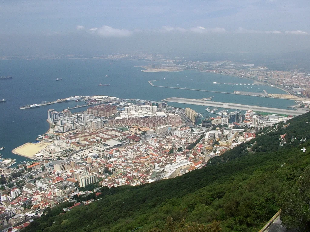
Tourist information offices
Stations
Roads nearby
Royal Anglian WayGibraltar
50 m
Windsor Suspension BridgeWindsor Suspension Bridge, Hayne's Cave Battery
200 m
Green LaneGreen Lane Northbound, Devil's Gap Battery, Green Lane Southbound
200 m
Great North RoadGreat North Road
250 m
Fosse Way250 m
Queen's RoadInglis Way, Tovey Battery
250 m
Old cemetery areaThe Alameda Open Air Theatre, Alameda Wildlife Conservation Park
300 m
Giuseppe Codali BridgeGiuseppe Codali (1847-1917), Gibraltar Castle and Key
350 m
Sandpits400 m
Gardiner's RoadGardiner's Road, The Magazine Studio Theatre, Gardiners road, Rock Gardens
400 m
Red Sands RoadCable Car Lower Station, George Don Gates, Governor's Meadow House, Alameda House, Pre-Paid Tickets, Cable Car Tickets, Ross house, Red Sands house, Kingsway house, Alameda house, Picton house, Cable Car Taxi Rank
450 m
Europa RoadEuropa Point Café, Rock Hotel, Old Casino, Piscina Rock Hotel, Shorthorn Farm, King George V Ramp, North Gorge, Garrison Gym, Mount Pleasant, Buena Vista, Eliott's Battery, Brympton, Loreto Convent School, 51 A Europa road, Buena Vista Park II, Europa mews, 63 Europa Road, 51 B Europa road
450 m
Ragged Staff Magazine500 m
Witham's RoadPlata Villa
500 m
South Barrack RoadShorthorn Farm, Schomberg, Matilde Francis Building (Francis Flats)
500 m
Boyd Street500 m
South Barrack Mews500 m
Trafalgar RoadTrafalgar Cemetery Top, Trafalgar Cemetery, Trafalgar Sports bar, Trafalgar Taxi Rank
550 m
St Bernard's Road550 m
QueenswayNew Harbours Industrial Estate, Edinburgh House, Leisure Cinemas, Park view house, Commonwealth Park, Queensway Quay East, Queensway Quay, King's Wharf, The Lounge Bar & Gastro Bar, Casa Pepe, Vithas Xanit Gibraltar, Mid-Town
550 m
Eliott's WayMama Mia, Eliott's Way
550 m
68 Queensway550 m
Armstrong's Steps550 m
Engineer RoadMount Alvernia, Griffon house, Goldcrest views, 2B ENGINEERS ROAD
550 m
Upper Witham's RoadKnights court
600 m
South Shed's Place11 scud hill
600 m
Rodger's RoadLord Napier Mews
650 m
Rodger's Steps650 m
Buildings nearby
Cable Car Lower Station450 m
Buildings nearby
Old Casino250 m
Library and Exibition400 m
Old Power Station Chimney550 m
Naval Dockyard Power Station550 m
Cemeteries nearby
Witham's Cemetery450 m
Commercial buildings nearby
GBC Broadcasting House550 m
Fire stations nearby
Gibraltar Fire and Rescue Service450 m
Gardens nearby
The Italian Gardens in the Dell300 m
Hospitals nearby
King George V Hospital (KG5)450 m
Hotels nearby
The Rock Hotel Pool Area250 m
The Rock Hotel250 m
Military areas nearby
His Majesty's Naval Base Gibraltar550 m
Parks nearby
La Bateria BoulevardGym
500 m
Residential areas nearby
Alameda Estate400 m
Sheds nearby
Withams Road500 m
Sports pitches nearby
Sandpits tennis courts350 m
Tourist information offices nearby
The Nature Shop400 m
Zoo nearby
Alameda Wildlife and Conservation Park300 m
Other nearby
Charles V Wall100 m
Line Wall Curtain500 m
Public transport map Gibraltar Legend
| Railway | |
| Bus | |
| Tram |
Cycling map Gibraltar Legend
| Cycle path | |
| Cycle lane on road | |
| Cycling on bus lane | |
| Bicycle street | |
| Cyclists allowed | |
| Cyclists allowed, good surface | |
| No cycling | |
| Cobblestones |
| Long-distance cycle route | (depending on scale) | |
| Long-distance cycle route |
Walking map Gibraltar Legend
| Path |
| Long-distance hiking trail | (depending on scale) | |
| Long-distance hiking trail | ||
| No pedestrians |