
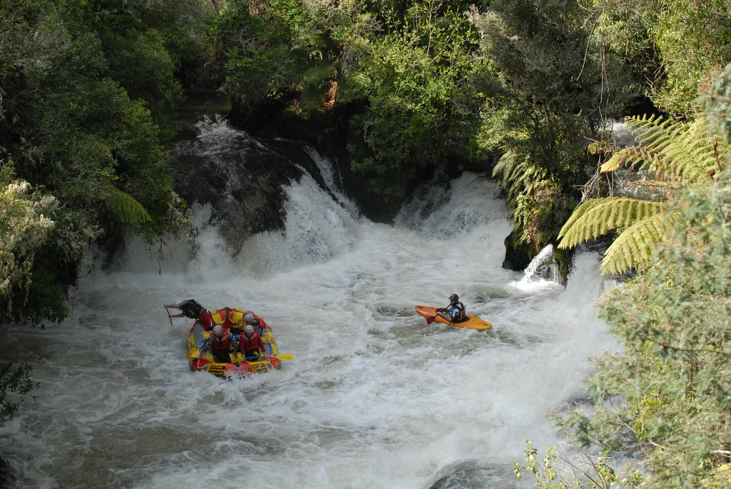
Kaituna River in Rotorua Lakes District
Kaituna River in Rotorua Lakes District is a river. Ⓦ.
- Waterway Type
- river
Image
Hotels
Beer gardens
Public baths
Viewpoint
Attraction
Cafés
Guest house
Fast food restaurants
Convenience stores
Places of worship
Bus stops
Garden centres
Roads nearby
Kaharoa Kokako Track3,8 km
Ōkere Falls Track5,7 km
Kaharoa RoadRotongata
5,7 km
Tutea Caves Track6,0 km
Okere Falls RoadKaituna Cascades Rafting Company
6,1 km
Lichenstein Road6,1 km
Otaramarae Road6,4 km
Trout Pool Road6,5 km
State Highway 33Mourea, Tokerau, Mourea Mini Mart, Mourea Kitchen, The Happy Angler, Mourea Coffee, Ōkere Falls
6,7 km
Okere Falls to Mourea shared pathOkere Falls Store, Okere Falls Beer Garden
6,8 km
Taheke Road6,8 km
Vercoe Place6,8 km
Kahuera Road6,9 km
Malvern Road6,9 km
Okere Road7,0 km
Kapukapu Road7,1 km
Maungarangi Road7,2 km
Hoko Road7,6 km
Ridge RoadOld bikes
7,6 km
Whangamoa DriveOtaramarae
7,6 km
Maniatutu Road7,8 km
Clark Road8,2 km
Te Akau RoadRotoiti Lakeside Lodge
8,2 km
Rangiuru RoadTia Marae
8,3 km
Goulding Road8,4 km
Benham Road8,5 km
Foster Road8,7 km
Penny Road8,8 km
Allport Road8,9 km
Attraction nearby
Rotorua Rafting6,7 km
Body of waters nearby
Lake Rotongata7,1 km
Buildings nearby
Okere Falls telephone exchange6,6 km
Rivers nearby
Paraiti River6,8 km
Streams nearby
Hururu Stream3,2 km
Onaia Stream4,6 km
Onepu Stream4,6 km
Ruato Stream4,7 km
Upokoongauru Stream5,7 km
Oeuteheuheu Stream6,2 km
Pokopoko Stream6,2 km
Otamamariri Stream7,1 km
Waiari Stream7,6 km
Waiwhakareto Stream8,0 km
Kiwi Stream8,2 km
Ruru Stream8,5 km
Pakipaki Stream8,5 km
| Length | 50 |
|---|---|
| Located in | Bay of Plenty Region, Western Bay of Plenty District, Rotorua Lakes District |
| Country | New Zealand |
| Origin | Ōkere Inlet, Lake Rotoiti / Te Roto kite ā Ihenga i ariki ai Kahu |
| Mouth | Bay of Plenty |
| Tributary | Onepu Stream, Hururu Stream, Paraiti River, Pakipaki Stream, Parawhenuamea Stream, Waiari Stream, Raparapahoe Canal, Kopuaroa Canal |
| Has part | Okere Falls, Kaituna Falls |
 Public transport map Rotorua Lakes District Legend
| Railway | |
| Bus | |
| Tram |
 Cycling map Rotorua Lakes District Legend
| Cycle path | |
| Cycle lane on road | |
| Cycling on bus lane | |
| Bicycle street | |
| Cyclists allowed | |
| Cyclists allowed, good surface | |
| No cycling | |
| Cobblestones |
| Long-distance cycle route | (depending on scale) | |
| Long-distance cycle route |
 Walking map Rotorua Lakes District Legend
| Path |
| Long-distance hiking trail | (depending on scale) | |
| Long-distance hiking trail | ||
| No pedestrians |