
SuperDARN (TIGER-Unwin) in Invercargill City
SuperDARN (TIGER-Unwin) in Invercargill City is a research institute (La Trobe University (Australia)) 🌐. SuperDARN (TIGER-Unwin) is also known as Super Dual Auroral Radar Network. SuperDARN (TIGER-Unwin) is near Invercargill Bluff Trail. Ⓦ.
- Alternative Name
- Super Dual Auroral Radar Network
- Amenity
- research institute
- Land Use
- meadow
- Operator
- La Trobe University (Australia)
- Website
- http://superdarn.org/
Image
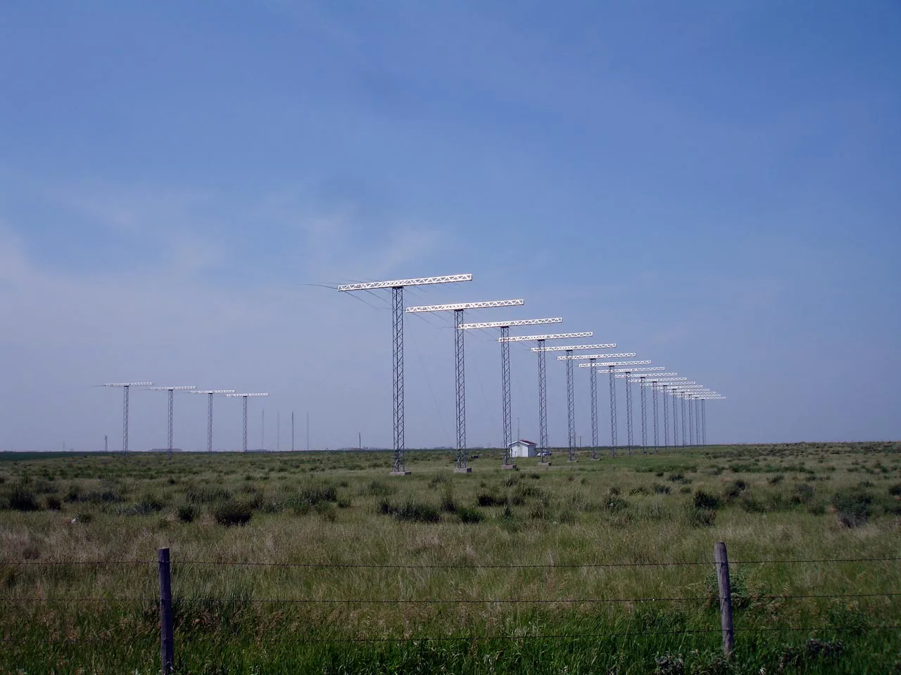
Attraction
Museum
- Awarua Communications Museum (opening hours: Sun 13–16, web) at Bluff Highway 1276 (9877) – approx. 900 m.
Fire station
Bus stops
Roads nearby
Hamilton Road1,1 km
Invercargill Bluff TrailEarly Sewerage Pipeline, The Changing Face of Pleasure Bay, Southern Light, Lady Barkly steam locomotive, Great Northern Railway, Otatara Tramway, Port of Invercargill, Changing face of the New River Estuary, 9/Bluff Line, 25/Bluff Line, Te Ahirari / Greenhills, 20/Bluff Line, 21/Bluff Line, Oysters
1,2 km
Awarua Siding Road1,9 km
Kekeno Place2,4 km
Colyer Road3,0 km
Garrett Road3,2 km
Awarua School Road3,9 km
Grange Road3,9 km
Mackay Road4,0 km
Dover Street4,0 km
Kent Street4,1 km
Devon Street4,1 km
Dale Street4,2 km
Ritchie Road4,2 km
Bluff Highway7/Bluff Line, 8/Bluff Line, 2/Bluff Line, 4/Bluff Line, 3/Bluff Line, 5/Bluff Line, Southland Phosphat Siding, 10/Bluff Line, 11/Bluff Line, 12/Bluff Line, 13/Bluff Line, 14/Bluff Line, 15/Bluff Line, 16/Bluff Line, 17/Bluff Line
4,3 km
Derby Street4,3 km
Somerville Street4,3 km
Pilcher Road4,3 km
Sussex Street4,3 km
Blyth StreetWoodend
4,4 km
Essex Street4,4 km
Dorset Street4,4 km
Stanley Township Road4,6 km
Gell Road4,9 km
Bayview Road4,9 km
Harewood Road5,0 km
Motu Rimu RoadMotu Rimu, Waimatua
5,2 km
Wilson Road South5,3 km
Heenan Road5,3 km
Boundary Road5,4 km
Hall Road5,5 km
Lee Road5,5 km
Bath Road5,5 km
Old Bluff Highway18/Bluff Line
5,6 km
Heale Street5,7 km
Chesney Street10 Chesney Street
6,0 km
Princes Road19/Bluff Line, Greenhills Church
6,3 km
Chalmers Road6,5 km
Community centres nearby
Woodend Hall4,3 km
Industrial areas nearby
Awarua Starlink Earth Station2,1 km
Ballance Agri-Nutrients2,6 km
Southwood Chip Mill2,7 km
Military areas nearby
Awarua Satellite Ground Station1,9 km
Parks nearby
Woodend Hall Reserve4,2 km
Blyth Reserve4,5 km
Railway lines nearby
Bluff Line4,1 km
Rivers nearby
Mokotua Stream2,4 km
Streams nearby
Waipaka Creek1,7 km
Waimatua or Duck Creek5,0 km
| Has part | Unwin Radar |
|---|
Public transport map Invercargill City Legend
| Railway | |
| Bus | |
| Tram |
Cycling map Invercargill City Legend
| Cycle path | |
| Cycle lane on road | |
| Cycling on bus lane | |
| Bicycle street | |
| Cyclists allowed | |
| Cyclists allowed, good surface | |
| No cycling | |
| Cobblestones |
| Long-distance cycle route | (depending on scale) | |
| Long-distance cycle route |
Walking map Invercargill City Legend
| Path |
| Long-distance hiking trail | (depending on scale) | |
| Long-distance hiking trail | ||
| No pedestrians |