
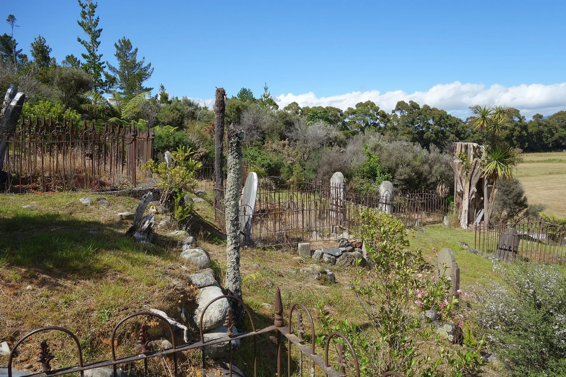
Collingwood Historic Cemetery in Tasman District
Collingwood Historic Cemetery in Tasman District is a cemetery. Collingwood Historic Cemetery is also known as Collingwood Old Cemetery.
- Land Use
- cemetery
Image
Museum
Attraction
Pensionen
Recycling centres
Hostel
Viewpoint
Gallery
- Estuary Arts (web) at Takaka-Collingwood Highway (7182) – approx. 3,6 km.
Confectioneries
Cafés
Bakeries
Benches
Restaurants
Tourist information offices
Petrol stations
Motel
Chalet
Roads nearby
Collingwood Heritage WalkLookout
200 m
Excellent Street200 m
Orion Street350 m
Old Topsail Street550 m
McDonald Place600 m
McDonald Place Walkway650 m
Ruataniwha Drive700 m
Lewis Street750 m
Collingwood Quay Walkway750 m
Beach RoadTrowel Trades Nelson, Rosy Glow Chocolate, Gibbstown
750 m
Washington Street800 m
Collingwood Quay800 m
Swiftsure Street800 m
Takaka-Collingwood HighwayThe Mussel Inn, Puramāhoi, Golden Bay Lookout, Bishops Saddle
850 m
Haven RoadHeritage panel, South fuels
850 m
Gibbs Road900 m
Poplar Lane950 m
Elizabeth StreetThe Station House Motel, VE Day Bench, VJ Day Bench
1000 m
Tasman StreetCollingwood Museum, Collingwood Tavern, Pioneer Motels, M.A.D. Café Golden Bay
1000 m
William Street1,2 km
Leslie's LookoutLeslie's lookout
1,6 km
Collingwood-Bainham Main RoadWodwork Gallery, Golden Bay Machinery & Early Settlers Museum, Rockville, Aorere, Collingwood Resource Recovery Centre, Bainham
1,6 km
Redwood Trail1,7 km
Mitch's Loop2,1 km
Rimu Flats2,1 km
Round the MountainThe Old Buggers Bench
2,2 km
Bishop's Saddle Track2,3 km
Milkwood2,3 km
Elise's Way2,4 km
Frampton's Fairway2,4 km
Ian's Incline2,5 km
The Old Master2,5 km
Hovenden's Hole2,5 km
Beehive Boulevard2,6 km
Bob's Bit2,6 km
Pakihi Path2,6 km
Buildings nearby
St John Ambulance300 m
Collingwood Old Police Station1000 m
Farewell Spit Eco Tours1,0 km
Collingwood Post & Telegraph Office1,1 km
Cafés nearby
Courthouse Cafe1000 m
Campsite nearby
Collingwood Camping Ground1,2 km
Cemeteries nearby
Collingwood Cemetery1,1 km
Fire stations nearby
Collingwood Fire Station1,0 km
General stores nearby
On the Spot1,1 km
Industrial buildings nearby
HealthPost300 m
Parks nearby
Ruataniwha Reserve700 m
Places of worship nearby
Saint Cuthbert's Church950 m
Streams nearby
Burton Ale Creek1,4 km
| Located in | Tasman District |
|---|---|
| Country | New Zealand |
 Public transport map Tasman District Legend
| Railway | |
| Bus | |
| Tram |
 Cycling map Tasman District Legend
| Cycle path | |
| Cycle lane on road | |
| Cycling on bus lane | |
| Bicycle street | |
| Cyclists allowed | |
| Cyclists allowed, good surface | |
| No cycling | |
| Cobblestones |
| Long-distance cycle route | (depending on scale) | |
| Long-distance cycle route |
 Walking map Tasman District Legend
| Path |
| Long-distance hiking trail | (depending on scale) | |
| Long-distance hiking trail | ||
| No pedestrians |