
Memorial Park in Tasman District
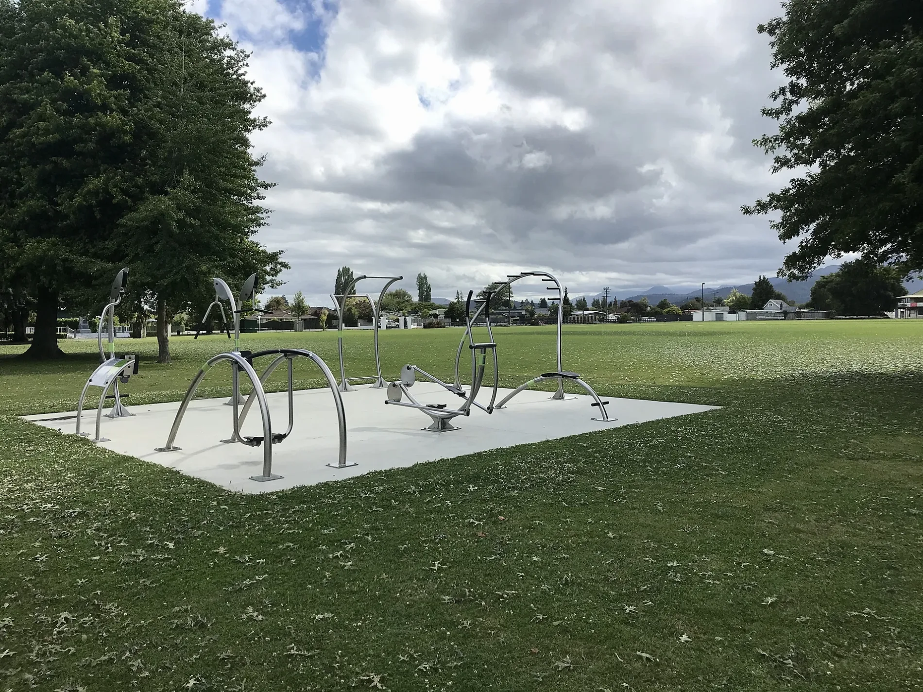
Memorial Park in Tasman District is a park. Memorial Park is near Michael Myers Street. Ⓦ.
- Leisure
- park
Image
Convenience stores
Dentist
Bakeries
Beauty salons
Hairdressers
Bank
Restaurants
Computer shops
Paint shops
Massage parlours
Cafés
Fast food restaurants
Public toilet
Pubs
Off-licences
Pharmacy
Clothing shops
Roads nearby
High StreetChokdee, Smoking Barrel, Steph Wills Dental, Pizza Kitchen, Reddys Mini Mart, Diamond Nails, BP 2 Go, High Street at Avalon Manor Motel, High Street near Woodlands Avenue, Avalon Manor Motel, Abel Tasman Motel, Happy Apple Backpackers, Toad Hall Cafe, High Street near Abbey Way, High Street near Motueka South School, 406 High Street, Mouteka Volunteer Fire Brigade, Liquorland, Affordable Computer, MyRide, Taste of Turkey, Rolling Pin Bakery, Hotel Motueka, Bridgestone, Westpac, Unichem, Bay Pharmacy, Muses Cafe, Subway, Simply Indian, Patisserie Royale - Bakery & Cafe, Lanna Thai Cuisine, Domino's, Paper Plus, Street Food Of China, Floral Studio, Dissaya Thai Massage, Betta Electrical, Dissaya, Dollarama, Ormolu, Onyx Hair, NZ Post, Smile Clothing NZ, Health 2000, BNZ, Delicious simply good food, Asian Food Store, Astrolabe Fashion, High Street Chinese Takeaways, Paper Nautilus, The Denture Clinic, Green World Health & Lifestyle, Kullawa, Paper Nautilus Cafe, Motueka Backpackers, Beet Root, NBS, Elevation Cafe Restaurant Bar, Tasman Bay Jewellers, Stirling Sports, Potters Patch, House of Travel, Habitat for Humanity ReStore, Whitwells Footwear, Saville's Giftware, Hair Edit, Bliss Hair, Westrupp Jewellers, Super Liquor, Caltex, Antonius Bakery, Coppins Outdoors & Cycles, Mitre 10, Motueka Bakery & Cafe, On The Spot, Hospice Shop, Wash Room, Revite Cafe, Bay Bridle, Bowater Toyota, Crystals & Gifts, The Happy Chippie, KFC, Tyre General
150 m
Sarah Lane200 m
Michael Myers Street250 m
Poole StreetPoole Street No34, Poole Street No29
250 m
Talbot StreetRichmond
250 m
Irvines LaneNZ Post, Laundry or Naked, Little Red Coffee Cart, Fusion Hair, Motueka Community House
300 m
Bennett Street300 m
Selwyn StreetSunflower motel
300 m
Hart LaneThe Sprig & Fern Tavern, The Gecko Cinema
350 m
Wallace StreetMotueka i-SITE Vistors Centre, The Doctors Motueka, Hat Trick Lodge, Life Pharmacy, Motueka Library Wallace Street
350 m
Bowers Lane350 m
Te Maatu Drive350 m
Eginton Street400 m
Simpson Street400 m
Vosper Street400 m
Wharepapa Grove400 m
Naumai Street450 m
Hohaia Place450 m
Jocelyn Avenue450 m
McGlashen Street450 m
Te Puketea Lane450 m
Inglis StreetNautilus Lodge Motel, Inglis Street at Vosper Street, Inglis Street at Saxon Street
500 m
Apo Place500 m
Wilkie Street500 m
Fry Street500 m
Kitakita Grove500 m
Pukeone Place550 m
Ngapiko Place600 m
Pā StreetPost Office Hotel, Restroom, The Pah Street Cafe
600 m
Parker Street650 m
Atkins Street750 m
Hulbert Street800 m
Buildings nearby
Old Motueka Library50 m
Community centres nearby
Memorial Hall50 m
Libraries nearby
Motueka Library Te Noninga Kumu350 m
Parks nearby
Decks Reserve300 m
Pethybridge Rose Garden400 m
Wharepapa Grove Reserve500 m
Ngapiko Place Reserve500 m
Parker Street Reserve600 m
Places of worship nearby
Saint Thomas Anglican Church200 m
Motueka Baptist Church250 m
Motueka Uniting Parish300 m
Victory Christian Church600 m
Social facilities nearby
Abbeyfield House550 m
Sports pitches nearby
Tennis Courts100 m
Sports Park450 m
Supermarkets nearby
Woolworths100 m
Tourist information offices nearby
iSite350 m
| Located in | Tasman District |
|---|---|
| Country | New Zealand |
| Has part | Memorial Park outdoorgym |
| Location | Motueka |
 Public transport map Tasman District Legend
| Railway | |
| Bus | |
| Tram |
 Cycling map Tasman District Legend
| Cycle path | |
| Cycle lane on road | |
| Cycling on bus lane | |
| Bicycle street | |
| Cyclists allowed | |
| Cyclists allowed, good surface | |
| No cycling | |
| Cobblestones |
| Long-distance cycle route | (depending on scale) | |
| Long-distance cycle route |
 Walking map Tasman District Legend
| Path |
| Long-distance hiking trail | (depending on scale) | |
| Long-distance hiking trail | ||
| No pedestrians |