
Motueka River in Tasman District
Motueka River in Tasman District is a river. Ⓦ.
- Waterway Type
- river
Image
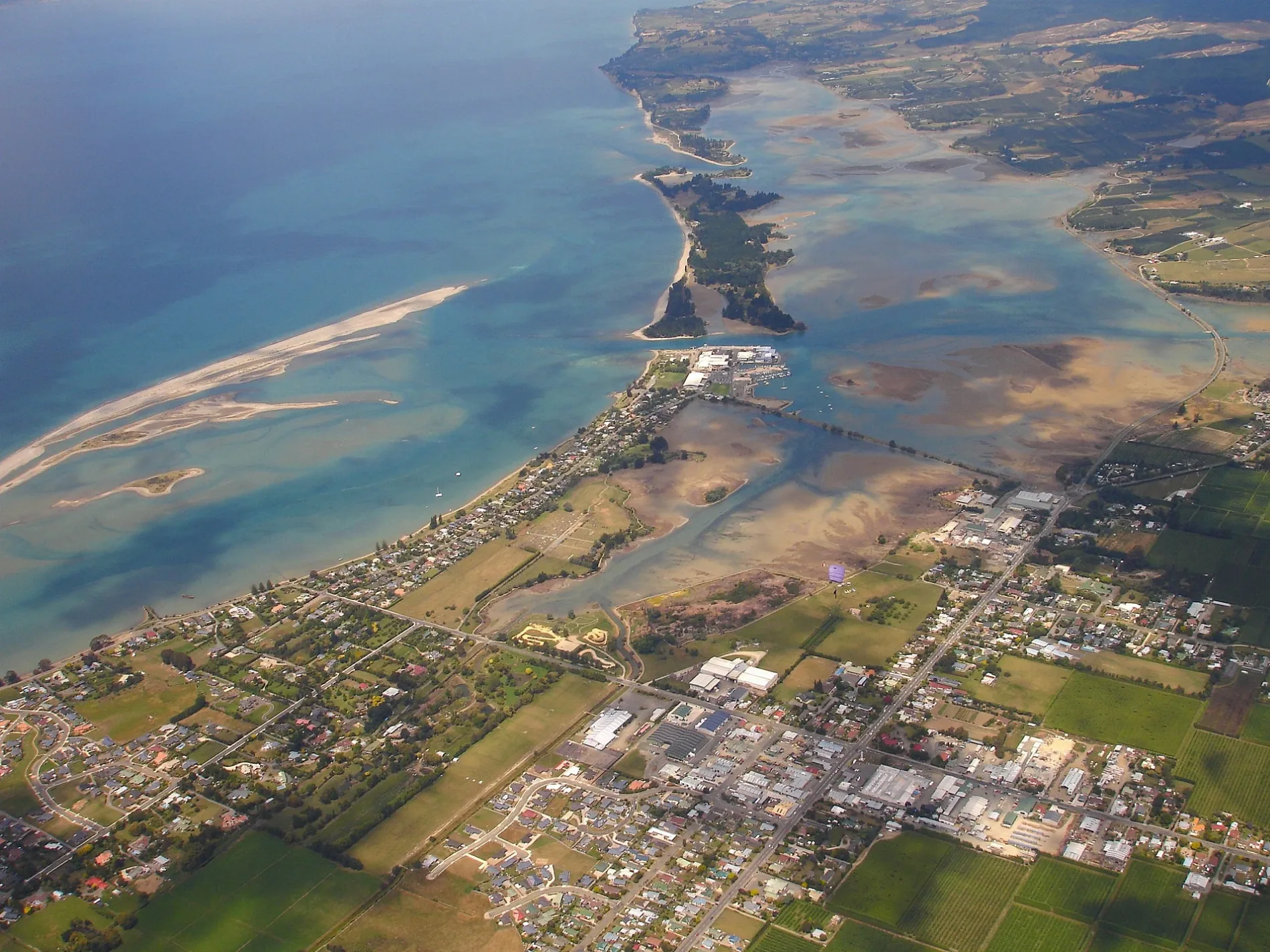
Motel
Petrol stations
Greengrocers
Convenience stores
Clothing shops
Bus stops
Tourist information offices
Public toilet
Charity shops
Fast food restaurants
Car parts shops
Off-licences
Hostel
Restaurants
Roads nearby
Douglas Road1,0 km
Peach Island Road1,1 km
Chamberlain Street1,4 km
Motueka River West Bank RoadBlue Gum Corner, Oke Manga Services Mechanical Repairs
1,5 km
College Street1,7 km
Pamariki Street1,9 km
Mickell Road2,0 km
Stony Ridge Way2,1 km
Linden Place2,1 km
Pā Street West2,2 km
Marchwood Park Road2,2 km
Shaggery Road2,3 km
Old Mill Road2,4 km
Starnes Road2,4 km
Motueka Valley HighwayMararewa, Ngātīmoti, Pokororo, River Haven Cafe, Pangatōtara, Stanley Brook, Kohatu Hotel, Kōhatu, Flat Rock Café, Flat Rock Cafe - Kohatu
2,4 km
Brooklyn Valley Road2,4 km
Whakarewa StreetMcDonald's
2,5 km
Thomason AvenueAbel Tasman Canyons
2,5 km
Te Ara o Tūrangaapeke2,6 km
Anderson Road2,6 km
Hurley Road2,6 km
Green Lane2,6 km
Hursthouse Street2,7 km
Queen Victoria StreetVictoria Gardens Fruit & Veges
2,7 km
Pā StreetPost Office Hotel, Restroom, The Pah Street Cafe
2,7 km
Umukuri Road2,7 km
Wellspring Place2,8 km
Hau Road2,9 km
Kuini Place2,9 km
Rore Street3,0 km
Poole StreetPoole Street No34, Poole Street No29
3,0 km
Amenities nearby
Te Awhina Marae2,6 km
Buildings nearby
Motueka Aero Club2,3 km
Skydive Abel Tasman2,4 km
Nelson Aviation College2,5 km
Cafés nearby
Hangar Round Cafe2,3 km
Cemeteries nearby
Te Uma1,8 km
Fire stations nearby
Tasman Volunteer Rural Fire Force2,5 km
Hangars nearby
Argus Aviation2,3 km
Skydive Abel Tasman Hangar2,5 km
TNT Helicopters Flight Training2,5 km
Industrial areas nearby
Z Aviation2,2 km
Former Tobacco Warehouse3,0 km
Parks nearby
Linden Place Reserve2,1 km
Brooklyn Stream Esplanade Reserve2,2 km
Brooklyn Reserve2,5 km
Streams nearby
Brooklyn Stream2,5 km
Warehouses nearby
Golden Bay Fruit2,5 km
Other nearby
Motueka Airport2,2 km
| Length | 120 |
|---|---|
| Located in | Tasman District |
| Country | New Zealand |
| Mouth | Tasman Bay / Te Tai-o-Aorere |
| Tributary | Baton River, Dove River, Little Pokororo River, Motupiko River, Pokororo River, Tadmor River, Wangapeka River, Pearse River |
 Public transport map Tasman District Legend
| Railway | |
| Bus | |
| Tram |
 Cycling map Tasman District Legend
| Cycle path | |
| Cycle lane on road | |
| Cycling on bus lane | |
| Bicycle street | |
| Cyclists allowed | |
| Cyclists allowed, good surface | |
| No cycling | |
| Cobblestones |
| Long-distance cycle route | (depending on scale) | |
| Long-distance cycle route |
 Walking map Tasman District Legend
| Path |
| Long-distance hiking trail | (depending on scale) | |
| Long-distance hiking trail | ||
| No pedestrians |