
Akona Lane in Hamilton City
Akona Lane in Hamilton City is an asphalted residential street (40 km/h, destination only). It runs in a north-south direction and ends at Brookfield Street, while the other end is a cul-de-sac.
- Road Type
- residential street
- Speed Limit
- 40
- Route
- north-south
Image
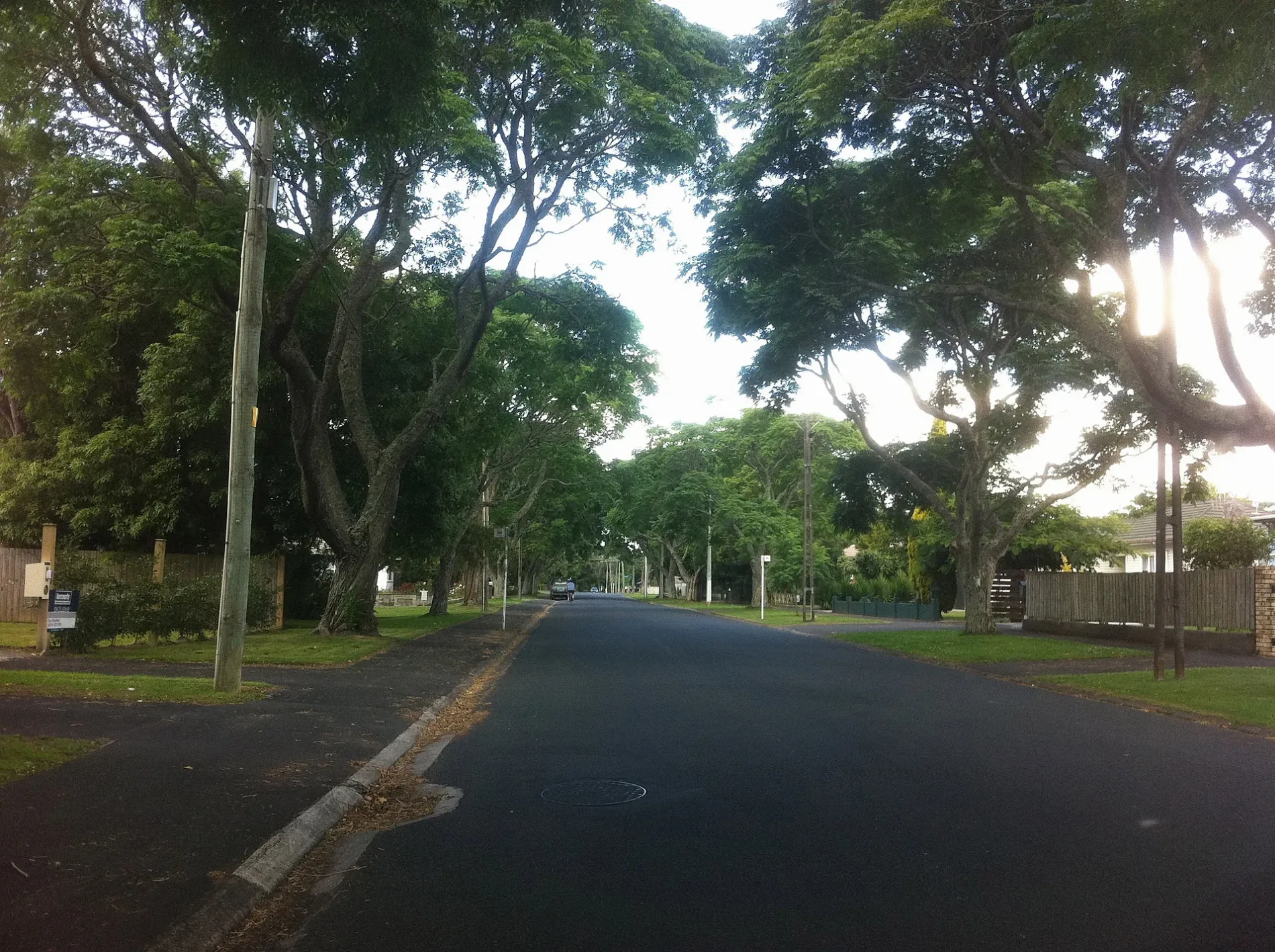
Car repair shops
Bus stops
Roads nearby
Brookfield Street110 Brookfield St, 65 Brookfield St, 49 Brookfield St, 82 Brookfield St, 37 Brookfield St, 50 Brookfield St, Fush n Chups Takeaways, 38 Brookfield St, 27 Brookfield St, 26B Brookfield St, 21 Brookfield St
200 m
Melrose Place200 m
Cotter Place250 m
Cobham DriveWairere Drive, Little Bull sculpture
350 m
Graham Street350 m
Sillary Street350 m
Newall Street350 m
Sillary Street Underpass400 m
Freyberg Street400 m
Galloway Street64 Galloway St, 14A Galloway St, 15 Galloway St
450 m
Wiremu Street500 m
Grey StreetManhattan Lodge Motel, Eastside Drycleaners, Juni Uni Preschool, 123 Grey St, 126 Grey St (Jetts fitness centre), 181 Grey St (Albert Court Motor Lodge), 248 Grey St, Thyme Square, Muse Hairdressing, Style House, 528 Grey St, 541 Grey St, Acuppa Cafe, Subway, Airscream, Kelly Cafe & Bakery, Babaganush, Feet First, Thai Orchid, Salvation Army Family Store, La Cherie, 2+ Dollar Shop, Scissor Sound, Hamilton East Dental Centre, Coffee Since Yesterday, Neon Nail & Beauty, Reburger, Jingles, Roast Plus, Hazelwood Digital Copy Centre, The Vape Shed, Nom Nom Korean Street Food, Tudor Dairy, Recycle Boutique, Red Cross, Grey Street Chippery, Books for Kids, Glam Hair & Beauty, Novi Roast, Sportsfuel, The 123 Mart, The Welcome Swallow, Pizza Club, 401 Grey St, 430 Grey St, Viands Brothers Bakery, Carl's Jr., Lord of the Fries, Singeasy Karaoke, Pita Pit, Rice Rice Baby, Waikato Udon, Eco Travels, DownLow burgers, Crystal Laundromat, Shosha, SPCA Op Shop, Salem Afghan Fool, Steff's Takeaways, Silver Star Bakery & Cafe, 668 Grey St, 669 Grey St, McDonald's, 291 Grey St, Opp 315 Grey St (Steele Park), Emm Jay Dairy, Pizza Hut, Hamilton East Pharmacy, Sushi Box, Manbok Asian Grocery, That's a Wrap Ltd, Heidi Art Picture Framing, Cheep Liquor, The Barber Shoppe, Sewing On Grey, Claudelands Coiffure, Nori Tori Japanese Eatery, Green Patch, Wholly Cow Butchery, Scoff, Dumpling House, Naturally Healthy
550 m
Firth StreetHamilton East
550 m
Findlay Street550 m
Albert Street600 m
Nixon Street600 m
Natland Street650 m
Wellington Street20 Wellington St, Opp 20 Wellington St, 38 Wellington St, Opp 38 Wellington St (Steele Park), 68 Wellington St, 43 Wellington St, 88 Wellington St, 55 Wellington St, L.K. Coffee Hub, 1 Wellington St, 2 Wellington St, 18 Wellington St, 19 Wellington St, 100 Wellington St, 69 Wellington St
700 m
Brown Street750 m
Coates Street800 m
Amenities nearby
Tolbecs Ear Centre400 m
Buildings nearby
Waikato Contract Bridge Club150 m
Claudelands Rovers Sports Club650 m
Hamilton East telephone exchange650 m
Commercial buildings nearby
Peter Granville CA550 m
Convenience stores nearby
Grey Street Supermarket400 m
Manhattan Dairy600 m
Dental practices nearby
Old Villa Dental Centre200 m
New Smile450 m
Fitness centres nearby
Jetts Fitness350 m
Funeral directors nearby
Pellows400 m
Gas suppliers nearby
Gas Pro400 m
Hardware shops nearby
Stihl450 m
Motel nearby
Hamilton Gardens Motel300 m
Albert Court Motor Lodge600 m
Aspen Manor Motel650 m
Nursing homes nearby
Eventhorpe Rest Home and Hospital150 m
Office buildings nearby
Link250 m
Hamilton East Community LInk350 m
Parks nearby
Galloway Park600 m
Places of worship nearby
Chanel Centre200 m
Hamilton Bible Church250 m
St James Anglican Church350 m
Hope Chapel / C3 Hamilton450 m
Knox Presbyterian Church450 m
Retail buildings nearby
Tops N Tales Costume Hire200 m
Sports pitches nearby
Hamilton East Croquet Club600 m
Training centres nearby
The Effect200 m
First Training Waikato500 m
 Public transport map Hamilton City Legend
| Railway | |
| Bus | |
| Tram |
 Cycling map Hamilton City Legend
| Cycle path | |
| Cycle lane on road | |
| Cycling on bus lane | |
| Bicycle street | |
| Cyclists allowed | |
| Cyclists allowed, good surface | |
| No cycling | |
| Cobblestones |
| Long-distance cycle route | (depending on scale) | |
| Long-distance cycle route |
 Walking map Hamilton City Legend
| Path |
| Long-distance hiking trail | (depending on scale) | |
| Long-distance hiking trail | ||
| No pedestrians |