
Southern Crater Lake in Rotorua Lakes District
Southern Crater Lake in Rotorua Lakes District is a body of water.
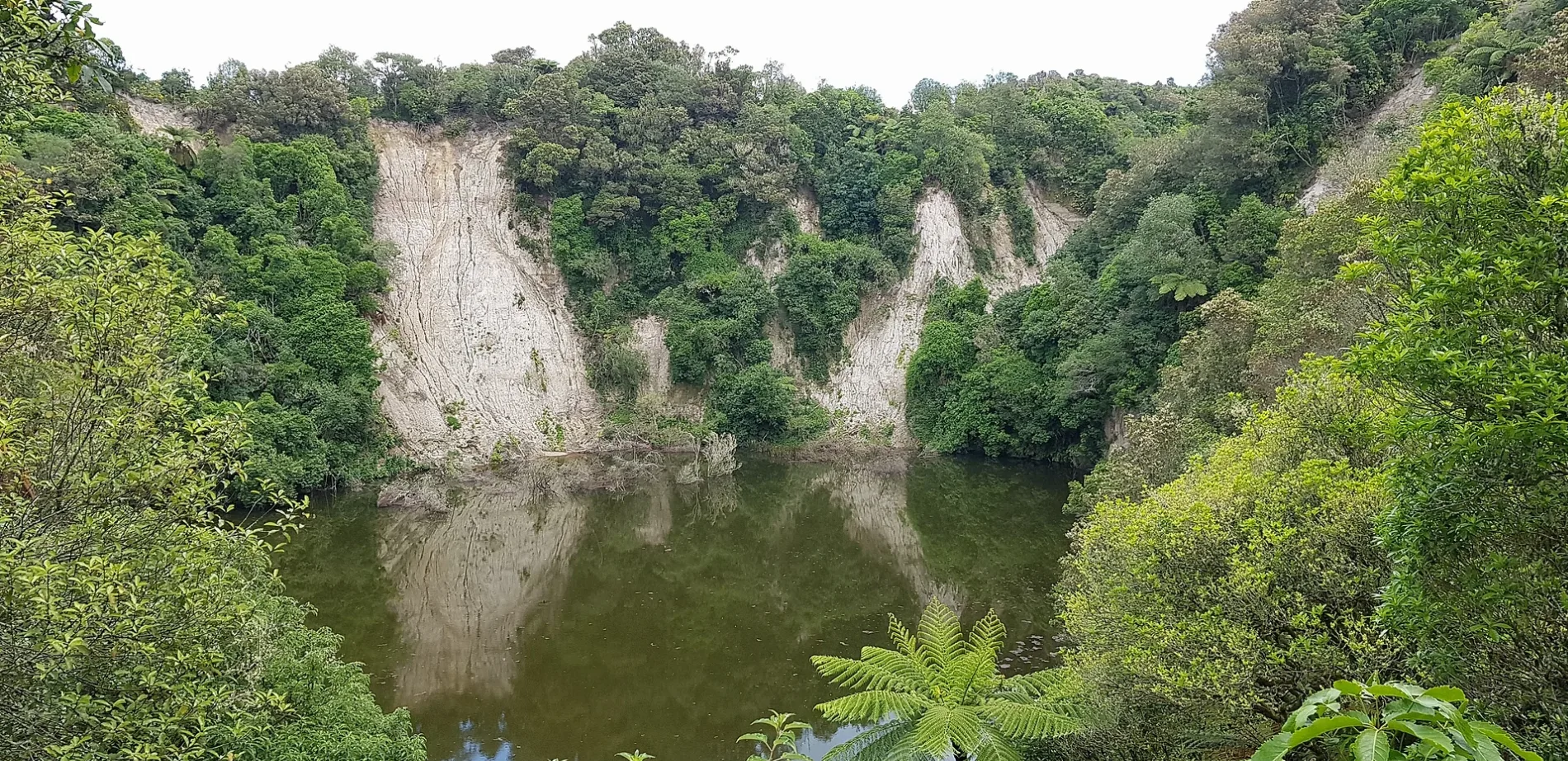
- Nature
- body of water
Tourist information offices
Petrol stations
Attraction
Cafés
Fire station
Campsite
Picnic site
Bus stops
Viewpoint
Pubs
Roads nearby
Waimangu Bus RouteWaimangu Volcanic & Thermal Valley, Waimangu Local Store & Cafe, Echo Crater, Waimangu Vegetation, Warbrick Terraces, Bus Stop 2, Bus Stop 3, Lake Rotomahana
750 m
Mt Haszard Hiking TrailRift Valley Panorama
1000 m
Lake Okaro WalkLake Okaro Reserve, Lake Okaro Campsite
1,3 km
Okaro RoadWaimangu
2,5 km
Waimangu Road2,7 km
State Highway 38Waiotapu Village, Rotomahana, SH38 - Dun Rd
3,0 km
Rotomahana Road3,2 km
Rainbow RoadWaiotapu Fire Station
4,0 km
Old Waiotapu Road4,3 km
Te Ranga trail4,4 km
Waikite Valley RoadBestStart Waikite Valley Kindy
6,4 km
Highlands Road7,0 km
State Highway 5Tarukenga, Full of Posies Flower Farm, Tumunui, Tumunui Road, 39/Rotorua Branch, Earthquake Flats, Waiotapu Tavern, Waiotapu, Gull, 37/Rotorua Branch
7,5 km
Waiotapu Loop RoadGeyser Café, Wai-o-Tapu Thermal Wonderland
7,9 km
Tarawera TrailTe Wairuha, Oneroa, Twin Streams, Hawaiki Bay, Hot Water Beach Campsite
8,3 km
Attractions nearby
Pioneer House8,5 km
Leisure nearby
Wai-o-Tapu Mud Pool6,5 km
Thunder crater8,2 km
Attraction nearby
Buried Village8,3 km
Body of waters nearby
Frying Pan Lake650 m
Inferno Crater Lake900 m
Lake Okaro1,1 km
Black Crater1,2 km
Opal Lake2,9 km
Lake Ngahewa3,5 km
Crater lake3,9 km
Rotowhero / Green Lake4,3 km
Lake Ōpōuri7,3 km
Buildings nearby
Lake Ngahewa telephone exchange3,0 km
Waiotapu Office4,0 km
Cafés nearby
Arataki Honey Shop6,6 km
Cliffs nearby
Steaming Cliffs3,2 km
Industrial areas nearby
Mill2,8 km
Museum nearby
Barracks Museum8,5 km
Wairoa Museum8,5 km
Public baths nearby
Hot 'n' Cold8,2 km
Reservoirs nearby
Oxidation pond7,2 km
Sports pitches nearby
Rotorua Pistol Club7,3 km
Streams nearby
Waimangu Stream1,2 km
Pareheru Stream1,5 km
Haumi Stream2,3 km
Wairua Stream3,4 km
Kerosene Creek5,5 km
Waikokomuka Stream6,3 km
Te Kapakapa Stream8,1 km
Wairoa Stream8,4 km
Wilderness huts nearby
Wairua Hut5,8 km
Woodlands nearby
Tumunui Bush6,5 km
Other nearby
Pātītī Island / Banded Island5,1 km
| Located in | Rotorua Lakes District |
|---|---|
| Country | New Zealand |
Public transport map Rotorua Lakes District Legend
| Railway | |
| Bus | |
| Tram |
Cycling map Rotorua Lakes District Legend
| Cycle path | |
| Cycle lane on road | |
| Cycling on bus lane | |
| Bicycle street | |
| Cyclists allowed | |
| Cyclists allowed, good surface | |
| No cycling | |
| Cobblestones |
| Long-distance cycle route | (depending on scale) | |
| Long-distance cycle route |
Walking map Rotorua Lakes District Legend
| Path |
| Long-distance hiking trail | (depending on scale) | |
| Long-distance hiking trail | ||
| No pedestrians |