
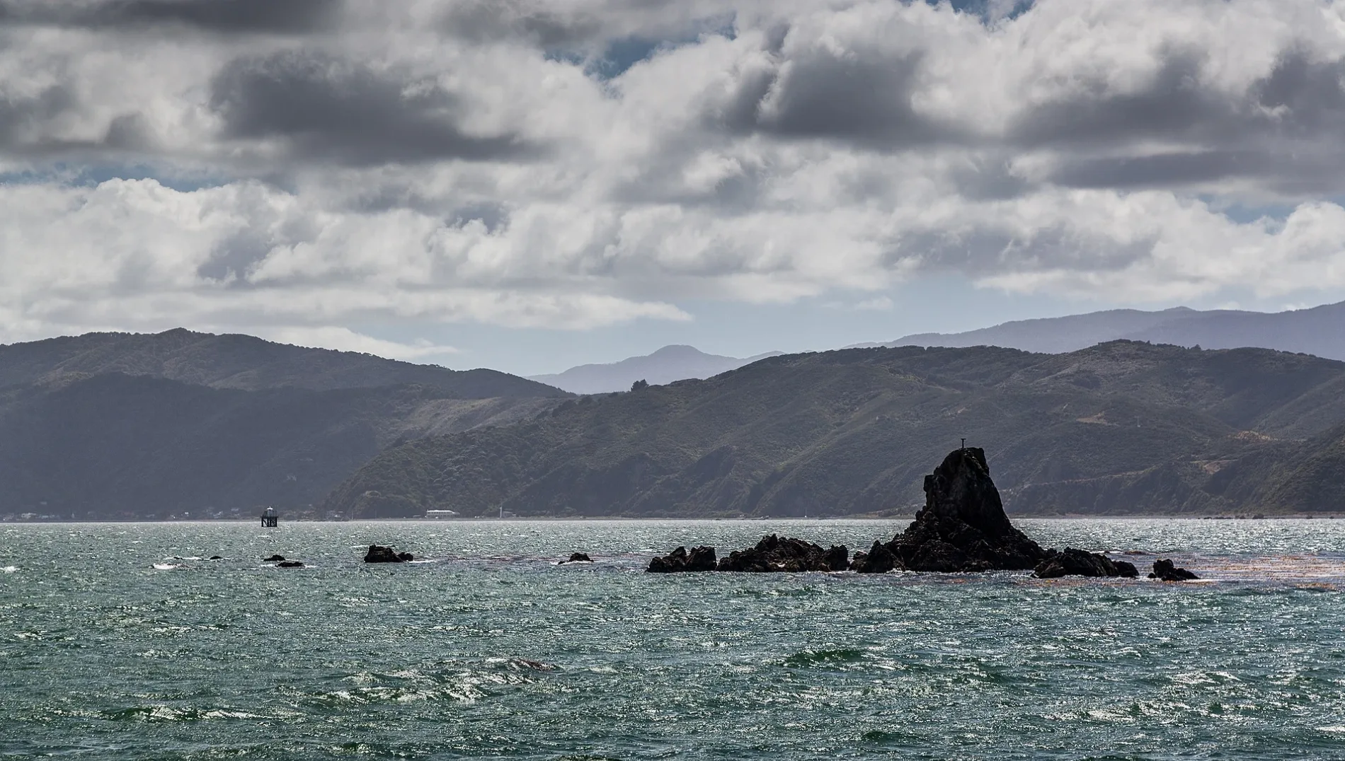
Steeple Rock / Te Aroaro-o-Kupe in Wellington
Steeple Rock / Te Aroaro-o-Kupe in Wellington is a bare rock. Steeple Rock / Te Aroaro-o-Kupe is also known as Steeple Rock. Ⓦ.
- Nature
- bare rock
Image
Roads nearby
Steeple LaneSeatoun Kindergarten
350 m
Boardwalk Lane350 m
Gore Street450 m
Fort Dorset TrackSeatoun Massage, Lookout, Hole in the rock
450 m
Hector StreetSeatoun Park - Hector Street
450 m
Dundas StreetDundas Street at Monro Street (near 68), Seatoun, Dundas Street at Monro Street (near 55), Seatoun Village - Dundas Street, Dundas Street at Falkirk Avenue, Four Square, Salt Hair Boutique, Little Sprig, Arcimboldi
500 m
Mantell Street550 m
Monro StreetMonro Street at Seatoun Park
600 m
Inglis StreetInglis Street at Mantell Street, Inglis Street at Burnham Street (near 88), Inglis Street opposite Mantell Street, Inglis Street at Burnham Street (near 91), Seaward Retreat
750 m
Berwick Grove800 m
Burnham StreetDorset Cove
800 m
Pinnacle Street800 m
Rawson Place800 m
Ludlam Street850 m
Marine ParadeMarine Parade (opposite 109), Worser Bay - Marine Parade (near 177), Worser Bay Lifesaving Club (opposite), Marine Parade (opposite 135), Worser Bay - Marine Parade (opposite 185), Marine Parade opposite Awa Road, Worser Bay - Marine Parade (near 115), Worser Bay Life Saving Club (opposite)
850 m
Pass of Branda850 m
Falkirk AvenueSeatoun Medical, Huckle & Co
850 m
Forres Street950 m
Ventnor Street950 m
Eastern WalkwayAtatürk Memorial
1000 m
Ferry StreetRoute 11, Ferry Street at Dundas Street, Ferry Street at Ludlam Street
1000 m
Lyons Crescent1,1 km
Tio Tio Road1,1 km
Beacon Hill RoadBeacon Hill Road opposite Tannadyce Street, Beacon Hill Road (near 11), Beacon Hill Road at Kinghorne Street, Beacon Hill Road (near 14)
1,1 km
Seatoun Tunnel1,1 km
Signallers Grove1,1 km
Netherleigh Street1,1 km
Pinelands Avenue1,1 km
Paratu Way1,2 km
Beaches nearby
Battery Bay Beach850 m
Seatoun Beach1,0 km
Buildings nearby
Seatoun Bowling Club900 m
Our Lady of the Star of the Sea Convent Chapel1,2 km
Bunkers nearby
Beach Battery600 m
Electric Light Directing Station650 m
Gap Battery Magazine650 m
4-inch Battery Observation Post700 m
6-inch Battery Observation Post750 m
Beacon Hill Victorian Era Coastal Bunker1,2 km
Community centres nearby
Seatoun Village Hall & St Christopher’s900 m
Convenience stores nearby
Seatoun Dairy800 m
Grass nearby
The Meadow750 m
Parks nearby
Point Dorset Reserve800 m
Places of worship nearby
St Anthony's Parish850 m
St George’s Anglican Church1,0 km
Recreation grounds nearby
Seatoun Park600 m
Churchill Park700 m
Service buildings nearby
33 Ludlam St Substation800 m
Studios nearby
Beacon Hill Signal Station1,2 km
| Country | New Zealand |
|---|
 Public transport map Wellington Legend
| Railway | |
| Bus | |
| Tram |
 Cycling map Wellington Legend
| Cycle path | |
| Cycle lane on road | |
| Cycling on bus lane | |
| Bicycle street | |
| Cyclists allowed | |
| Cyclists allowed, good surface | |
| No cycling | |
| Cobblestones |
| Long-distance cycle route | (depending on scale) | |
| Long-distance cycle route |
 Walking map Wellington Legend
| Path |
| Long-distance hiking trail | (depending on scale) | |
| Long-distance hiking trail | ||
| No pedestrians |