
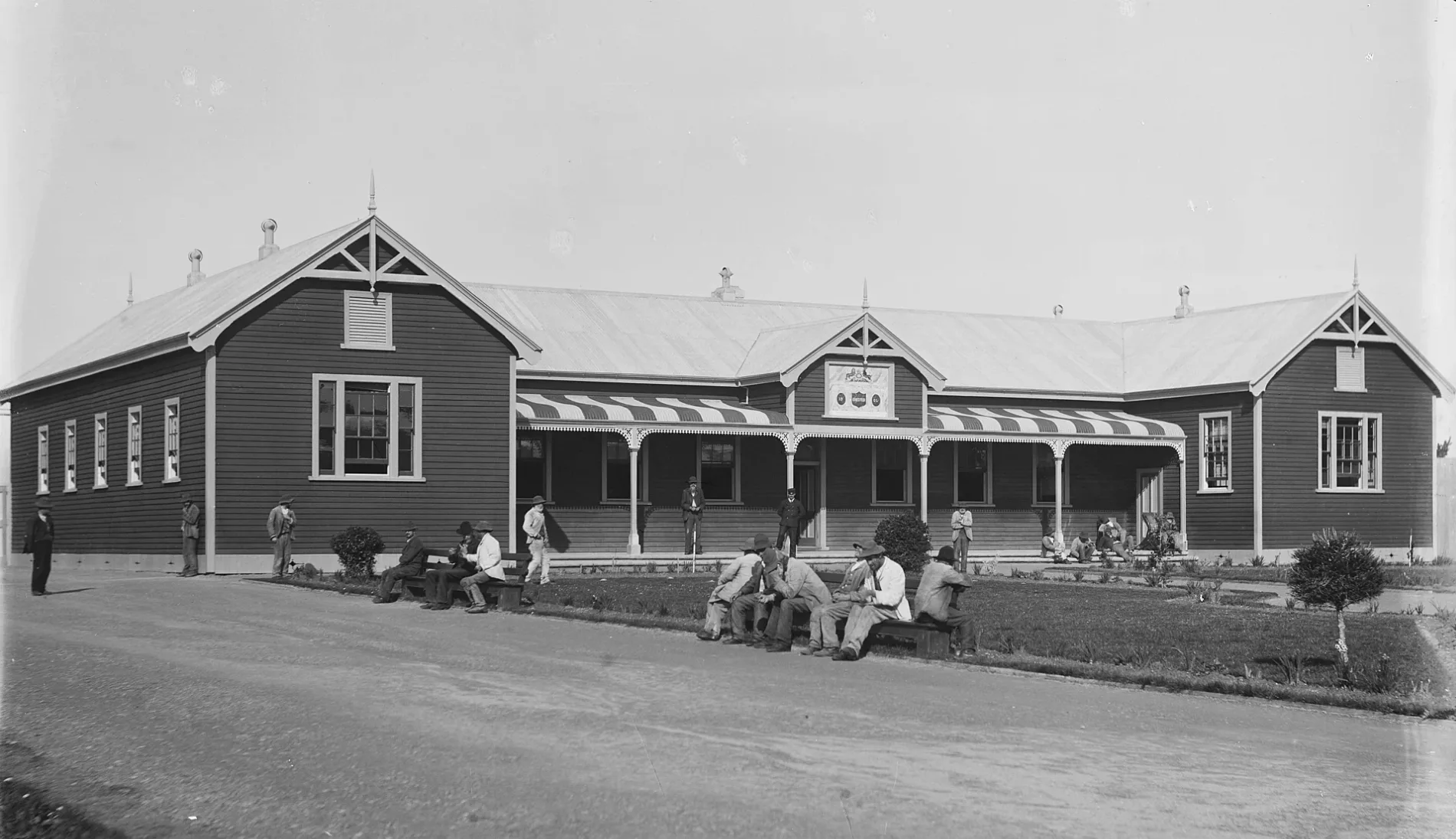
Seaview Asylum in Westland District
Seaview Asylum in Westland District is ruins. Seaview Asylum is also known as Seaview Psychiatric Hospital. Seaview Asylum is near Kumara Junction Highway. Ⓦ.
- Land Use
- grass
Image
Petrol stations
Sanitary dump stations
Clinic
Off-licences
Bank
Pubs
Motel
Campsite
Guest house
Cafés
Fire station
ATMs
Hotels
Supermarkets
Laundries
Viewpoint
Hairdressers
Zoo
Police stations
Bus stops
Roads nearby
Mandl Rise300 m
Kumara Junction HighwayGlow-Worm Dell, Birdsong Backpackers YHA, Hokitika Public Dump Station, Seaview Lodge, 36/Hokitika Line, 37/Hokitika Line, 20/Hokitika Line, 21/Hokitika Line, 22/Hokitika Line, 26/Hokitika Line, 27/Hokitika Line, 28/Hokitika Line, 29/Hokitika Line, Chesterfield, 23/Hokitika Line, 24/Hokitika Line, 25/Hokitika Line, 31/Hokitika Line, 19/Hokitika Line, 32/Hokitika Line, 33/Hokitika Line, 34/Hokitika Line, 30/Hokitika Line, 35/Hokitika Line
300 m
Ellis Terrace300 m
Richards Drive650 m
Whitcombe Terrace800 m
Spencer Street850 m
Bonar Drive900 m
Tudor Street1,0 km
Bert Mercer Drivede Havilland cafe
1,1 km
Airport Drive1,2 km
Brian Waugh Lane1,2 km
Bealey Street1,2 km
Park Street38/Hokitika Line
1,3 km
Heenan Place1,3 km
Alpine View1,4 km
Howitt Place1,4 km
Hall StreetSTOP Caravan park
1,5 km
Sewell StreetRailway Hotel, Hokitika Police, Westland Medical Centre, Lizzy's Laundry, Seddon statue, The Batch Café Hokitika
1,5 km
Hampden StreetBarber Shop
1,6 km
Fitzherbert StreetJade court motor lodge, Laundry or Naked, BP 2go, Coaster's Supermarket, Challenge
1,6 km
Revell StreetASB Bank, Westpac, ANZ, Super Liquor, 252 Beachside Motels & Holiday Park, Skin & Body, Kiwibank, take note, Fat Pipi Pizzas, Priya Indian Restaurant, Thatcher & Small, The Hokitika Sandwich Company, The Vintage Tree, Total Automotive, Alchemy & Storm, Can-am, East Eat, Rata And Rose
1,6 km
Stafford StreetHokitika Volunteer Fire Brigade, Bella Vista Hokitika
1,7 km
Brittan Street1,7 km
Tancred StreetNational Kiwi Centre, ANZ, Regent Theatre, Wilderness Gallery, Cafe 39, Westland Greenstone Ltd, Sweet Alice’s, Mountain Jade, Hokitika Cycle & Sportsworld
1,8 km
Sale StreetFour Square
1,8 km
Rolleston Street1,8 km
Davie Street1,8 km
Railway TerraceHokitika, Intercity Bus Stop
1,8 km
Dalton Street1,9 km
Jollie Street1,9 km
Weld StreetHokitika Town Clock, Hokitika Westland isite Visitor Information Centre, Mountain Jade Hokitika, Chez Millie, Oliver's Shoe Store, Flippen Lekker, Westland Pharmacy, Stumpers Bar Hotel
1,9 km
Mount Cook View Drive1,9 km
Livingstone Street2,0 km
Beaches nearby
Hokitika Beach450 m
Buildings nearby
Como House1,9 km
Westland District Council1,9 km
Campsite nearby
Shining Star Beachfront Accommodation600 m
Caravan site nearby
252 Beachside Motels & Holiday Park700 m
Hokitika's Kiwi Holiday Park and Motel1,2 km
Cemeteries nearby
Hokitika Cemetery550 m
Motel nearby
Fitzherbert Court Motel1,0 km
Parks nearby
Cass Square1,9 km
Petrol stations nearby
NPD1,7 km
Places of worship nearby
St Andrew's Untied Church1,5 km
St Mary's Catholic Church1,7 km
All Saint's Hokitika1,7 km
Railway lines nearby
Hokitika Line1,5 km
Supermarkets nearby
New World1,8 km
Other nearby
Hokitika Airport1,2 km
| Inception | 1872 |
|---|---|
| Located in | Westland District |
| Country | New Zealand |
| Location | Seaview |
 Public transport map Westland District Legend
| Railway | |
| Bus | |
| Tram |
 Cycling map Westland District Legend
| Cycle path | |
| Cycle lane on road | |
| Cycling on bus lane | |
| Bicycle street | |
| Cyclists allowed | |
| Cyclists allowed, good surface | |
| No cycling | |
| Cobblestones |
| Long-distance cycle route | (depending on scale) | |
| Long-distance cycle route |
 Walking map Westland District Legend
| Path |
| Long-distance hiking trail | (depending on scale) | |
| Long-distance hiking trail | ||
| No pedestrians |