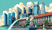
Cartogiraffe.com

Singapore

Public transport map Public transport map Singapore Legend
Railway
Bus
Tram
Cycling map Cycling map Singapore Legend
Cycle path
Cycle lane on road
Cycling on bus lane
Bicycle street
Cyclists allowed
Cyclists allowed, good surface
No cycling
Cobblestones
Long-distance cycle route (depending on scale)
Long-distance cycle route
Walking map Walking map Singapore Legend
Path
Long-distance hiking trail (depending on scale)
Long-distance hiking trail
No pedestrians
 · 
Singapore
Pedra Branca
East Region
Bedok
Changi
Pasir Ris
Paya Lebar
Tampines
Changi Bay
North-east Region
North-Eastern Islands
Hougang
Punggol
Seletar
Ang Mo Kio
Sengkang
Serangoon
Central Region
Bukit Timah
Queenstown
Marine Parade
Bishan
Novena
Geylang
Toa Payoh
River Valley
Orchard
Newton
Marina East
Kallang
Outram
Tanglin
Singapore River
Marina South
Downtown Core
Southern Islands
Straits View
Museum
Rochor
Bukit Merah
West Region
Tengah
Jurong West
Jurong East
Bukit Batok
Bukit Panjang
Choa Chu Kang
Western Water Catchment
Clementi
Western Islands
Tuas
Pioneer
Boon Lay
North Region
Sungei Kadut
Lim Chu Kang
Woodlands
Sembawang
Central Water Catchment
Mandai
Simpang
Yishun