
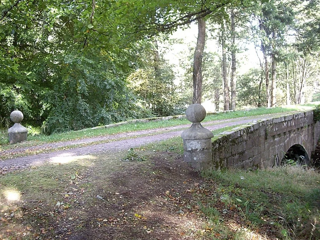
Allach Bridge in Aberdeenshire
Allach Bridge in Aberdeenshire is a track. It runs in an east-west direction and ends in a cul-de-sac. Allach Bridge is also known as Aboyne Castle, Allach Bridge.
- Road Type
- track
- Route
- east-west
Image
Roads nearby
Golf Place400 m
Golf RoadKnockothie Brae, Chapel Road, Ballater Post Office, Byron Bakery, Golf Road, Bean For Coffee, New Shanghai
450 m
Old Ballater RoadOne to One, Blondeze, The Secret Garden
600 m
Queens Hill Drive600 m
North Deeside RoadBellwood Road, Sunnyside Drive, Silverbank, Kincardine O'Neil, Kincardine O'Neil Post Office, Mane Attraction, Pitmurchie Road, Village Store, Golden House, Dee Street, Tersets Road End, Park, Drumoak, Nether Sunnyside, Keithmuir Gardens, Harestone Road End, The White Cottage, Kirkton Croft, Creag-an-Sgor, Easter Anguston Rd End, Wardmill, Aboyne Service Station, Aboyne Ford, Tesco, Station Wood, Parish Church, Neilburn Drive, Pantoch Drive, Drum Castle Road End, East Mains of Drum, Crathes Castle
600 m
Station SquareThe Corner Shop, Shah's Fish and Chips Aboyne, Corner House, Rothesay Rooms, Ballater Library, Ballater iCentre, Brook Taverner, Wilkies, The Gordon Guest House, Lumphanan Stores, Station Square, Lumphanan Post Office, Macbeth Arms
650 m
Bonty Place650 m
Station BraeAboyne, Davidsons Chemists, Monkey Business
650 m
Golf CrescentNether Davah Court
700 m
Formaston Park700 m
Alan Brodie Lane700 m
Huntly Mews700 m
Ballater RoadRhu na Haven Road, Bridge View Road, Ladywood, Old Tollhouse Road, Gordon Crescent, Victory Hall, Top Up Tap
700 m
Old Mart Road750 m
Low RoadBark + Ride, Spider on a Bicycle, Ellington Mennie, HolidayMakers, Deeside Refill, Aboyne Post Office, Woodside Veterinary Group, Aimee Christina Hair Salon
800 m
Old Mart Place800 m
Gordon Crescent850 m
Balmoral Terrace850 m
Balmoral Lane850 m
Charlestown RoadThe Boat, Knowles John & Sons, The Paper Girls
900 m
Huntly Road900 m
Bakeries nearby
Courie Courie600 m
Buildings nearby
Scout Hut550 m
Aboyne Bowling Club550 m
Aboyne Golf Club House700 m
Aboyne Telephone Exchange750 m
Aboyne Buisness Centre900 m
Butcher's nearby
John Troup600 m
Cafés nearby
The Black Faced Sheep600 m
Commercial areas nearby
Aboyne Castle Business Centre250 m
Community centres nearby
Victory Hall600 m
Dental practices nearby
Aboyne Dental Practice600 m
Events venues nearby
Coo Cathedral400 m
Fast food restaurants nearby
The Oriental600 m
Hairdresser's nearby
MillionHairs & Beauty600 m
Myloka600 m
Industrial areas nearby
Aboyne Industrial Estate700 m
Military buildings nearby
Aboyne Regiment500 m
Pet shops nearby
Pawz 'n' Klawz650 m
Places of worship nearby
St Margaret's800 m
Razed railways nearby
Deeside Line700 m
Restaurants nearby
Nurtaj600 m
Social facilities nearby
Allachburn Home700 m
Supermarkets nearby
Strachan's of Royal Deeside650 m
Co-op Food850 m
Terraced houses nearby
Bonty Court700 m
Village greens nearby
Charlestown Green750 m
Warehouses nearby
Aboyne Games Shed600 m
Woodlands nearby
Allach Wood300 m
| Located in | Aberdeenshire, Aboyne and Glen Tanar |
|---|---|
| Country | United Kingdom |
| Crosses | Tarland Burn |
| Carries thoroughfare | unclassified road |
 Public transport map Aberdeenshire Legend
| Railway | |
| Bus | |
| Tram |
 Cycling map Aberdeenshire Legend
| Cycle path | |
| Cycle lane on road | |
| Cycling on bus lane | |
| Bicycle street | |
| Cyclists allowed | |
| Cyclists allowed, good surface | |
| No cycling | |
| Cobblestones |
| Long-distance cycle route | (depending on scale) | |
| Long-distance cycle route |
 Walking map Aberdeenshire Legend
| Path |
| Long-distance hiking trail | (depending on scale) | |
| Long-distance hiking trail | ||
| No pedestrians |