
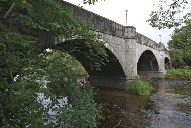
Bridge of Alford in Aberdeenshire
Bridge of Alford in Aberdeenshire is a lit main road. It runs in a north-south direction and ends in a cul-de-sac. This road is part of the long-distance road "Highland Tourist Route". Ⓦ.
- Road Type
- main road
- Speed Limit
- 30 mph
- Route
- north-south
Image
Roads nearby
Waterside GardensBridge of Alford
200 m
Old Military RoadBogs of Noth, Duffschool, Feughside Inn, Potarch Rd End, Bucharn, Burnend, Snow Gate, Beaulah Hall, Mountainview, Candy, Jeldah, Backburn, Kirkstile, Edinville, Potarch, Mill of Gartly, Drumblade Junction, Road End, Clattering Bridge, Cairn O' Mount View, Snow Sport School, Equipment Hire, Tea @ The Shee, Ticket Office, Glenshee Ski Centre, Shenbhal, Ringing Stone, Bridge of Nessbogie
650 m
Baillie Crescent1,2 km
Balcarres Terrace1,2 km
Parkhill RoadFastglass Direct
1,3 km
Tillyfour Court1,3 km
McCombie Terrace1,3 km
Watson Terrace1,4 km
Tullibardine Walk1,4 km
David McLean Drive1,4 km
Tullibardine Close1,4 km
Alen Drive1,5 km
Baillie Drive1,5 km
Grampian Road1,5 km
Gordon Place1,5 km
Davidson Crescent1,5 km
Gordon RoadWhitely Well Drive
1,6 km
Leslie Crescent1,6 km
Grampian Court1,6 km
Donside RoadDavid McLean Drive, Farquharson Fountain, Bank Brae
1,6 km
Graham Terrace1,6 km
Haughton Place1,6 km
Littlewood Place1,7 km
Balfour RoadVictoria Road, Alford Police Station
1,7 km
Victoria RoadVictoria Road, Shorty's Ice Cream Parlour, Rowan Jewellery & Gifts, Gleaner
1,7 km
Ashgrove1,7 km
School RoadRuthven, Edinview Estate, Newmachar Fish Bar, Lumphanan, Meet Again Tea Shop, Port Elphinstone, St Fergus, School Road, School Crescent, East Park Road, Tuach Road, La Rusticana, Beauty Matters, Donview Veterinary Centre Kintore, Lotus, Sainsbury's Local, Sunnyside View, Midmill Business Park, Torryburn, Meethill School, Mile End Place, Springbank
1,8 km
Murray Terrace1,8 km
Greystone Place1,8 km
Montgarrie RoadChloe's Kitchen Creations
1,8 km
Greystone RoadHaughton Arms Hotel, Jock O Bennachie Steen
1,8 km
Bank Brae1,9 km
Shops nearby
Donside Heating Supplies1,4 km
Buildings nearby
Ambulance Depot1,7 km
Alford Dry Ski Slope1,7 km
Alford Telephone Exchange1,8 km
Butcher's nearby
Graeme Barber Butcher1,7 km
Cemeteries nearby
Alford Cemetery1,4 km
Commercial buildings nearby
Alford Clinic1,6 km
Doctor's practice nearby
Alford Medical Practice1,6 km
Forests nearby
Murray Park950 m
Hairdresser's nearby
The Barbers1,8 km
Houses nearby
Mill of Breda1,2 km
Burnside1,4 km
Berrywood1,5 km
Gardeners Cottage1,5 km
Westbrig1,5 km
East Lodge1,5 km
Streams nearby
Leochel Burn1,4 km
| Located in | Aberdeenshire, Tullynessle and Forbes |
|---|---|
| Country | United Kingdom |
| Crosses | River Don |
| Carries thoroughfare | A944 road |
 Public transport map Aberdeenshire Legend
| Railway | |
| Bus | |
| Tram |
 Cycling map Aberdeenshire Legend
| Cycle path | |
| Cycle lane on road | |
| Cycling on bus lane | |
| Bicycle street | |
| Cyclists allowed | |
| Cyclists allowed, good surface | |
| No cycling | |
| Cobblestones |
| Long-distance cycle route | (depending on scale) | |
| Long-distance cycle route |
 Walking map Aberdeenshire Legend
| Path |
| Long-distance hiking trail | (depending on scale) | |
| Long-distance hiking trail | ||
| No pedestrians |