
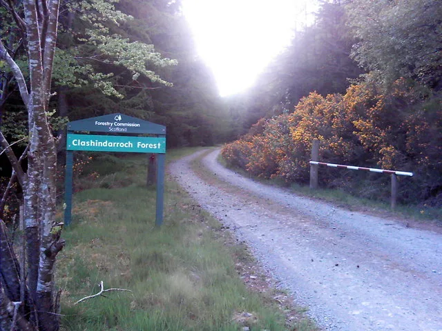
Clashindarroch Forest in Aberdeenshire
Clashindarroch Forest in Aberdeenshire is a forest. Ⓦ.
- Land Use
- forest
Image
Roads nearby
Clashindarroch Wind Farm2,8 km
Bridge of Nessbogie5,3 km
Clashmach Hill Foot Path5,4 km
Park LaneGartly
5,8 km
Old Military RoadBucharn, Burnend, Bogs of Noth, Duffschool, Feughside Inn, Potarch Rd End, Snow Gate, Beaulah Hall, Mountainview, Candy, Jeldah, Backburn, Kirkstile, Edinville, Potarch, Mill of Gartly, Drumblade Junction, Road End, Clattering Bridge, Cairn O' Mount View, Snow Sport School, Equipment Hire, Tea @ The Shee, Ticket Office, Glenshee Ski Centre, Shenbhal, Ringing Stone, Bridge of Nessbogie
5,9 km
Bridge of Bogforth6,4 km
Cairnford Bridge6,5 km
Bridge of GlassHaugh of Glass
6,6 km
Bridge of MilltownMill of Noth
7,4 km
Essie Park7,5 km
Essie Crescent7,6 km
Buildings nearby
Coynachie2,3 km
Burncruinach3,4 km
Culdrain House4,9 km
Beldorney Castle5,2 km
Glass Telephone Exchange6,1 km
Cemeteries nearby
Walla Kirk5,0 km
Churches nearby
Glass Parish Church6,5 km
Farm buildings nearby
Bogancloch5,9 km
Farmyards nearby
Lower Gordonsburn3,7 km
Millhill5,3 km
Oldmanse Farm6,9 km
Milltown O Noth6,9 km
Forests nearby
Aswanley Wood5,2 km
Houses nearby
Clashindarroch3,2 km
Mytice3,5 km
Finglenny4,0 km
Boganclogh Lodge6,0 km
Residential areas nearby
Wellheads5,4 km
Boganclogh6,0 km
The Bruntland6,4 km
Rivers nearby
River Deveron4,7 km
River Bogie5,2 km
Rocks nearby
Clochmaloo5,5 km
Giant's Stone5,5 km
Service buildings nearby
Gartly Telephone Exchange5,3 km
Streams nearby
Burn of Bedlaithen2,7 km
Priest's Water3,8 km
Gordon's Burn5,2 km
Burn of Collonach5,9 km
Burn of Essie6,8 km
Burn of Oldmanse6,9 km
Burn of Easaiche6,9 km
Burn of Templand7,5 km
Town halls nearby
Gartly Community Hall5,3 km
Glass Hall6,7 km
Valleies nearby
Glen of Noth5,0 km
Woodlands nearby
Birks of Aswanley5,9 km
Other nearby
Cairnford Substation6,4 km
| Located in | Aberdeenshire |
|---|---|
| Country | United Kingdom |
| Website | https://scotland.forestry.gov.uk/visit/clashindarroch |
 Public transport map Aberdeenshire Legend
| Railway | |
| Bus | |
| Tram |
 Cycling map Aberdeenshire Legend
| Cycle path | |
| Cycle lane on road | |
| Cycling on bus lane | |
| Bicycle street | |
| Cyclists allowed | |
| Cyclists allowed, good surface | |
| No cycling | |
| Cobblestones |
| Long-distance cycle route | (depending on scale) | |
| Long-distance cycle route |
 Walking map Aberdeenshire Legend
| Path |
| Long-distance hiking trail | (depending on scale) | |
| Long-distance hiking trail | ||
| No pedestrians |