
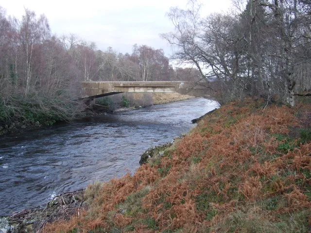
Dinnet Bridge in Aberdeenshire
Dinnet Bridge in Aberdeenshire is an unlit secondary road. It runs in a north-south direction starting from Firmounth Road and ends at Firmounth Road. This road is part of the mountain bike route "Scotland Trail".
- Road Type
- secondary road
- Speed Limit
- 60 mph
- Route
- north-south
Image
Roads nearby
Firmounth RoadDinnet, Knockie Viewpoint, Crossroads, Small Pearl-Bordered, Kentish Glory
600 m
Mulloch ViewCrossroads
650 m
Firnmouth Road1,1 km
Queen's RoadArduthie Primary School, Queen's Road, Russell Street
2,3 km
Bridge of Tanar2,6 km
Old Deeside RoadBridge of Gairn, Balmoral Rd End, Leys of Newton, Inver, Newton of Drumgesk
2,6 km
Glen Tanar RoadGlen Tanar Postbox, Tanar
2,7 km
StableyardPublic Car Park
2,9 km
Body of waters nearby
Clarack Loch950 m
River Dee1,3 km
Braeroddach Loch2,8 km
Fairy Lochan3,1 km
Buildings nearby
Dinnet House1,3 km
Wooden Workshop2,8 km
Glentanar House2,9 km
Car repair shops nearby
Dinnet Garage650 m
Community centres nearby
Kinord Hall600 m
Dances nearby
Glen Tanar Ballroom3,0 km
Farmyards nearby
Cobbleheugh1000 m
Clarack1,1 km
Ferrar2,4 km
Home Farm2,7 km
Forests nearby
Tom na Croiche1,7 km
Belrorie Wood2,4 km
Hangars nearby
Main Hangar2,8 km
Blister Hangar2,8 km
Maintenance Hangar2,8 km
Horse ridings nearby
Glen Tanar Equestrian Centre2,8 km
Hotels nearby
Loch Kinord Hotel & Restaurant600 m
Houses nearby
Old Kinord School House1,6 km
Dee Castle farmhouse2,7 km
Industrial areas nearby
Aboyne Burnroot Sawmill2,4 km
Nature reserves nearby
Dinnet Oakwood Site of Special Scientific Interest250 m
Muir of Dinnet National Nature Reserve1,7 km
Places of worship nearby
Chapel of St Lesmo2,8 km
Public buildings nearby
Clubhouse2,9 km
Razed railways nearby
Deeside Line2,4 km
Residential areas nearby
Angrinan300 m
Bush Cottages2,9 km
Rivers nearby
Water of Tanar2,9 km
School buildings nearby
Glen Tanar School1,1 km
Streams nearby
Dinnet Burn1,1 km
Monandavan Burn2,3 km
Tourist information offices nearby
Glen Tanar Visitor Centre2,6 km
Valleies nearby
Deeside2,1 km
Woodlands nearby
Castle Island2,6 km
Little Ord2,7 km
Other nearby
Prison Island2,2 km
12/302,8 km
| Protected area | Cairngorms National Park |
|---|---|
| Located in | Aberdeenshire, Glenmuick, Tullich and Glengairn |
| Country | United Kingdom |
| Crosses | River Dee |
| Carries thoroughfare | B9158 road |
 Public transport map Aberdeenshire Legend
| Railway | |
| Bus | |
| Tram |
 Cycling map Aberdeenshire Legend
| Cycle path | |
| Cycle lane on road | |
| Cycling on bus lane | |
| Bicycle street | |
| Cyclists allowed | |
| Cyclists allowed, good surface | |
| No cycling | |
| Cobblestones |
| Long-distance cycle route | (depending on scale) | |
| Long-distance cycle route |
 Walking map Aberdeenshire Legend
| Path |
| Long-distance hiking trail | (depending on scale) | |
| Long-distance hiking trail | ||
| No pedestrians |