
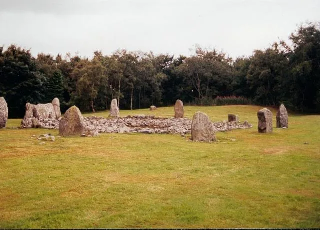
Loanhead Stone Circle in Aberdeenshire
Loanhead Stone Circle in Aberdeenshire is an archaeological site (listed building). Loanhead Stone Circle is also known as Loanhead, stone circle and enclosed cremation cemetery. Loanhead Stone Circle is near Loanhead Park. Ⓦ.
- Land Use
- grass
Image
Roads nearby
Loanhead Park300 m
WellparkDaviot
650 m
WellbraeKirkton Park
750 m
Kirkton Park800 m
Wellbrae Terrace800 m
Sandy Bryce Drive850 m
Stable Close850 m
Woodland Gardens900 m
Sleigh Park950 m
Edinmore DriveEdinmore Drive
1000 m
Craigshannoch Road1,0 km
Mackenzie Drive1,1 km
Earls ReeEarls Ree
3,2 km
Parkside Gardens3,3 km
Cameron ParkMeikle Wartle
3,4 km
Whiteford RoadWhiteford, Whiteford Road
3,8 km
Whiteford Place3,8 km
Whiteford Gardens3,8 km
Bridge of Pitcaple3,8 km
Urievale Road4,0 km
Wester Harlaw Steadings4,0 km
Abandoned railways nearby
Inverurie to Old Meldrum Branch4,1 km
Body of waters nearby
Muckle Troot Loch4,2 km
Buildings nearby
Wartle Telephone Exchange900 m
Pitcaple Castle3,4 km
Pitcaple Telephone Exchange4,1 km
Lochter Activity Centre4,3 km
Battle of Harlaw Monument4,7 km
Cemeteries nearby
Folla Rule Episcopal Graveyard4,4 km
Churches nearby
Daviot Church600 m
Farmhouses nearby
Mill of Esterton3,6 km
Bethelnie4,0 km
North Bethelnie4,2 km
Farmyards nearby
Teuchathaugh1,9 km
Newton of Boghead3,2 km
New Boghead3,4 km
Balcairn3,8 km
Newton of Tulloch4,3 km
West Mains of Harlaw4,3 km
Forests nearby
Pitcaple Wood3,6 km
Houses nearby
House of Daviot750 m
Nature reserves nearby
Wartle Moss SSSI3,8 km
Parks nearby
Daviot Park550 m
Public buildings nearby
Logie Durno Hall3,6 km
Pubs nearby
Smiddy650 m
Railway lines nearby
Aberdeen to Inverness Line4,1 km
Razed railways nearby
Inveramsay to Macduff Branch3,1 km
Residential areas nearby
Station Cottages3,7 km
Streams nearby
Lochter Burn3,6 km
| Located in | Aberdeenshire, Daviot |
|---|---|
| Country | United Kingdom |
| Location | Daviot |
 Public transport map Aberdeenshire Legend
| Railway | |
| Bus | |
| Tram |
 Cycling map Aberdeenshire Legend
| Cycle path | |
| Cycle lane on road | |
| Cycling on bus lane | |
| Bicycle street | |
| Cyclists allowed | |
| Cyclists allowed, good surface | |
| No cycling | |
| Cobblestones |
| Long-distance cycle route | (depending on scale) | |
| Long-distance cycle route |
 Walking map Aberdeenshire Legend
| Path |
| Long-distance hiking trail | (depending on scale) | |
| Long-distance hiking trail | ||
| No pedestrians |