
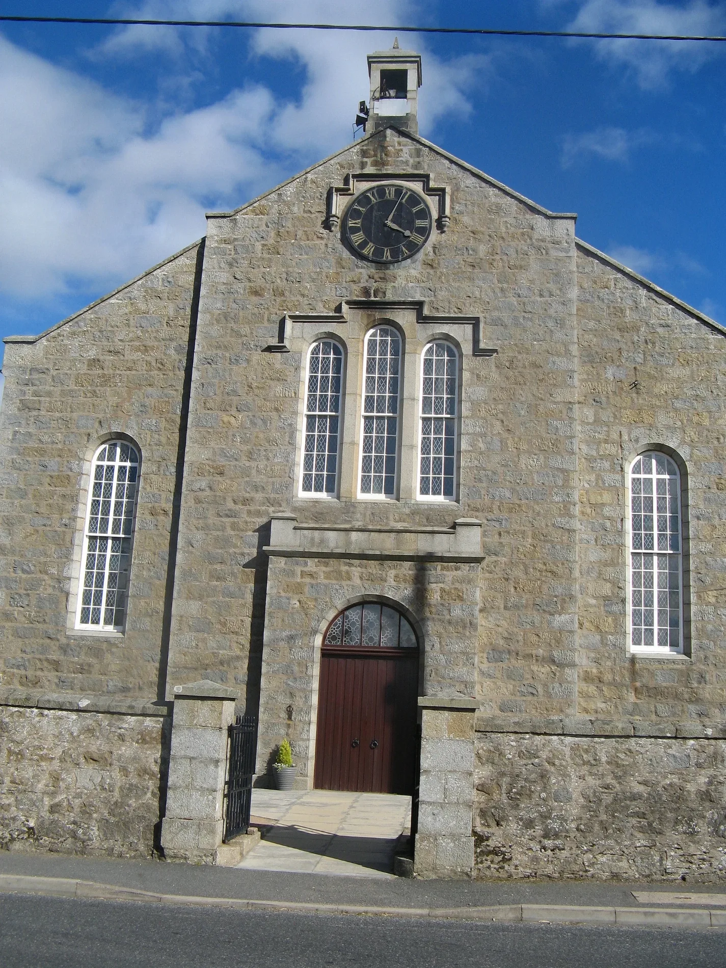
Longside Parish Church in Aberdeenshire
Longside Parish Church in Aberdeenshire is a church. It is near Church Lane and is also known as Longside, Old Parish Church. The church is a listed building. Ⓦ.
- Amenity
- place of worship
- Building Type
- church
Image
Roads nearby
Laburnum Lane100 m
Armoury Lane100 m
The Riggs150 m
Inn Brae150 m
Braehead Place150 m
Smithy LaneKean Bookie, The Square
150 m
Cooper's BraeCoopers Brae
200 m
Glebefield200 m
Inverquhomery Road200 m
Winding BraeBeautannics
250 m
Main StreetLongside, Main Street, Station Road, Winding Brae, Market Hill, Bruce Brae, Longside Post Office, Rothienorman, Rothienorman Pre-school, Celebrations of Turriff, Nickel & Dime, Milanos, Cheynes Place, Chapel Lane, Costcutter, Sandhaven, Sandhaven Post Office, School, Mitchell Court, The Terrace, Odyssee Hair Design, Johnshaven Stores, Knockhall Road, Inch Road, The Quay, Eider Road, Gardenstown, Cairnbulg, Cairnbulg Post Office, Aldersyde House, Banff Road, Cruden Bay Post Office & Store, Rhynie Post Office, MacKay Court, The Square, School Road, Priory Cottages, Sauchen, Green Meadows, The Arch Cafe & Bistro, Sir John S Forbes Memorial Fountain, New Deer Post Office, Culsh Terrace, S & N Purdie, Brucklay Arms, Church Crescent, Church Cresent, Luthermuir, Garmond, Bridge Gardens, Castle Road, Stewart Road, Great Wall, Kingsford Road, Alford Bistro, Alford, Everlong Art Studio & Gift Shop, Aberchirder, School Lane, Rose Innes Home
250 m
Bank Lane300 m
Anderson Drive300 m
Burgess Drive300 m
Parkvale300 m
Church Lane300 m
Market Hill400 m
Harvest Hill400 m
Tullochgorum Gardens450 m
Imray Way500 m
Imray Place550 m
Annand Crescent550 m
Fleeman Avenue600 m
Bruce Brae650 m
Auchlee Bridge650 m
Station RoadLong Close, Modley Avenue, Whisky Brae, Modley Place, Rocksley Inn, Stirling Village, Gordon Avenue, Hatton Post Office, Hatton Market, Murdoch Allan, Station Road, Inverurie, Cocoworks, Littlewood Court, Cafe 83, Orient Express, Cardamom, Aden Country Park, Carnegie Inverurie Museum, Attic, Specsavers, Ladbrokes, Keystore, Henry Lane, Ardmore Distillery, Turriff Service Station, The Auld Mill, Bridgend Terrace, Hatton, Village Hall, Cinnamon Fringe, John Ross Chemist, Dragon House, Bridge Street, Ellon, Inverurie Rail Station, Leys Road, Arbeadie House, Dee Street, Deeside Kilts Ltd, Derbar Indian Restaurant, Gentlemen's Barber, Banchory Gallery, Wee Shoe Shop, Deeside Dental Care, Hughes Macdonald & Davidson, Glebe Park, Newlands Road, Station Court
700 m
Fleeman Crescent700 m
Skinner Road700 m
Fleeman Way750 m
Station PlaceRoad End
750 m
Cheves Circle750 m
Station Terrace800 m
Formatine and Buchan WayAuchnagatt, Post Office, The Formatine & Buchan Way: Ellon to Auchnagatt
1,5 km
Buildings nearby
Longside Telephone Exchange300 m
Auchlee1,1 km
Newmill2,1 km
Canals nearby
Mill Lade2,1 km
Car repair shops nearby
Duthie Motors Ltd400 m
Convenience stores nearby
Londis250 m
Farmhouses nearby
Strawberry Bank1,1 km
Golf courses nearby
Longside Golf Club550 m
Places of worship nearby
Saint John's Church300 m
Public buildings nearby
Longside Church Hall100 m
Recreation grounds nearby
Davidson Park450 m
Rivers nearby
South Ugie Water650 m
School buildings nearby
Longside School250 m
Sports pitches nearby
Longside F.C.300 m
Streams nearby
Burn of Cairngall200 m
Burn of Ludquharn800 m
| Heritage designation | category A listed building |
|---|---|
| Located in | Aberdeenshire, Longside |
| Country | United Kingdom |
 Public transport map Aberdeenshire Legend
| Railway | |
| Bus | |
| Tram |
 Cycling map Aberdeenshire Legend
| Cycle path | |
| Cycle lane on road | |
| Cycling on bus lane | |
| Bicycle street | |
| Cyclists allowed | |
| Cyclists allowed, good surface | |
| No cycling | |
| Cobblestones |
| Long-distance cycle route | (depending on scale) | |
| Long-distance cycle route |
 Walking map Aberdeenshire Legend
| Path |
| Long-distance hiking trail | (depending on scale) | |
| Long-distance hiking trail | ||
| No pedestrians |