
Braefoot Bay Marine Terminal in Aberdour
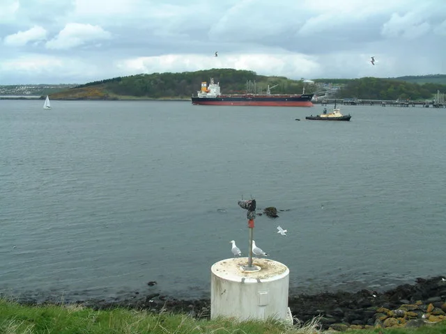
Braefoot Bay Marine Terminal in Alba / Scotland, Aberdour is an industrial area. Braefoot Bay Marine Terminal is also known as Braefoot Bay Terminal.
- Land Use
- industrial area
Image
Antique shops
Delicatessens
Library
Tourist information offices
Newsagent's
Bus stops
Car repair shops
Beauty salons
Hotels
Pharmacy
Pubs
Restaurants
Gift shops
Cafés
Guest house
Community centre
Hairdressers
Off-licences
ATMs
Roads nearby
Beech Avenue600 m
St Colme Avenue1,1 km
St Colme Road1,2 km
St Colme Drive1,2 km
Crowhill Road1,2 km
St Bridget's Roundabout1,2 km
Barnhill Place1,3 km
Moray Way NorthMeadowfield, Forth Crescent, Markfield Road, Hopetoun View, Pentland Rise, Dalgety House View, Couston Drive, Albavet, Sand & Paws, Ace of Fades
1,3 km
Barnhill Road1,3 km
Frankfield Crescent1,3 km
Dalgety House View1,4 km
Dalgety Gardens1,4 km
Frankfield Road1,4 km
Moray Way SouthFrankfield Place, Frankfield Road, Pinnel Place, St Bridget's Brae
1,4 km
Frankfield Place1,4 km
Eastern Access RoadMoray Way North Roundabout, East Access Ridge Way, Dalgety Parish Yard
1,4 km
Inchmickery Avenue1,5 km
Inverkeithing RoadSt. Columba's Church
1,5 km
Old ammunition tunnelInchcolm Museum
1,5 km
Bellhouse Road1,6 km
Inch Avenue1,6 km
Dovecot Park1,6 km
Nature nearby
Long Craig1,0 km
Inchcolm1,4 km
Bare rocks nearby
John Deas Craig400 m
Haystack1,1 km
Meadulse1,2 km
Craigdimas1,4 km
Swallow Craig1,4 km
Buildings nearby
Blockhouse No. 4 (Inner Ring)50 m
Dalgety Bay Art Club1,4 km
Bunkers nearby
Blockhouse No.3 (Outer Ring)250 m
Cemeteries nearby
St Bridget's Kirk1,0 km
Farmyards nearby
Barns Farm1,5 km
Forests nearby
Braefoot Plantation250 m
Temple Plantation650 m
Golf courses nearby
Aberdour Golf Club1,1 km
Houses nearby
St Colme House800 m
Railway lines nearby
Fife Circle Line1,5 km
Service buildings nearby
Watch House1,1 km
Wetlands nearby
Dalgety Bay1,2 km
Woodlands nearby
Tattie Knoll750 m
Primrose Wood850 m
Crowhill Wood1,1 km
Moss Plantation1,1 km
Downans Plantation1,3 km
Skellies Plantation1,4 km
Bluebell Woods1,4 km
Other nearby
Hawes Pier - Inchcolm Island1,8 km
| Located in | Fife |
|---|---|
| Country | United Kingdom |
| Body of water | Firth of Forth |
Public transport map Aberdour Legend
| Railway | |
| Bus | |
| Tram |
Cycling map Aberdour Legend
| Cycle path | |
| Cycle lane on road | |
| Cycling on bus lane | |
| Bicycle street | |
| Cyclists allowed | |
| Cyclists allowed, good surface | |
| No cycling | |
| Cobblestones |
| Long-distance cycle route | (depending on scale) | |
| Long-distance cycle route |
Walking map Aberdour Legend
| Path |
| Long-distance hiking trail | (depending on scale) | |
| Long-distance hiking trail | ||
| No pedestrians |