
Couston Castle in Aberdour
Couston Castle in Alba / Scotland, Aberdour is a castle (listed building, stately home). Couston Castle is near Eastern Access Road. Ⓦ.
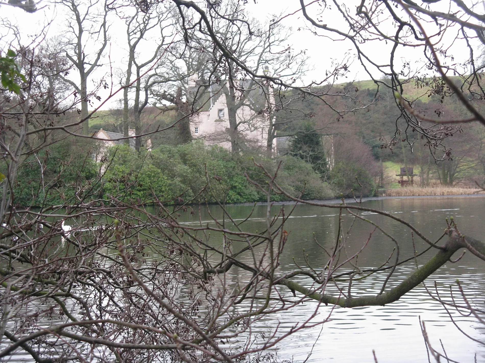
- Building Type
- house
Bus stops
Beauty salons
Pharmacy
Off-licences
Restaurants
Antique shops
Gift shops
Hotels
Pubs
Library
ATMs
Cafés
Guest house
Car repair shops
Delicatessens
Newsagent's
Community centre
Hairdressers
Roads nearby
Seafire Place650 m
Skua Drive800 m
East Way850 m
Cross Way900 m
Eastern Access RoadMoray Way North Roundabout, East Access Ridge Way, Dalgety Parish Yard
900 m
Craigridge Place950 m
Seton Place1000 m
Moubray Road1000 m
St Bridget's Roundabout1,0 km
Moray Way NorthMeadowfield, Forth Crescent, Markfield Road, Hopetoun View, Pentland Rise, Dalgety House View, Couston Drive, Albavet, Sand & Paws, Ace of Fades
1,0 km
Dalgety Gardens1,0 km
Pentland RiseAsian Express, Dalgety Fish Bar, Ale and Pate, Dalgety Bay Dental Practice
1,1 km
Moray Way SouthFrankfield Place, Frankfield Road, Pinnel Place, St Bridget's Brae
1,1 km
Inchmickery Avenue1,1 km
Dalgety House View1,1 km
St Colme Drive1,1 km
Inchmickery Road1,1 km
Frankfield Crescent1,2 km
St Colme Road1,2 km
Barnhill Place1,2 km
Frankfield Road1,2 km
Barnhill Road1,2 km
Crowhill Road1,2 km
Buildings nearby
Cockairnie House150 m
Lochside Cottages200 m
Otterston Castle400 m
Markfield Tower450 m
Mount Laura Tower550 m
Unique Flooring Fife850 m
Points North Ltd850 m
Elements Centre for Wellbeing900 m
Dalgety Bay Art Club1,1 km
Bunkers nearby
Pillbox800 m
Car repair shops nearby
MH Auto Services850 m
Community centres nearby
48th Fife (Dalgety Bay) Scout Group600 m
859 Squadron - Air Training Corps900 m
Dog parks nearby
Barns Farm Dog Field450 m
Farmyards nearby
Barns Farm800 m
Pleasants900 m
Banks Farm1,2 km
Funeral directors nearby
Crosbie Matthew Funeral Directors1,2 km
Industrial areas nearby
BAE Systems750 m
Industrial buildings nearby
Kelvin Building850 m
Office buildings nearby
Logos House900 m
Eastway Construction900 m
Orchards nearby
Banks Farm Orchard1,1 km
Places of worship nearby
Cornerstone Full Gospel Church600 m
Woodlands nearby
Harelaw Island100 m
Bluebell Woods1,1 km
| Located in | Fife, Aberdour |
|---|---|
| Country | United Kingdom |
Public transport map Aberdour Legend
| Railway | |
| Bus | |
| Tram |
Cycling map Aberdour Legend
| Cycle path | |
| Cycle lane on road | |
| Cycling on bus lane | |
| Bicycle street | |
| Cyclists allowed | |
| Cyclists allowed, good surface | |
| No cycling | |
| Cobblestones |
| Long-distance cycle route | (depending on scale) | |
| Long-distance cycle route |
Walking map Aberdour Legend
| Path |
| Long-distance hiking trail | (depending on scale) | |
| Long-distance hiking trail | ||
| No pedestrians |