
Cullalo Crescent in Aberdour
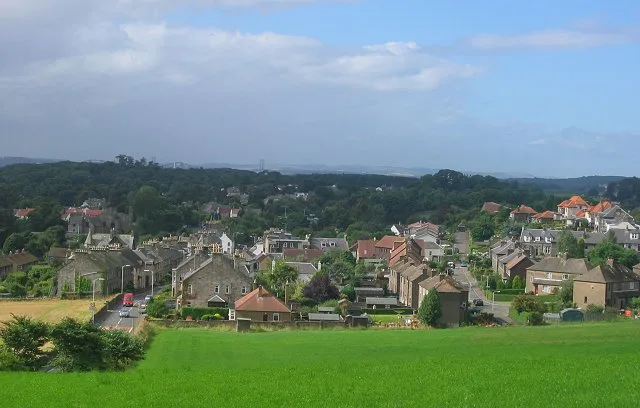
Cullalo Crescent in Alba / Scotland, Aberdour is an asphalted residential street and it runs in a northeast-southwest direction starting from Murrell Road and ends in a cul-de-sac.
- Road Type
- residential street
- Speed Limit
- 20 mph
- Route
- northeast-southwest
Image
Cafés
Bicycle shops
Stations
ATMs
Pubs
Bus stops
Gift shops
Platforms
Museum
- Aberdour Heritage Centre (opening hours: Wed 14–16; Sat 14–16, web) at Station Place (KY3 0SN) – approx. 550 m.
Restaurants
Hairdressers
Newsagent's
Antique shops
Guest house
Artwork
Candle shops
Off-licences
Roads nearby
Murrell Road100 m
St Fillans Grove100 m
Humbie Terrace150 m
Lower Glebe150 m
Murrell Terrace200 m
St Fillans Crescent250 m
Murray PlaceThe Seanie Guest House
250 m
MorayvaleDave's Bike Shed
300 m
The Glebe300 m
Balram Road300 m
Morton Lane300 m
Main StreetMurrell Road, Morayvale, The Purple Shop
300 m
The Heughs View350 m
Castle View400 m
Home Park450 m
Tarlair Wynd450 m
Hawkcraig Road550 m
Hewitt PlaceAberdour in Bloom
600 m
Station PlaceAberdour, Railway Station, Aberdour Heritage Centre
600 m
Telney Place600 m
Mill Farm Road600 m
High StreetRBS, Aberdour Bistro, The Drinks Cabinet, The Curator, Blakes Vintage & Collectables, Willie's Newsagent, Aberdour, Foresters Arms, Aberdour Pharmacy, Park Lane, Aberdour Hotel, Antiques and Gifts, The Crescent, P&P Delicatessen, Small Wonders, Manse Place, Woodside Garage
650 m
Livingston LaneLittle White Candle
650 m
Dour Burn Bridge650 m
Kemal's Cut650 m
Donkey Brae700 m
Shore RoadCafe @ Number 16, Hair By Alexis, Heart's Desire, Coastal Reflections, Aberdour Library, Aberdour Community Centre, Peartree House B And B, The Prospect From Aberdour, Còsagach Harbour Studio
800 m
Ladies Walk850 m
Arts centres nearby
Aberdour Signal Box500 m
Attraction nearby
Aberdour Castle400 m
Beaches nearby
Silver Sands850 m
Buildings nearby
Pavilion450 m
Aberdour Castle Dovecot500 m
Aberdour Telephone Exchange700 m
Aberdour Boat Club800 m
Cafés nearby
Sands, A Place By The Sea800 m
Community centres nearby
St Fillan's Church Hall700 m
Farmyards nearby
Humbie500 m
Gardens nearby
Aberdour Castle Gardens450 m
The Old School Sensory Garden600 m
Places of worship nearby
St. Fillans400 m
Railway lines nearby
Fife Circle Line350 m
Recreation grounds nearby
Hawkcraig Park450 m
Silver Sands Park750 m
Residential buildings nearby
Aberdour House550 m
Rivers nearby
Dour Burn400 m
Sports pitches nearby
Aberdour Shinty Club600 m
Tourist information offices nearby
Aberdour Castle and Gardens400 m
Woodlands nearby
Humbie Wood850 m
Public transport map Aberdour Legend
| Railway | |
| Bus | |
| Tram |
Cycling map Aberdour Legend
| Cycle path | |
| Cycle lane on road | |
| Cycling on bus lane | |
| Bicycle street | |
| Cyclists allowed | |
| Cyclists allowed, good surface | |
| No cycling | |
| Cobblestones |
| Long-distance cycle route | (depending on scale) | |
| Long-distance cycle route |
Walking map Aberdour Legend
| Path |
| Long-distance hiking trail | (depending on scale) | |
| Long-distance hiking trail | ||
| No pedestrians |