
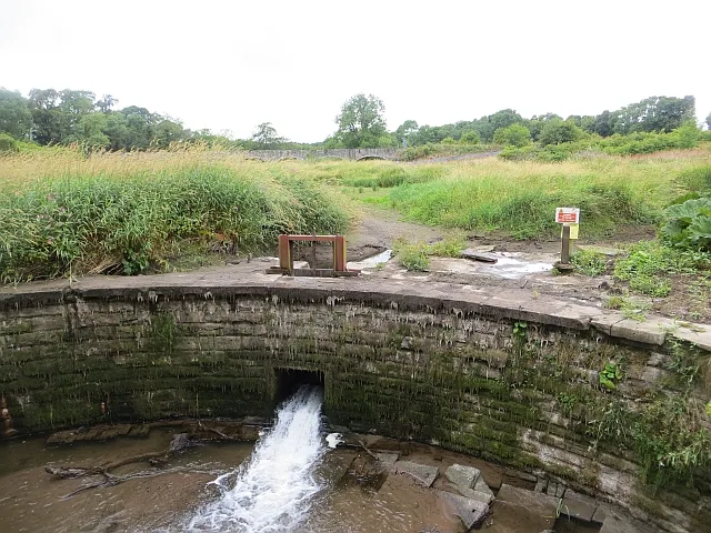
Burnside of Duntrune Dam in Angus, Scotland
Burnside of Duntrune Dam in Angus is a weir. Burnside of Duntrune Dam is also known as Burnside Of Duntrune, Mill, Dam.
- Waterway Type
- weir
Image
Roads nearby
Braeside CottagesBraeside Cottages
150 m
Oak Loan500 m
Elm Rise850 m
Golf View900 m
Lime Grove900 m
Copper Beech Row1000 m
Old Quarry Road1000 m
Silver Birch DriveBallumbie Castle Estate
1000 m
Ballumbie View1,0 km
Ballumbie Gardens1,0 km
Ballumbie Drive1,1 km
Ballumbie Rise Walk1,1 km
Ballumbie Rise Avenue1,2 km
Ballumbie Rise Gardens1,2 km
Ballumbie Place1,2 km
Ballumbie Braes1,3 km
Thirlestane Place1,3 km
Aberlady Crescent1,3 km
Ballumbie Meadows1,3 km
Castleview Park1,3 km
Traquair Gardens1,3 km
Dunbar Park1,4 km
Chirnside Place1,4 km
Dunbar Terrace1,4 km
Haddington Place1,4 km
Duns Crescent1,4 km
Ballumbie RoadBerwick Drive, Hawick Drive, Burnside of Duntrune
1,4 km
Greenfield Drive1,4 km
Dunbar Gardens1,4 km
Castleview Place1,4 km
Earlston Avenue1,4 km
Peebles DriveBallumbie, Myrtlehall Gardens, Spartleton Place
1,5 km
Lothian CrescentLonghaugh Primary School, St Francis RC Primary School, Quarry View Nursery, Whitfield Drive, Whitfield, Ballumbie Primary School, The Crescent, Metal Tree
1,5 km
Selkirk Gardens1,5 km
Ashkirk Place1,5 km
Badenoch Place1,5 km
Silver Link Avenue1,5 km
Britannia Drive1,5 km
Westhall TerracePhone Box, Westhall Terrace
1,9 km
Buildings nearby
Duntrune House550 m
Ballumbie Castle (remains)750 m
Community centres nearby
Murroes Community Hall1,8 km
Farmyards nearby
Craighill1000 m
KnoweheadBook Swap Box
1,6 km
Golf courses nearby
Ballumbie Castle Golf Course900 m
Parks nearby
Middleton Wood1,1 km
Rivers nearby
Fithie Burn850 m
Social facilities nearby
Ballumbie Court1,2 km
Woodlands nearby
Backmuir Wood1,6 km
| Located in | Angus, Murroes |
|---|---|
| Country | United Kingdom |
| Location | Burnside of Duntrune |
 Public transport map Angus Legend
| Railway | |
| Bus | |
| Tram |
 Cycling map Angus Legend
| Cycle path | |
| Cycle lane on road | |
| Cycling on bus lane | |
| Bicycle street | |
| Cyclists allowed | |
| Cyclists allowed, good surface | |
| No cycling | |
| Cobblestones |
| Long-distance cycle route | (depending on scale) | |
| Long-distance cycle route |
 Walking map Angus Legend
| Path |
| Long-distance hiking trail | (depending on scale) | |
| Long-distance hiking trail | ||
| No pedestrians |