
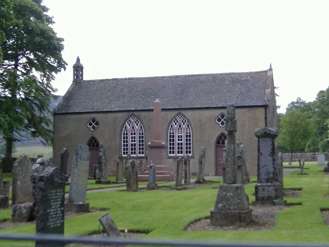
Lochlee Parish Church in Angus, Scotland
Lochlee Parish Church in Angus is a church. It is near Mounth Road and is a listed building.
- Amenity
- place of worship
- Building Type
- building
Image
Roads nearby
Mounth RoadHouse of Mark
1,6 km
Tarfside Bridge4,7 km
Buskhead Bridge4,8 km
Glen Mark4,9 km
The Whisky RoadBuskhead, Collfrusk, Stonyford
5,0 km
Fungle RoadShinfur
5,2 km
Boathouses nearby
Boat House3,3 km
Body of waters nearby
Loch Lee2,8 km
Carlochy4,5 km
Buildings nearby
Tarfside Cottages4,7 km
Tarfside Telephone Exchange4,8 km
Cliffs nearby
Gilfumman2,7 km
Craig Breostock3,7 km
Black Skelly4,0 km
Farmyards nearby
Milton Farm3,7 km
Hotels nearby
House of Mark300 m
Houses nearby
Gardener's Cottage300 m
Whitehillocks1,0 km
Birchgrove1,1 km
Glenmark cottage3,8 km
Industrial buildings nearby
River Mark Guaging Station200 m
Places of worship nearby
St Drostan's Church & Lodge4,6 km
Rivers nearby
Water of Lee650 m
Water of Effock2,7 km
Water of Tarf4,8 km
Streams nearby
Burn of Laurie1,8 km
Burn of Glascorrie2,1 km
Burn of Calanach2,2 km
Burn of Reehewan2,9 km
Burn of Branny3,1 km
Burn of Bathie3,2 km
Burn of Milton3,4 km
Burn of Cluan3,8 km
Burn of Rowan3,9 km
Burn of Cochlie4,0 km
Cateran Grain4,4 km
Burn of Camlet4,4 km
Easter Burn4,5 km
Burn of Glasspit4,7 km
Burn of Badlessie4,8 km
Burn of Clearach5,1 km
Burn of Keddloch5,1 km
Burn of Blackstock5,2 km
Ladder Burn5,3 km
Burn of Crippley5,4 km
Millstone Stripe5,5 km
Swimming areas nearby
Monk's Pool1,1 km
Valleies nearby
Glen Effock2,8 km
Glen Lee3,4 km
| Heritage designation | category B listed building |
|---|---|
| Protected area | Cairngorms National Park |
| Located in | Angus, Lochlee |
| Country | United Kingdom |
 Public transport map Angus Legend
| Railway | |
| Bus | |
| Tram |
 Cycling map Angus Legend
| Cycle path | |
| Cycle lane on road | |
| Cycling on bus lane | |
| Bicycle street | |
| Cyclists allowed | |
| Cyclists allowed, good surface | |
| No cycling | |
| Cobblestones |
| Long-distance cycle route | (depending on scale) | |
| Long-distance cycle route |
 Walking map Angus Legend
| Path |
| Long-distance hiking trail | (depending on scale) | |
| Long-distance hiking trail | ||
| No pedestrians |