
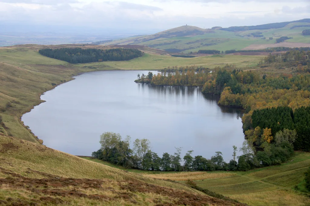
Long Loch in Angus, Scotland
Long Loch in Angus is a body of water. Long Loch is also known as Long Loch of Lundie. Long Loch also exists in Highland, South Ayrshire and East Renfrewshire. Ⓦ.
- Nature
- body of water
Image
Roads nearby
Keillor Path2,3 km
Dundee RoadThe Newtyle Garage, Red Lion Caravan Park, Red Lion, Ice Cream Bar, HomeBargain Bus Stop, Asda, Newtyle Church, Glamis Village, Glamis School, Mary Countess Way, Kerr's Miniature Railway, Elliot Caravan Park
2,8 km
Kirkton RoadKirkton of Newtyle, Park View, Kirkton Shops, Cairnie Loan, Aikman Road, Millfield Kitchens & Chinese Takeaway, Primary School, Kirkton of Airlie, Grange of Airlie, Kirkton Road, Hunter Road, East Kirkton Road
2,8 km
Smiddy Road2,9 km
Monteith Place2,9 km
Dunarn Terrace2,9 km
Body of waters nearby
Pitlyal1,0 km
Lundie Loch1,3 km
Hunkrum Dubs1,7 km
Ledcrieff Loch2,1 km
Smithton Loch2,3 km
Ledyatt Loch3,0 km
Buildings nearby
Kinpurnie Castle2,1 km
Bannatyne House2,6 km
Lodge2,8 km
Cliffs nearby
Lundie Craigs1,4 km
Farmyards nearby
Wester Keith450 m
Easter Keith800 m
Sunnyhall800 m
Ardgarth1,4 km
High Keillor1,7 km
Kirkton of Lundie1,9 km
The Neuk1,9 km
Balshando2,4 km
Millhole2,8 km
Ledyatt2,9 km
Hatton2,9 km
Lochindores3,0 km
Forests nearby
Lundiecraigs Wood1,7 km
The Birks2,0 km
Millhole Strip2,1 km
Houses nearby
Thriepley1,4 km
Burnside2,0 km
Smithy House2,5 km
East Kinpurney2,7 km
Nature reserves nearby
Round Loch of Lundie SSSI1,1 km
Balshando Bog2,5 km
Places of worship nearby
Lundie Parish Church1,8 km
Newtyle Parish Church2,9 km
Quarries nearby
Burnside Quarry (disused)2,5 km
Residential areas nearby
Clushmill1,8 km
Streams nearby
Den Burn1,5 km
Neuk Burn2,2 km
Clushmill Burn2,2 km
Newtyle Burn2,6 km
Valleies nearby
Glack of Newtyle2,6 km
Wetlands nearby
Ardgarth Loch1,2 km
Woodlands nearby
Palmer Wood550 m
Ledyatt Wood3,0 km
| Area | 29 ha |
|---|---|
| Located in | Angus |
| Country | United Kingdom |
 Public transport map Angus Legend
 | Railway | |
| Bus | |
| Tram |
 Cycling map Angus Legend
 | Cycle path | |
| Cycle lane on road | |
| Cycling on bus lane | |
| Bicycle street | |
| Cyclists allowed | |
| Cyclists allowed, good surface | |
| No cycling | |
| Cobblestones |
| Long-distance cycle route | (depending on scale) | |
| Long-distance cycle route |
 Walking map Angus Legend
 | Path |
| Long-distance hiking trail | (depending on scale) | |
| Long-distance hiking trail | ||
| No pedestrians |