
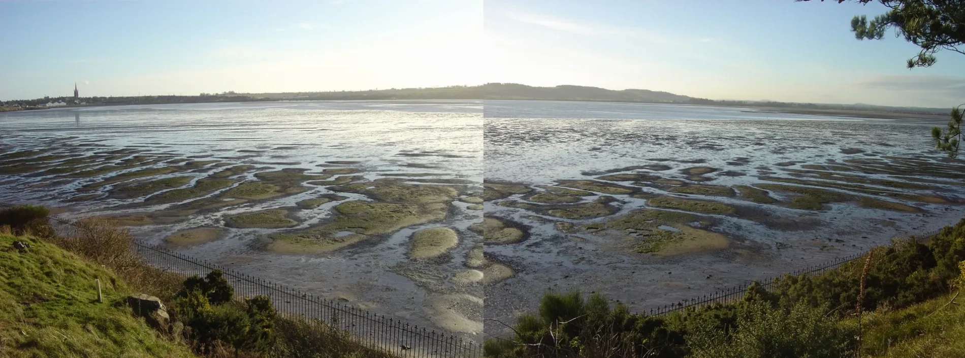
Montrose Basin Local Nature Reserve in Angus, Scotland
Montrose Basin Local Nature Reserve in Angus is a nature reserve (Scottish Wildlife Trust) 🌐. Montrose Basin Local Nature Reserve is also known as Montrose Basin. Montrose Basin Local Nature Reserve is near Braoch Road. Ⓦ.
- Alternative Name
- Montrose Basin;Montrose Basin LNR
- Leisure
- nature reserve
- Operator
- Scottish Wildlife Trust
- Website
- http://www.montrosebasin.org.uk/
Image
Roads nearby
Ferryden Roundabout850 m
Braoch Road850 m
Burnside PlaceBurnside Place
850 m
Inch Terrace850 m
St Brioc Way850 m
Thomson Terrace900 m
Braoch Park900 m
Seaview Place950 m
Rossie Island RoadGood Food 2 Go, Inch Terrace, Rossie Island Rd at Inch Terrace, Bus Depot, Riverside Road, Croft Road
950 m
Craig RoadCrossroads
950 m
Craig Crescent1000 m
Esk Road1,1 km
Caird AvenueRossie Island
1,1 km
Croft Road1,1 km
Riverside Road1,1 km
Barns Brae1,1 km
Eskview Terrace1,1 km
Grampian View1,1 km
Ogilvie TerraceBurnside Place, West Terrace
1,2 km
Inchbrayock RoadFerryden
1,3 km
Wharf StreetStroma Bistro
1,3 km
Bridge StreetBridge Street, Old Post Office
1,5 km
SeagateCoolinary Café, The Old Brewhouse, Arbroath Fisheries, Alex Spink & Sons
1,5 km
Shore Wynd1,5 km
Basin ViewMontrose Infirmary, BP, Nisa
1,6 km
Upper Craigo Street1,6 km
Lower Craigo StreetPremier
1,6 km
Provost Johnston Road1,6 km
Apple Wynd1,6 km
Castle StreetNewtyle, Westwood
1,6 km
Bird hides nearby
The Bank of Scotland Hide200 m
Buildings nearby
Craig House450 m
Montrose Royal Infirmary1,4 km
Inchbraoch House1,5 km
Montrose Lifeboat Station1,5 km
Churches nearby
Craig Church850 m
Farmyards nearby
East Mains of Dysart1,8 km
Balkiellie1,8 km
Industrial areas nearby
Harkand1,0 km
Montrose Port1,3 km
Places of worship nearby
Inchbrayock Parish Church1,5 km
Melville South Church1,6 km
Railway lines nearby
Edinburgh to Aberdeen Line1,4 km
Razed railways nearby
Iron Foundry1,4 km
Recreation grounds nearby
King George Playing Fields1,0 km
Sports pitches nearby
Montrose Bowling Club1,6 km
Tidal channels nearby
Steinshell Burn1,0 km
Tourist information offices nearby
Montrose Basin Wildlife Centre100 m
Woodlands nearby
Baldovie Den1,3 km
| Heritage designation | Site of Special Scientific Interest, Ramsar site |
|---|---|
| Located in | Angus |
| Country | United Kingdom |
 Public transport map Angus Legend
| Railway | |
| Bus | |
| Tram |
 Cycling map Angus Legend
| Cycle path | |
| Cycle lane on road | |
| Cycling on bus lane | |
| Bicycle street | |
| Cyclists allowed | |
| Cyclists allowed, good surface | |
| No cycling | |
| Cobblestones |
| Long-distance cycle route | (depending on scale) | |
| Long-distance cycle route |
 Walking map Angus Legend
| Path |
| Long-distance hiking trail | (depending on scale) | |
| Long-distance hiking trail | ||
| No pedestrians |