
Image
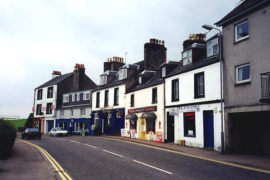
Roads nearby
Brackley Park150 m
Glenburn RoadThe Grey Gull Hotel, Dalriada B&B
400 m
Linnet Court850 m
Columba Court900 m
Poltalloch StreetThe Square Peg, The Square Peg Sandwich Bar
950 m
Glenfyne Park950 m
Upper Glenfyne ParkPrimary School, Ardrishaig, Glenfyne Terrace
1000 m
Ross Crescent1000 m
Paterson Street1000 m
Colchester SquareThe Square Peg
1,0 km
Smithy LaneThe Smiddy Bistro
1,0 km
Lochnell StreetLochnell Street, The Comm, The Argyll Inn, West Coast House, Bee Sweet
1,0 km
Lorne StreetStag Hotel, Argyll Book Centre, Cafe 35, Lochgilphead, Lorne Street
1,0 km
Peddie Bank1,1 km
Argyll StreetLochgilphead, Truhealth Pharmacy, Morrisons Daily, Argyll Pharmacies Ltd, Marmalade Deli, H.D Ferguson & Sons, Argyll Cafe, Danny's, Mountain Warehouse, Joules, Chalmers, Taste of Argyll Kitchen, Captain's Folly, Fat Face, Sea Kayak Oban, Dunoon, Moir Street, Boots, Co-op, St. John's Church, rightmedicine Pharmacy, Bookpoint, The Wee Shop, Dunoon Turkish Barber, Kents of Dunoon, Top Up Tap, Library, Walkers Garden Centre, Argyll Street Surgery, The Bargain Zone, Murray Smoked Products, Bluestone, Fyne Tackle, The Community Shop
1,1 km
Stag Park Court1,1 km
Union StreetThe Archway
1,1 km
Macbraynes Lane1,1 km
Dochas Place1,1 km
Stag Park1,1 km
Highbank1,1 km
Bishopton RoadLochgilphead Council Yard, Fernoch Drive opp, Fernoch Drive
1,2 km
Jubilee Terrace1,2 km
Brodie Crescent1,2 km
Oban RoadLochgilphead, Oban Road, at Co-op
1,2 km
Highbank Park1,2 km
Fernoch Park1,3 km
Fernoch Drive1,3 km
Banks nearby
Bank of Scotland950 m
Buildings nearby
Clock Lodge950 m
Ardrishaig Bowls & Tennis Club1000 m
McCracken Court1,0 km
Lochgilphead Telephone Exchange1,0 km
Coronation Terrace1,2 km
Campsite nearby
Lochgilphead Caravan Park900 m
Convenience stores nearby
Co-op Food1,2 km
Funeral directors nearby
Donald McDonald1000 m
Guest house nearby
The Corran800 m
Kilmory1,0 km
Places of worship nearby
Lochgilphead Baptist Church1,1 km
Christ Church1,2 km
St Margret's1,3 km
Post depots nearby
Lochgilphead Delivery Office950 m
Rivers nearby
Cuil Arstich Burn850 m
Service buildings nearby
Automatic Waster350 m
Sports pitches nearby
Ropework Park1,2 km
Streams nearby
Kilduskland Burn950 m
Badden Burn1,3 km
Tyre shops nearby
Argyll Tyres1,2 km
| Located in | Argyll and Bute, South Knapdale |
|---|---|
| Country | United Kingdom |
| Population | 1290 |
 Public transport map Argyll and Bute Legend
| Railway | |
| Bus | |
| Tram |
 Cycling map Argyll and Bute Legend
| Cycle path | |
| Cycle lane on road | |
| Cycling on bus lane | |
| Bicycle street | |
| Cyclists allowed | |
| Cyclists allowed, good surface | |
| No cycling | |
| Cobblestones |
| Long-distance cycle route | (depending on scale) | |
| Long-distance cycle route |
 Walking map Argyll and Bute Legend
| Path |
| Long-distance hiking trail | (depending on scale) | |
| Long-distance hiking trail | ||
| No pedestrians |