
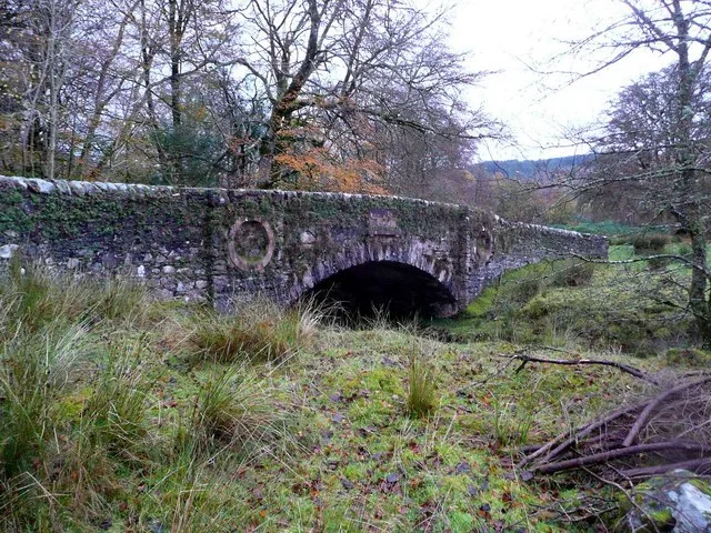
Betty Jenkins' Bridge in Argyll and Bute
Betty Jenkins' Bridge in Argyll and Bute is a track (solid surface). It runs in a north-south direction and ends in a cul-de-sac. Betty Jenkins' Bridge is also known as Strachur House Policies, Betty Jenkins's Bridge.
- Bicycle
- yes
- Road Type
- track
- Route
- north-south
Image
Roads nearby
Stronechrevich Lane400 m
Strachur Village RoadStrachur
400 m
Clachan Beag450 m
New City RoadStrachur Post Office, Bay Cottage
500 m
Montgomery Place550 m
Manse Gardens550 m
Forest View700 m
Baycroft1000 m
Old Baycroft1,2 km
Balliemeanoch LaneBalliemeanoch
1,6 km
Letters Way1,9 km
East Letters2,0 km
West Side Of Loch Eck Track Benmore to GlenbranterBernice Glen
4,8 km
Upper AvenueNorth Cromalt
5,8 km
The Avenue5,9 km
Manse Crescent6,0 km
Buildings nearby
Games Hall4,1 km
Buildings nearby
Strachur House300 m
High Hall400 m
Strachur Telephone Exchange500 m
Old Manse500 m
The Pavilion1,1 km
Balliemeanoch Farmhouse1,6 km
Allt Darach2,4 km
Site Office4,2 km
Campsite nearby
Stucreoch Caravan Park3,9 km
Caravan site nearby
Argyll Caravan Park4,0 km
Doctor's practice nearby
Strachur Medical Practice750 m
Farmyards nearby
Succoth Farm3,2 km
Dalchenna Farm4,3 km
Fire stations nearby
Strachur Community Fire Station500 m
Golf courses nearby
Inveraray Golf Club5,9 km
Guest house nearby
Watterside Cottage700 m
Rudha-Na-Craige, B&B5,9 km
Heaths nearby
Teanga na Mein2,6 km
Hotels nearby
The Creggans Inn900 m
Military areas nearby
MOD Loch Fyne2,9 km
Museum nearby
Strachur Smiddy550 m
Places of worship nearby
Strachur Free Church400 m
Strachur and Strathlachlan Parish Church400 m
Pubs nearby
The Clachan Bar550 m
Restaurants nearby
Skippers4,1 km
Rivers nearby
Allt Gan Ainm400 m
Allt nan Sac500 m
Eas Dubh2,2 km
Sports pitches nearby
Shinty Field1,2 km
Streams nearby
River Cur3,2 km
Allt Robuic4,9 km
Town halls nearby
Strachur Memorial Hall300 m
| Named after | Betty Jenkins |
|---|---|
| Located in | Argyll and Bute, Strachur |
| Country | United Kingdom |
| Crosses | Eas Dubh |
| Carries thoroughfare | unclassified road |
 Public transport map Argyll and Bute Legend
| Railway | |
| Bus | |
| Tram |
 Cycling map Argyll and Bute Legend
| Cycle path | |
| Cycle lane on road | |
| Cycling on bus lane | |
| Bicycle street | |
| Cyclists allowed | |
| Cyclists allowed, good surface | |
| No cycling | |
| Cobblestones |
| Long-distance cycle route | (depending on scale) | |
| Long-distance cycle route |
 Walking map Argyll and Bute Legend
| Path |
| Long-distance hiking trail | (depending on scale) | |
| Long-distance hiking trail | ||
| No pedestrians |