
Image
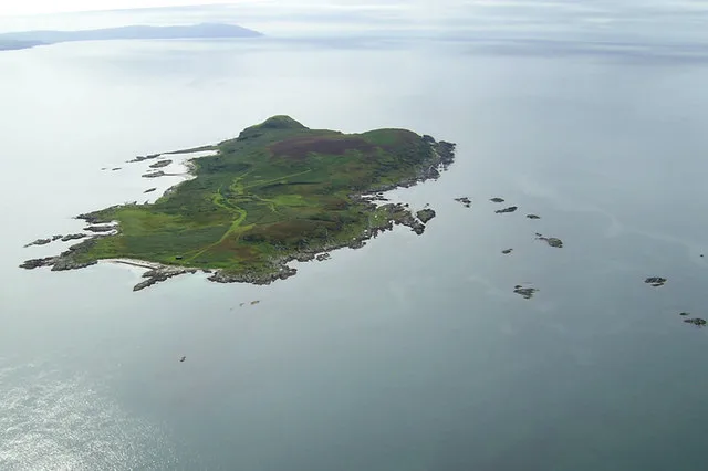
Roads nearby
Grianan4,2 km
RaonmorArdminish, Gigha (Isle Of) Post Office, Ardminish Stores
4,5 km
Gigha Ferry SlipGigha
4,8 km
A' Chleit DriveA' Chleit
5,0 km
Tarbert RoadBrae Road junct, Corriechrevie Vista, Corriechrevie, Kilchenzie, Clachan, opposite Ronachan House, Clachan Filling Station, Tayinloan, Rhunahaorine, Muasdale, Drum, the Putechan, Low Ballevain, Westport, Killean, Glenbarr, Bellochantuy, Men of Kilcalmonell War Memorial Gateway, Clachan, Bus Shelter, Whitehouse, West Kintyre Community Council, The Putechan
5,2 km
Standing Stone Road5,3 km
Beachmore DriveNorth Beachmore (closed?)
5,3 km
Tayinloan Ferry RoadFerry Farm Tea Room, Tayinloan PO, Tayinloan
5,7 km
Nature nearby
Sgeir Buideil300 m
Coire Cara550 m
Sgeir a'Bhuntata700 m
Sgeir Leathan1,1 km
Sgeir nan Sgarbh1,2 km
Corr Eilean1,4 km
Sgeir nan Ròn1,5 km
Gigalum1,8 km
Eilean na h-Uilinn1,9 km
Sgeir Cailleach Eòin2,0 km
Eilean Lagan a'Phuirt2,0 km
Eilean Liath3,3 km
Craro3,6 km
Eilean a' Chùil4,1 km
Eilean Bracach4,1 km
Aquacultures nearby
Gigha Halibut2,6 km
Body of waters nearby
Tarr an Tairbh5,3 km
Upper Loch5,8 km
Mill Loch5,8 km
Buildings nearby
Brae House4,0 km
Gigha Telephone Exchange4,6 km
HM Coastguard - Gigha Coastguard Rescue Team4,8 km
Campsite nearby
Gigha Camp and Motorhome Site5,0 km
Cemeteries nearby
Killean Old Chuchyard Cemetery Extension5,5 km
Community centres nearby
Gigha Village Hall3,6 km
Fire stations nearby
Gigha Community Fire Station3,8 km
Golf courses nearby
Gigha Golf Club5,4 km
Guest house nearby
Ferry Farm B&B5,7 km
The Ferry Inn5,8 km
Hotels nearby
Gigha Hotel4,3 km
Places of worship nearby
Gigha and Cara Parish Church4,6 km
A' Chleit4,9 km
Public toilets nearby
Gigha Ferry5,8 km
Reefs nearby
Sgeir a'Caolas4,3 km
Straits nearby
Sound of Gigha1000 m
Caolas Gigalum1,6 km
Streams nearby
Dubh Ghlac2,1 km
Killean Burn5,3 km
Tayinloan Burn5,6 km
Other nearby
Gigha2,3 km
Tayinloan - Gigha4,6 km
| Area | 66 ha |
|---|---|
| Located in | Argyll and Bute, Gigha and Cara |
| Country | United Kingdom |
| Body of water | Sea of the Hebrides |
| Part of | Inner Hebrides |
 Public transport map Argyll and Bute Legend
| Railway | |
| Bus | |
| Tram |
 Cycling map Argyll and Bute Legend
| Cycle path | |
| Cycle lane on road | |
| Cycling on bus lane | |
| Bicycle street | |
| Cyclists allowed | |
| Cyclists allowed, good surface | |
| No cycling | |
| Cobblestones |
| Long-distance cycle route | (depending on scale) | |
| Long-distance cycle route |
 Walking map Argyll and Bute Legend
| Path |
| Long-distance hiking trail | (depending on scale) | |
| Long-distance hiking trail | ||
| No pedestrians |