
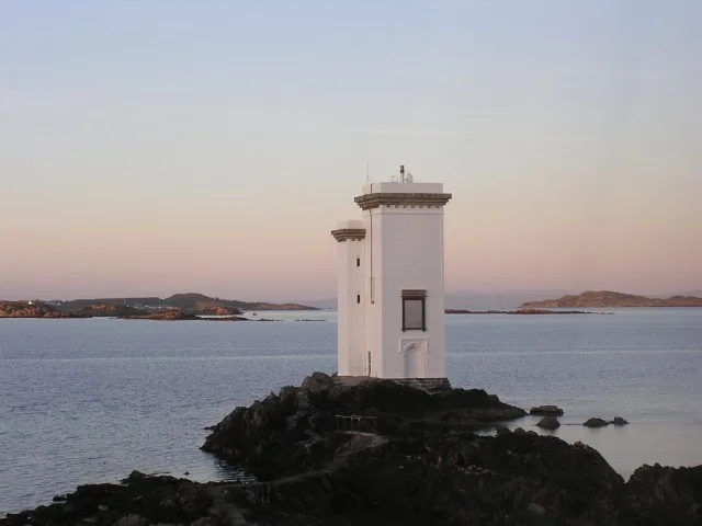
Carraig Fhada Lighthouse in Argyll and Bute
Carraig Fhada Lighthouse in Argyll and Bute is a lighthouse (elevation 21 m). Carraig Fhada Lighthouse is also known as Islay, Carraig Fhada, Port Ellen Lighthouse. Carraig Fhada Lighthouse is near Mckerral Road. Ⓦ.
- Building Type
- building
Image
Roads nearby
Mckerral Road1,6 km
81,6 km
9Caledonian MacBrayne
1,6 km
71,6 km
61,6 km
51,6 km
41,6 km
31,6 km
21,6 km
1Port Askaig Stores & Post Office, Port Askaig
1,6 km
School StreetBowmore, Gearach, Kilchiaran, Tylochan, Gleann Mòr
1,7 km
Dail Na Mara1,7 km
Pier RoadAskernish, Camella Crafts, Port Charlotte, The Villager Royal, Pier, St Mocha Coffee, Yellow Hare, Pier Laundry, Loch Lomond Arms Hotel, Alderdale Cottage, The Village Rest, Luss Seafood Bar, Luss General Store, Small Isles Bay, Jura Hotel Toilets, Port Ellen
1,7 km
Bay View1,9 km
North Bay1,9 km
Antrim View54723256
1,9 km
Nature nearby
Sgeir Fhada1,2 km
Sgeir Phlocach1,3 km
Sgeir Liath1,4 km
Sgeir nan Cruban1,4 km
Attraction nearby
Kilnaughton Chapel1,0 km
Beaches nearby
The Singing Sands450 m
Kilnaughton Beach1,1 km
Port an Eas2,0 km
Buildings nearby
Port Ellen Distillery1,8 km
Port Ellen Warehouse1,8 km
Port Ellen Maltings1,9 km
Cemeteries nearby
War Graves1,1 km
Kilnaughton Cemetery1,1 km
Commercial buildings nearby
The Lemonade Factory1,9 km
Guest house nearby
Cala Sith1,7 km
40 Pier Road1,7 km
Houses nearby
Samhchair900 m
Kilnaughton House1,3 km
Heather Park1,4 km
Cairnmore House1,4 km
Western Cottage1,4 km
Cairn Cottage1,4 km
Carraig Mhor1,5 km
The Old School1,7 km
Cinnamara1,9 km
Industrial areas nearby
Kiln Square1,8 km
Industrial buildings nearby
Port Ellen Grain Store1,6 km
Residential areas nearby
Kilnaughton1,0 km
Stations nearby
Port Ellen Ferry Terminal1,6 km
Straits nearby
Caolas Eilean nan Caorach1,4 km
Streams nearby
Allt an t-Seilich1,0 km
Kilnaughton River1,3 km
Woodlands nearby
Cairnmore Woods1,4 km
| Heritage designation | category B listed building |
|---|---|
| Located in | Argyll and Bute, Kildalton |
| Country | United Kingdom |
 Public transport map Argyll and Bute Legend
| Railway | |
| Bus | |
| Tram |
 Cycling map Argyll and Bute Legend
| Cycle path | |
| Cycle lane on road | |
| Cycling on bus lane | |
| Bicycle street | |
| Cyclists allowed | |
| Cyclists allowed, good surface | |
| No cycling | |
| Cobblestones |
| Long-distance cycle route | (depending on scale) | |
| Long-distance cycle route |
 Walking map Argyll and Bute Legend
| Path |
| Long-distance hiking trail | (depending on scale) | |
| Long-distance hiking trail | ||
| No pedestrians |