
Loch Loskin in Argyll and Bute
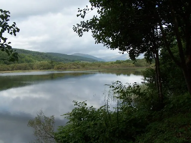
Loch Loskin in Argyll and Bute is a body of water. Ⓦ.
- Nature
- body of water
Image
Roads nearby
Ardenslate RoadDunoon Grammar School
150 m
Dunloskin View300 m
Lochan Avenue400 m
Birch Gate400 m
Bencorrum Brae600 m
Sanderson Drive650 m
Sandbank RoadDunloskin
650 m
Elizabeth Avenue650 m
Shuna Gardens750 m
Hafton Court750 m
Sanda GardensArdenslate
750 m
Ardenslate Crescent800 m
Bogleha RoadBogleha
850 m
Victoria ParkMinard
900 m
Park Road950 m
Bogleha Green1000 m
Cowal Avenue1000 m
Alexander StreetValrose Terrace
1000 m
Union StreetThe Archway
1,0 km
Hamilton Street1,0 km
Johnston Terrace1,0 km
Limecroft1,0 km
Miller Court1,1 km
Jessie Place1,1 km
Jaycroft1,1 km
Union Lane1,1 km
Glenallan1,1 km
Victoria Road1,1 km
St Andrew's Square1,1 km
Spence Court1,1 km
Gorsecroft1,1 km
Cowal PlaceMilton
1,2 km
Heathercroft1,2 km
Queen StreetDunoon Post Office, An Tigh Seinnse, Terminus, Orsay House, Craigieburn Guest House
1,2 km
King StreetBute Baptist Church
1,2 km
Manse Avenue1,2 km
Fircroft1,2 km
McArthur StreetThe Top Shop
1,2 km
Argyll StreetLibrary, Walkers Garden Centre, Argyll Street Surgery, Mountain Warehouse, Joules, Chalmers, Taste of Argyll Kitchen, Captain's Folly, Fat Face, Sea Kayak Oban, Dunoon, Moir Street, Boots, Morrisons Daily, Co-op, St. John's Church, rightmedicine Pharmacy, Bookpoint, The Wee Shop, Dunoon Turkish Barber, Kents of Dunoon, Top Up Tap, Lochgilphead, Truhealth Pharmacy, Argyll Pharmacies Ltd, Marmalade Deli, H.D Ferguson & Sons, Argyll Cafe, Danny's, The Bargain Zone, Murray Smoked Products, Bluestone, Fyne Tackle, The Community Shop
1,2 km
Eaglecroft1,2 km
Highland Avenue1,3 km
Commercial areas nearby
Clyde Garage1,2 km
Golf courses nearby
Cowal Golf Club700 m
Police stations nearby
Road Policing/Accomodation1,0 km
Dunoon Police office1,1 km
Recycling points nearby
Bogleha Recycling Centre900 m
Streams nearby
Milton Burn850 m
Supermarkets nearby
The Co-operative Food1,2 km
Woodlands nearby
Camas Rainach450 m
| Located in | Argyll and Bute |
|---|---|
| Country | United Kingdom |
 Public transport map Argyll and Bute Legend
| Railway | |
| Bus | |
| Tram |
 Cycling map Argyll and Bute Legend
| Cycle path | |
| Cycle lane on road | |
| Cycling on bus lane | |
| Bicycle street | |
| Cyclists allowed | |
| Cyclists allowed, good surface | |
| No cycling | |
| Cobblestones |
| Long-distance cycle route | (depending on scale) | |
| Long-distance cycle route |
 Walking map Argyll and Bute Legend
| Path |
| Long-distance hiking trail | (depending on scale) | |
| Long-distance hiking trail | ||
| No pedestrians |