
Loch Restil in Argyll and Bute
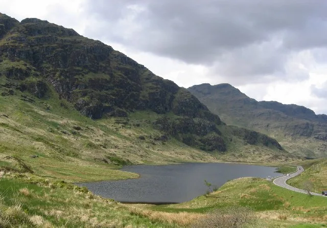
Loch Restil in Argyll and Bute is a body of water. Ⓦ.
- Nature
- body of water
Image
Roads nearby
Old Military RoadAldochlay, Bandry
450 m
Rest And Be ThankfulArgyll Forest Holidays, Ardgartan, Larachpark, Rest and Be Thankful, Rest And Be Thankful
5,7 km
KilmorichCairndow, Cairndow Inn
5,7 km
Donich Park6,1 km
Manson ViewClachan
6,3 km
Donich View6,5 km
Highland Drive6,5 km
Viewfield TerraceLochgoilhead Post Office, Pinetrees, Village shop
6,6 km
Invergoil6,8 km
Attraction nearby
Window Walk5,4 km
Madenii Bank5,5 km
Bodnant Bank5,6 km
Sir John's Bank5,6 km
Pinetum5,6 km
Bars nearby
Fyne Ales Tap Room6,2 km
Body of waters nearby
Lochan a' Mhill Bhig5,5 km
Clachan Surge Pond7,1 km
Buildings nearby
Ardgartan Visitor Centre5,7 km
Cairndow Telephone Exchange5,7 km
Top activity store6,8 km
Canals nearby
Clachan Tailrace6,3 km
Caravan site nearby
Honeymoon Bridge4,5 km
Stay the Night Ardgartan5,6 km
Lochgoilhead Holiday Park6,8 km
Clinics nearby
Lochgoilhead Medical Centre6,6 km
Community centres nearby
Cairndow Village Hall5,7 km
Fire stations nearby
Lochgoilhead Community Fire Station6,7 km
Garden centres nearby
Tree Shop Garden Centre & Cafe6,4 km
Gardens nearby
Ardkinglas Woodland Garden5,6 km
Lochgoil Community Garden6,5 km
Industrial areas nearby
Clachan Power Station6,7 km
Industrial buildings nearby
Fyne Ales6,2 km
intake screen7,1 km
Marketplaces nearby
Loch Fyne Farm Shop6,4 km
Places of worship nearby
Kilmorich Church5,7 km
Restaurants nearby
Loch Fyne Oyster Bar6,4 km
Retail areas nearby
Loch Fyne Oysters6,4 km
Rivers nearby
Kinglas Water1,8 km
Croe Water4,3 km
River Goil5,2 km
Donich Water5,8 km
Shelters nearby
Poetry Gazebo5,6 km
Streams nearby
Allt Beinn Ime1,9 km
Allt a' Bhalachain5,1 km
Garbh-allt Beag5,2 km
Garbh-allt Mòr5,2 km
Waterfalls nearby
Eagles fall6,8 km
Wilderness huts nearby
Abyssinia4,8 km
Other nearby
Ardkinglas Substation6,7 km
| Located in | Argyll and Bute |
|---|---|
| Country | United Kingdom |
 Public transport map Argyll and Bute Legend
| Railway | |
| Bus | |
| Tram |
 Cycling map Argyll and Bute Legend
| Cycle path | |
| Cycle lane on road | |
| Cycling on bus lane | |
| Bicycle street | |
| Cyclists allowed | |
| Cyclists allowed, good surface | |
| No cycling | |
| Cobblestones |
| Long-distance cycle route | (depending on scale) | |
| Long-distance cycle route |
 Walking map Argyll and Bute Legend
| Path |
| Long-distance hiking trail | (depending on scale) | |
| Long-distance hiking trail | ||
| No pedestrians |