
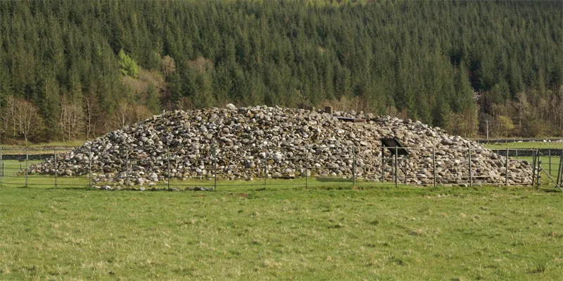
Nether Largie North Cairn in Argyll and Bute
Nether Largie North Cairn in Argyll and Bute is an attraction (limited wheelchair access). Nether Largie North Cairn is near Barrmor View. Ⓦ.
- Tourism
- attraction
- Website
- http://www.historic-scotland.gov.uk/index/places/propertyresults/propertydetail.htm?PropID=PL_313
- Wheelchair Access
- limited
Image
Roads nearby
Barrmor ViewKilmartin, Living Stones Christian Centre
700 m
Old Coach Road (Biffs Passage)3,6 km
Nature nearby
Island Macaskin4,2 km
Eilean nan Gabhar4,4 km
Eilean Righ4,8 km
Attraction nearby
Nether Largie Middle Cairn200 m
Glebe Cairn550 m
Nether Largie South Cairn600 m
Temple Wood Stone Circle800 m
Ri Cruin Cairn1,4 km
Baluachraig Cup and Ring Carving1,5 km
Dunchraigaig Cairn1,7 km
Ballymeanoch Henge2,2 km
Carnasserie Castle2,5 km
Body of waters nearby
Lochan Add3,4 km
Lochan an Torrnalaich3,8 km
Lochan na Curaich3,8 km
Loch Long John4,0 km
Buildings nearby
Kilmartin Telephone Exchange650 m
Lodge1,1 km
Kilchoan Lodge3,0 km
Mother Brown's Cottage3,8 km
Sandies Cottage4,3 km
Castle Cottage4,5 km
Ormiston Cottage4,6 km
Stag Cottage4,6 km
The Bothy4,6 km
Duntrune Castle4,7 km
Dun na Nighinn4,7 km
Cafés nearby
The Glen Bistro600 m
Car repair shops nearby
Kilmartin Auto Repairs800 m
Cemeteries nearby
Kilmartin Churchyard500 m
Chalet nearby
Kilmartin Castle850 m
Chapels nearby
Saint Columba's Chapel2,4 km
Farmyards nearby
Nether Largie500 m
Ormaig4,5 km
Forests nearby
Miller's Wood3,0 km
Gardens nearby
Duntrune Gardens4,4 km
Guest house nearby
Rosebank Bed & Breakfast650 m
Dunchraigaig House Bed and Breakfast1,9 km
Hotels nearby
Kilmartin Hotel600 m
Museum nearby
Kilmartin House Museum600 m
Parks nearby
Temple Wood Stone Circles Park750 m
Dunchraigag Cairn Park1,6 km
Places of worship nearby
Kilmartin Church550 m
Residential buildings nearby
Victoria Hall400 m
Rivers nearby
Kilmartin Burn2,6 km
Streams nearby
Abhain Airidhcheoduis4,4 km
Other nearby
Kilmartin850 m
| Located in | Argyll and Bute, Kilmartin |
|---|---|
| Country | United Kingdom |
 Public transport map Argyll and Bute Legend
| Railway | |
| Bus | |
| Tram |
 Cycling map Argyll and Bute Legend
| Cycle path | |
| Cycle lane on road | |
| Cycling on bus lane | |
| Bicycle street | |
| Cyclists allowed | |
| Cyclists allowed, good surface | |
| No cycling | |
| Cobblestones |
| Long-distance cycle route | (depending on scale) | |
| Long-distance cycle route |
 Walking map Argyll and Bute Legend
| Path |
| Long-distance hiking trail | (depending on scale) | |
| Long-distance hiking trail | ||
| No pedestrians |