
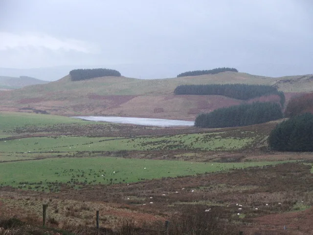
Skeroblin Loch in Argyll and Bute
Skeroblin Loch in Argyll and Bute is a body of water. Skeroblin Loch is also known as Park Loch.
- Nature
- body of water
Image
Roads nearby
Sound of KintyreSound of Kintyre
4,4 km
Drumore Cottages4,4 km
Islay View4,4 km
Water House Bray4,5 km
Snipefield Industrial Estate4,6 km
Balegreggan Road4,8 km
Drumore Gardens5,0 km
Tarbert RoadBrae Road junct, Corriechrevie Vista, Corriechrevie, Kilchenzie, Clachan, opposite Ronachan House, Clachan Filling Station, Tayinloan, Rhunahaorine, Muasdale, Drum, the Putechan, Low Ballevain, Westport, Killean, Glenbarr, Bellochantuy, Men of Kilcalmonell War Memorial Gateway, Clachan, Bus Shelter, Whitehouse, West Kintyre Community Council, The Putechan
5,0 km
Davaar AvenueCalton
5,1 km
Hillside Road5,1 km
Craigowan Crescent5,1 km
Craiggowan Road5,1 km
DIY stores nearby
Buildbase4,9 km
Body of waters nearby
Lussa Loch3,5 km
Black Loch3,7 km
Aucha Lochy4,4 km
Loch Ruan Reservoir4,6 km
Buildings nearby
High Park Farm850 m
Kilkenzie Telephone Exchange3,2 km
Lussa Power Station3,3 km
Campbeltown Airport Terminal4,5 km
Gortan4,6 km
Campbeltown Motor Company4,7 km
Glenburn5,1 km
Dams nearby
Lussa Loch Dam2,6 km
Aucha Loch Dam4,4 km
Farmhouses nearby
Hillside Farm House4,8 km
Farmyards nearby
West Darlochan4,3 km
Hillside Farm4,8 km
West Backs4,8 km
Grasslands nearby
The Mill Dam5,1 km
Hotels nearby
Dellwood Hotel5,1 km
Industrial areas nearby
CS Wind UK4,9 km
Kitchen showrooms nearby
Howdens Joinery4,9 km
Quarries nearby
Calliburn Quarry1,7 km
McFadyens Quarry4,3 km
Rivers nearby
Glenlussa Water2,1 km
Specialist shops nearby
Jewson5,0 km
Streams nearby
Puball Burn900 m
March Burn2,0 km
Ronachan Burn2,2 km
Kilchenzie Burn2,9 km
Backs Water3,1 km
Ballywilline Burn3,8 km
Tangy Burn4,0 km
Auchalochy Burn4,3 km
The Glen Burn5,0 km
Woodlands nearby
Balegreggan Glen5,1 km
Other nearby
Campbeltown Airport4,9 km
| Located in | Argyll and Bute |
|---|---|
| Country | United Kingdom |
| Described by source | Ordnance Survey name book |
 Public transport map Argyll and Bute Legend
| Railway | |
| Bus | |
| Tram |
 Cycling map Argyll and Bute Legend
| Cycle path | |
| Cycle lane on road | |
| Cycling on bus lane | |
| Bicycle street | |
| Cyclists allowed | |
| Cyclists allowed, good surface | |
| No cycling | |
| Cobblestones |
| Long-distance cycle route | (depending on scale) | |
| Long-distance cycle route |
 Walking map Argyll and Bute Legend
| Path |
| Long-distance hiking trail | (depending on scale) | |
| Long-distance hiking trail | ||
| No pedestrians |