
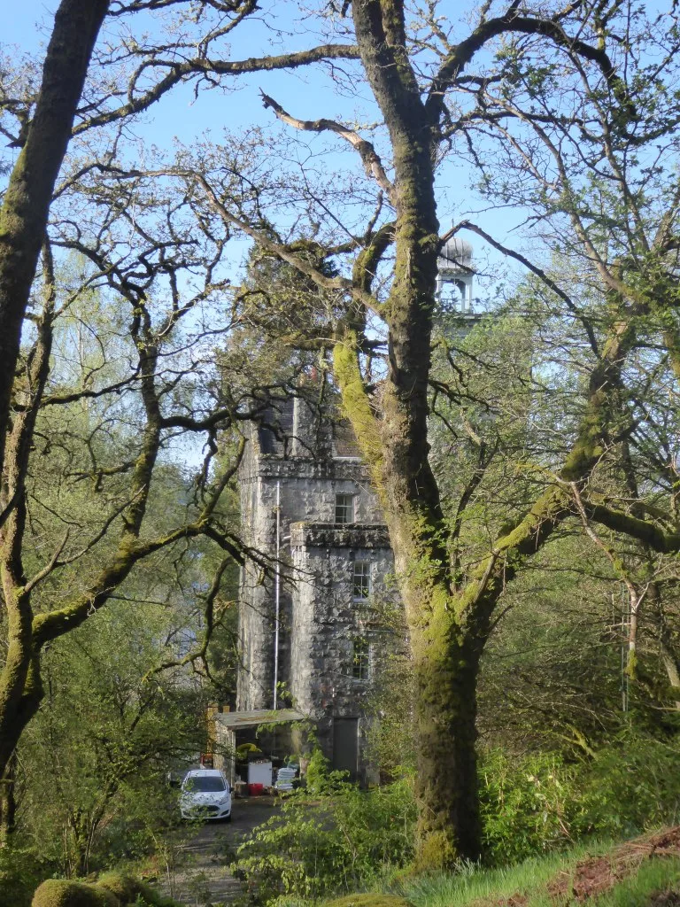
St Conan's Tower in Argyll and Bute
St Conan's Tower in Argyll and Bute is a historic building (PA33 1AH). St Conan's Tower is near St. Conan's Kirk Drive. Ⓦ.
- Postal Code
- PA33 1AH
- Building Type
- building
Image
Roads nearby
St. Conan's Kirk Drive600 m
St Conan's RoadSt Conans Road junction
850 m
Kilchurn Castle Drive2,1 km
Dalmally Village Loop RoadDalmally, Dalmally Station Airbnb, Glenorchy Lodge Hotel
3,7 km
Mhoille Bridge4,2 km
Body of waters nearby
Cruachan Reservoir4,3 km
Buildings nearby
Dalmally Telephone Exchange3,9 km
Tervin4,2 km
Rose Cottage4,5 km
Auction House4,5 km
Cafés nearby
The Kirk Tearoom600 m
Commercial buildings nearby
Dalmally Golf Club Clubhouse2,5 km
Community centres nearby
Lochawe Village Hall1,4 km
Dams nearby
Cruachan Dam4,0 km
Detached houses nearby
Garden Cottage3,9 km
Golf courses nearby
Dalmally Golf Club2,2 km
Guest house nearby
Carraig Thura Kilchurn Suites900 m
Starthorchy Bed & Breakfast2,5 km
Hotels nearby
Ben Cruachan Inn350 m
Loch Awe Hotel450 m
Ardanaiseig Hotel3,9 km
Glenorchy Lodge4,4 km
Houses nearby
West Cottage250 m
East Cottage300 m
Inistrynich House3,9 km
Industrial areas nearby
Cruachan Power Station4,0 km
Railway lines nearby
West Highland Line850 m
Rivers nearby
River Orchy2,4 km
River Strae3,0 km
Eas Eunaich3,5 km
Ruins nearby
Fraoch Eilean Castle (ruins)2,3 km
Streams nearby
Allt Coire Ghlais2,0 km
Allt Coire Chreachainn3,0 km
Alt Cruachan3,9 km
Allt Cruachan4,1 km
Allt Mhoille4,2 km
Allt Lairig Ianachain4,2 km
Tourist information offices nearby
Cruachan Power Station Visitor Centre4,2 km
Valleies nearby
Strath of Orchy3,0 km
Other nearby
Innis Chonain1,9 km
Baden Tomain1,9 km
Eilean Beith2,1 km
Fraoch Eilean2,3 km
Dalmally Substation3,1 km
Inishail3,2 km
Eilean a' Chomhraidh3,4 km
Black Islands3,8 km
Eilean Seileachan3,9 km
Cruachan Substation4,0 km
| Located in | Argyll and Bute |
|---|---|
| Country | United Kingdom |
 Public transport map Argyll and Bute Legend
| Railway | |
| Bus | |
| Tram |
 Cycling map Argyll and Bute Legend
| Cycle path | |
| Cycle lane on road | |
| Cycling on bus lane | |
| Bicycle street | |
| Cyclists allowed | |
| Cyclists allowed, good surface | |
| No cycling | |
| Cobblestones |
| Long-distance cycle route | (depending on scale) | |
| Long-distance cycle route |
 Walking map Argyll and Bute Legend
| Path |
| Long-distance hiking trail | (depending on scale) | |
| Long-distance hiking trail | ||
| No pedestrians |