
St Moluag's Cathedral in Argyll and Bute
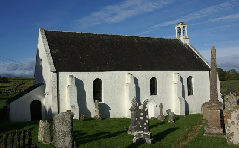
St Moluag's Cathedral in Argyll and Bute is a church. It is near Lorn View and is also known as Lismore Parish Church. The church was built in 1300 and is a listed building. Ⓦ.
- Alternative Name
- Lismore Parish Church
- Amenity
- place of worship
- Building Type
- building
Image
Roads nearby
An t-Sràid2,3 km
Lorn ViewAchnacroish
2,8 km
Shuna View5,2 km
Bealach na MaraPort Appin
5,4 km
Nature nearby
Dubh Sgeir1,6 km
Eilean Loch Oscair2,2 km
Branra2,3 km
Eilean nam Meann2,7 km
Eilean nam Bàn2,9 km
Eilean Trenach3,0 km
Eilean Ramsay3,1 km
Sgeir na Cloich3,2 km
Eilean Droineach3,8 km
Appin Rocks3,8 km
Sgeir Liath4,1 km
Eilean Riabhach4,4 km
Cuilean Rock4,8 km
Inn Island4,8 km
Eilean nan Chaorainn4,9 km
Sgeir nan Tom5,1 km
Body of waters nearby
Loch Baile a' Ghobhainn600 m
Buildings nearby
Lismore Telephone Exchange450 m
Castle Coeffin800 m
Taigh Iseabal Dhaidh900 m
Port Moluag House1,0 km
Druimneil House5,0 km
Airds House5,0 km
Lochnell House5,2 km
Community centres nearby
Port Appin Village Hall4,9 km
Convenience stores nearby
Lismore Stores1,8 km
Doctor's practice nearby
Port Appin Surgery5,2 km
Farmyards nearby
Bailuacraich Farm1,1 km
The Sailean Project3,8 km
Shenvalie3,8 km
Fire stations nearby
Lismore Community Fire Station500 m
Hotels nearby
Isle of Eriska Hotel4,2 km
The Pierhouse4,6 km
Houses nearby
Killandrist1,1 km
The Wee House2,4 km
Industrial areas nearby
Scottish Sea Farms5,0 km
Museum nearby
Ionad Naomh Moluag850 m
Shelters nearby
Ferry Waiting Room4,3 km
Streams nearby
Allt a' Mhuilinn1,9 km
Allt a' Chamais Bhàin5,0 km
Supermarkets nearby
Port Appin Stores & PO4,9 km
Town halls nearby
Lismore Public Hall2,6 km
Woodlands nearby
Ceann Garbh4,8 km
Other nearby
Eilean Dubh1,9 km
Baile Geamhraidh2,3 km
| Inception | 1300 |
|---|---|
| Heritage designation | scheduled monument, category B listed building |
| Located in | Argyll and Bute, Lismore and Appin |
| Country | United Kingdom |
 Public transport map Argyll and Bute Legend
| Railway | |
| Bus | |
| Tram |
 Cycling map Argyll and Bute Legend
| Cycle path | |
| Cycle lane on road | |
| Cycling on bus lane | |
| Bicycle street | |
| Cyclists allowed | |
| Cyclists allowed, good surface | |
| No cycling | |
| Cobblestones |
| Long-distance cycle route | (depending on scale) | |
| Long-distance cycle route |
 Walking map Argyll and Bute Legend
| Path |
| Long-distance hiking trail | (depending on scale) | |
| Long-distance hiking trail | ||
| No pedestrians |