
Carsluith Castle in Dumfries and Galloway
Carsluith Castle in Dumfries and Galloway is a castle (defensive castle). Carsluith Castle is near Carsluith Diversion. Ⓦ.
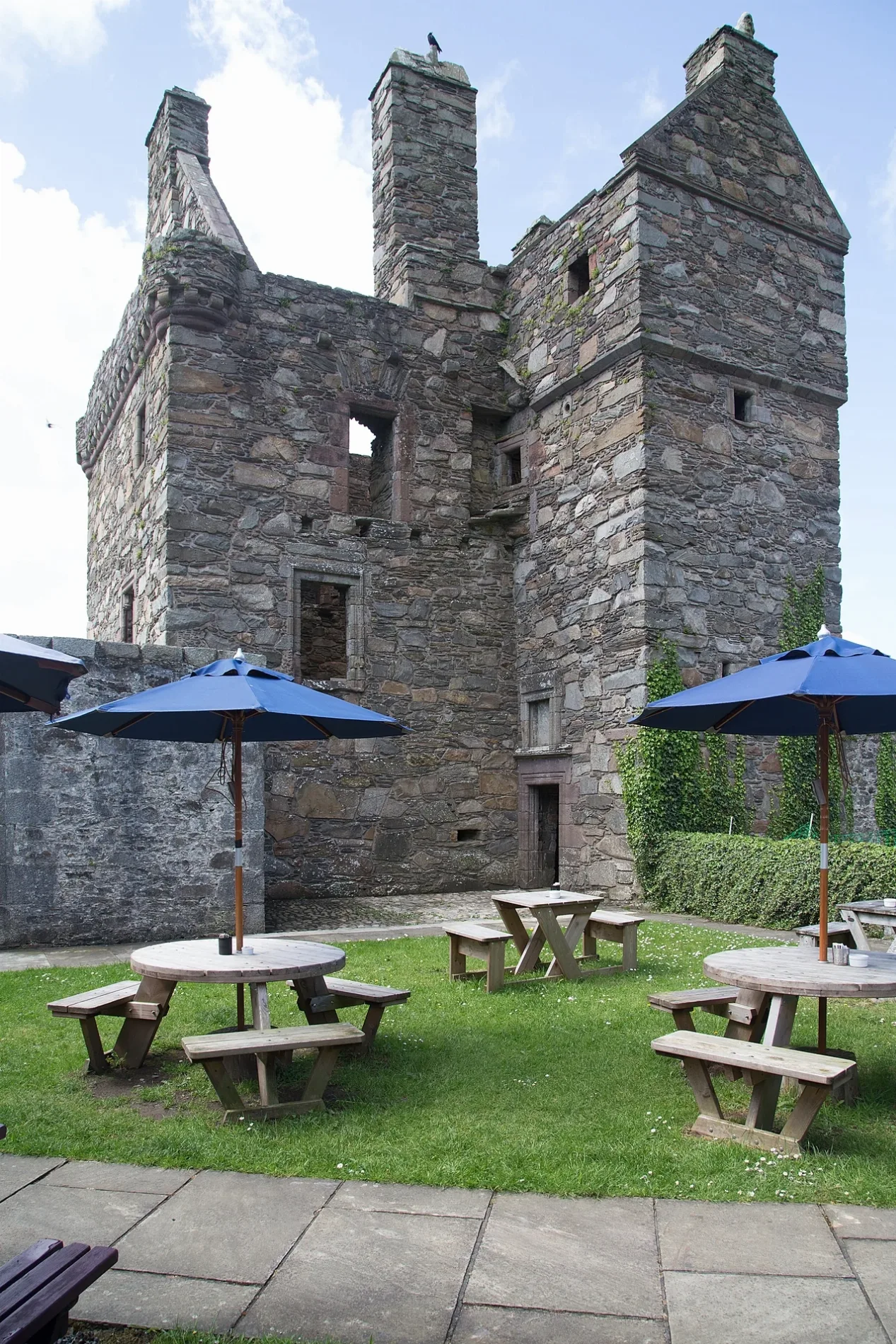
- Building Type
- building
- Website
- http://www.historic-scotland.gov.uk/index/places/propertyresults/propertydetail.htm?PropID=PL_057
- Wheelchair Access
- no
Roads nearby
Carsluith DiversionGalloway Smokehouse
1,4 km
Kirkdale - Ravenshall DiversionHoliday Park
3,7 km
Park CrescentPark Crescent
4,6 km
Corse of Slakes RoadWhiteside
4,7 km
Louden Place4,7 km
Norris Street4,8 km
Grimshawe Terrace4,8 km
Kirk Brae4,8 km
Mill StreetDrummore, Village, Drummore Stores, Drummore Post Office, Queen's Hotel
4,8 km
Crispin StreetBarholm Accomodation
4,9 km
Harbour StreetPort Rodie / Tesco, Custom House, Mull Of Galloway Trail, Loch Ryan Coastal Path, The Shorefront, Stranraer Skills Station, Port Rodie / Stance 1
4,9 km
Creetown Bypass4,9 km
St John StreetSt John Street, Streaks Ahead, Kayleigh's, Pink, The Royal Hotel, The Cutting Edge, Royal Mail, Indian Kebab House, i Beauty, Root 39
4,9 km
Hill StreetJohn Gillespie & Son, Downshire Arms
5,0 km
Silver Street5,0 km
High RoadTinwald Shaws
5,1 km
High StreetDalbeattie, High Street, Cafe, Acorns Tea Room & Shop, The Granite Kitchen, Dalbeattie Post Office, Best Pizza & Kebab House, Village, The Crown Hotel, Wilsons' Newsagent, Just Be, Davidsons Chemists, The Starfish, Marchbank Bakers, Keen 2 Clean, Who's Next, Kirkcudbright, Harbour Cottage Gallery, Sheep, Annan, Anglers, Monument, Queensberry Arms, Annan Post Office, The Anglers, Francis T A & Sons, Well Pharmacy, Morrisons Daily, Gatehouse of Fleet, Mill on the Fleet, Gatehouse-Of-Fleet Post Office, Bank of Fleet Hotel, Spar, Galloway Lodge, Top Up Tap, The Angel Coffee House, Cafe Ariete, Pawfect for Pets, Grieve's Newsagent, Wildflower Designs, Moffat Pottery Art and Craft Gallery, Lochmaben, Kings Arms Hotel, Lochmaben Library, Lochmaben Post Office, The Blue Bell, Sanquhar, The Crown Inn, RBS, rightmedicine Pharmacy, Co-op Food, Spicy Hut, Bank of Scotland, Nisa Local, C & M Brown, Helen's Kitchen, Pathhead Bakery, Sanquhar Tolbooth Museum, Langholm, Langholm Police Station, Post Office, Crown Hotel, Londis, Buck Hotel, Townhead Bakery, Flats, Langholm Flats, Gulf, Eskdale Community Shop, Polla-Anna's, The Douglas, Martins Tyre Service, Bridge House, Lochmaben Medical Group, Craigdarroch Hotel, Moniaive Post Office, The Crafty Crow, Braeside, Moffat, Moffat High Street, Colin Picken Eyecare, The Rumblin' Tum, Campbell's Confections, Hugo's, Wise Owls Nursery, Mutchies Munchies, Colvin Fountain
5,1 km
Minnipool Place5,1 km
Duke Street5,1 km
Barholm StreetCreetown
5,2 km
Beaches nearby
Baldoon Sands5,1 km
Buildings nearby
Barholm Farm2,8 km
Barholm Castle2,8 km
Barony Mill Surgery4,8 km
Creetown Telephone Exchange5,0 km
Clock Towe5,1 km
Cafés nearby
Oakhill Cafe & Deli50 m
Castle View Cafe4,1 km
Campsite nearby
Creetown Caravan Park5,1 km
Chalet nearby
High Auchenlarie Cottage4,4 km
CY14,5 km
CY24,5 km
CY44,6 km
CY34,6 km
Community centres nearby
Carsluith Village Hall950 m
Convenience stores nearby
Castle View Shop4,1 km
Creetown Stores4,9 km
Farmyards nearby
Kirkmabreck2,4 km
Garrochar4,8 km
Houses nearby
Bayview House1000 m
Places of worship nearby
Kirkmabreck Parish Church4,7 km
Post offices nearby
Creetown Post Office5,0 km
Recreation grounds nearby
Castlecary Park4,5 km
Residential areas nearby
Kirkdale2,3 km
Barholm2,8 km
Claughreid3,1 km
Kirkclaugh Farm4,0 km
Restaurants nearby
Lairds Inn4,0 km
Sports pitches nearby
Creetown F.C.4,5 km
| Heritage designation | scheduled monument, category A listed building |
|---|---|
| Located in | Dumfries and Galloway, Kirkmabreck |
| Country | United Kingdom |
| Described by source | CastlesFortsBattles |
| Location | Carsluith |
 Public transport map Dumfries and Galloway Legend
| Railway | |
| Bus | |
| Tram |
 Cycling map Dumfries and Galloway Legend
| Cycle path | |
| Cycle lane on road | |
| Cycling on bus lane | |
| Bicycle street | |
| Cyclists allowed | |
| Cyclists allowed, good surface | |
| No cycling | |
| Cobblestones |
| Long-distance cycle route | (depending on scale) | |
| Long-distance cycle route |
 Walking map Dumfries and Galloway Legend
| Path |
| Long-distance hiking trail | (depending on scale) | |
| Long-distance hiking trail | ||
| No pedestrians |