
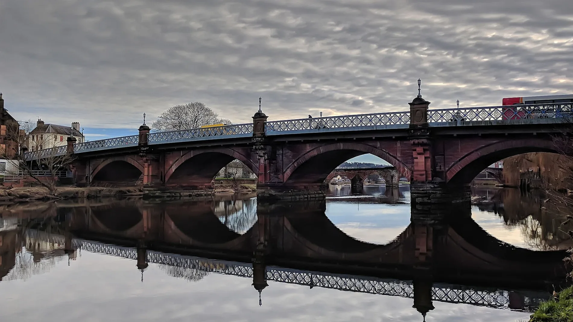
Buccleuch Street Bridge in Loreburn
Buccleuch Street Bridge in Dumfries and Galloway, Loreburn is a lit main road (also known as New Bridge). It runs in a northeast-southwest direction starting from Galloway Street and ends at Buccleuch Street. Buccleuch Street Bridge is also known as New Bridge. This road is part of the long-distance road "Galloway Tourist Route".
- Alternative Name
- New Bridge
- Road Type
- main road
- Speed Limit
- 30 mph
- Route
- northeast-southwest
Image
Courthouse
Museum
- Old Bridge House Museum (opening hours: Apr–Sep: Mon–Sat 10–17; Apr–Sep: Sun 14–17, free, web) at Mill Road (DG2 7BE) – approx. 200 m.
Post offices
Restaurants
Greengrocers
Pubs
Bar
Travel agencies
Bus stops
Theatres
Chemist's
Off-licences
Roads nearby
Buccleuch StreetBuccleuch Street, Robert the Bruce, Caven Arms, Dumfries Sheriff Court
50 m
Park Lane50 m
WhitesandsWhitesands, Whitesands Stance 2
50 m
Market SquareThe Globe Inn, Salutation Inn
150 m
Galloway Street150 m
High StreetTown Centre, Midsteeple, Wee Phone Shop, Vodafone, Coral, The Wee Spec Shop, Greggs, Specsavers, Superdrug, O2, Three., Holland & Barrett, Poundland, Mountain Warehouse, Waterstones, Trespass, The Stove, Virgin Money, Peter's Fish and Chicken Bar, Specsavers Audio, Hole in the Wa' Inn, Argos, Moshulu, Ryman, Iceland, Marie Curie
150 m
Glasgow StreetGlasgow Street
200 m
Well Street200 m
Howgate StreetDevorgilla Lounge, The Brigend Theatre, Galloway Street Post Office
200 m
Church StreetRotchell Road
200 m
Nith Avenue200 m
David Street200 m
McAughtrie Court200 m
College StreetCollege Street
250 m
Loreburn Bridge250 m
Rosemount Street250 m
Maxwell Street300 m
Union Street350 m
Shortridge Court350 m
Corberry Mews350 m
Steel Avenue350 m
King StreetKing Street
400 m
James Avenue400 m
Stakeford Street400 m
LaurieknoweLaurieknowe, Dumfries
400 m
School Lane400 m
Lime Tree Walk450 m
Hill StreetHill Street
450 m
Portland DriveGlasgow Street
450 m
College Court500 m
Nelson Street500 m
Sunderries Road500 m
Nithside AvenueSandside
500 m
Summerville Avenue550 m
Terregles StreetTerregles St, Palmerston Car Wash
550 m
Glasgow RoadKFC, Glasgow Street, Goldie Park
600 m
Sunderries Avenue600 m
Buildings nearby
St Benedict's Convent450 m
Car repair shops nearby
ATS Euromaster200 m
Charity shops nearby
The Salvation Army250 m
Convenience stores nearby
Scotfresh300 m
Frozen food shops nearby
Farmfoods150 m
Ice rinks nearby
Dumfries Ice Bowl400 m
Parks nearby
The Green Sands300 m
Places of worship nearby
Maxwellton West Church250 m
St. Teresa's RC Church500 m
Public toilets nearby
Whitesands Toilets100 m
Sports halls nearby
Laurieknowe Squash & Racketball Club400 m
Sports pitches nearby
Queen of the South F.C.500 m
| Located in | Dumfries and Galloway, Dumfries |
|---|---|
| Country | United Kingdom |
| Crosses | River Nith |
| Carries thoroughfare | A780 road |
| Location | Dumfries |
 Public transport map Loreburn Legend
| Railway | |
| Bus | |
| Tram |
 Cycling map Loreburn Legend
| Cycle path | |
| Cycle lane on road | |
| Cycling on bus lane | |
| Bicycle street | |
| Cyclists allowed | |
| Cyclists allowed, good surface | |
| No cycling | |
| Cobblestones |
| Long-distance cycle route | (depending on scale) | |
| Long-distance cycle route |
 Walking map Loreburn Legend
| Path |
| Long-distance hiking trail | (depending on scale) | |
| Long-distance hiking trail | ||
| No pedestrians |