
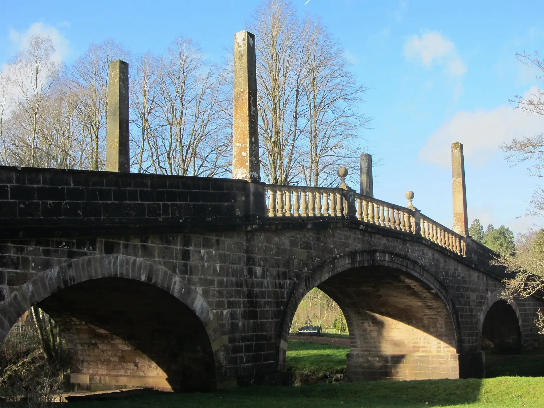
Avenue Bridge in East Ayrshire
Avenue Bridge in East Ayrshire is a gravelled service road. It runs in a north-south direction and ends in a cul-de-sac. Avenue Bridge is also known as Dumfries House, Lugar Water, Avenue Bridge.
- Road Type
- service road
- Route
- north-south
Image
Post offices
Attraction
Holiday apartment
Stations
Convenience stores
Frozen food shops
Bus stops
Hairdressers
Bookmakers
Cafés
Pubs
Places of worship
Petrol stations
Recycling centres
Variety stores
Roads nearby
The AvenueDumfries House
650 m
Station Avenue1,5 km
Barony Road1,5 km
Darnlaw View1,5 km
Pennylands View1,5 km
Runnels View1,6 km
Church Hill1,7 km
Highhouse View1,7 km
Main StreetJET, Dunlop, Auld Hoose, Merito, Idle Hands Shop and Bakery, Dunlop Post Office, Stewarton, Joan Scott, Boots, Charlie's Gents Hairdresser, Headquarters, Co-op Food, Deli At One, Wm Allan & Son, Jan de Vries Healthcare, Your Home Store, The Coffee Pot, Stewarton Podiatry Practice Foot Care Centre, SPECIALLY FOR YOU, D. Bonellie Opticians, LOVELY, Woody's Ice Cream Parlour & Dessert Bar, Neilson Newsagent, Dalrymple, Patna, Muirkirk, Newmilns, Ochiltree, Gallowlee Avenue, Cafe@45, Ayr Road, Ochiltree Tyres, Shopsmart, Green Shutters Pharmacy, Mauchline Road, Auchinleck, Auchinleck Post Office, Sharlene's, Sorn, Sorn Inn
1,7 km
Park Road1,8 km
Market Place1,8 km
The Old School Yard1,8 km
Beechwood Avenue1,9 km
Market Road1,9 km
Mauchline RoadPropeller
1,9 km
Templeton Roundabout1,9 km
Dettingen Roundabout1,9 km
Ayr RoadFenwick Interchange, Trinity Church, Riccarton: Campbell Street / Old Street, Elderslie Crescent, Cunninghame Drive, Stonyhill Avenue
1,9 km
Dalshalloch Road2,0 km
Boswell Drive2,0 km
School Road2,0 km
Lambfair Gardens2,0 km
Arran Drive2,1 km
Back Rogerton Crescent2,1 km
Quarry Knowe2,1 km
Coal RoadBoswell Arms
2,1 km
The Kirk's Alarm2,1 km
Dippol Crescent2,1 km
Berry Hill Drive2,1 km
Darsie Brae2,1 km
Pottery Row2,1 km
Jimmy Boyd Walk2,2 km
Skares RoadSkares Road Recycling Centre, Skares
2,2 km
Abandoned railways nearby
Annbank and Cronberry Line2,0 km
Buildings nearby
Enclosure1,8 km
Social club1,9 km
Grandstand1,9 km
The Boswell Centre2,0 km
Farmyards nearby
Knagshill1,9 km
Darnlaw2,0 km
Dykes2,2 km
Gardens nearby
Walled Garden450 m
Parks nearby
Barony A Frame1,6 km
Places of worship nearby
Barony Church1,6 km
Railway lines nearby
Glasgow South Western Line1,8 km
Rivers nearby
Lugar Water1,4 km
Sports centres nearby
Beechwood Park1,8 km
Sports pitches nearby
Auchinleck Talbot F.C.1,9 km
Supermarkets nearby
Tesco1,9 km
| Located in | East Ayrshire, Old Cumnock |
|---|---|
| Country | United Kingdom |
| Crosses | Lugar Water |
| Carries thoroughfare | unclassified road |
 Public transport map East Ayrshire Legend
| Railway | |
| Bus | |
| Tram |
 Cycling map East Ayrshire Legend
| Cycle path | |
| Cycle lane on road | |
| Cycling on bus lane | |
| Bicycle street | |
| Cyclists allowed | |
| Cyclists allowed, good surface | |
| No cycling | |
| Cobblestones |
| Long-distance cycle route | (depending on scale) | |
| Long-distance cycle route |
 Walking map East Ayrshire Legend
| Path |
| Long-distance hiking trail | (depending on scale) | |
| Long-distance hiking trail | ||
| No pedestrians |