
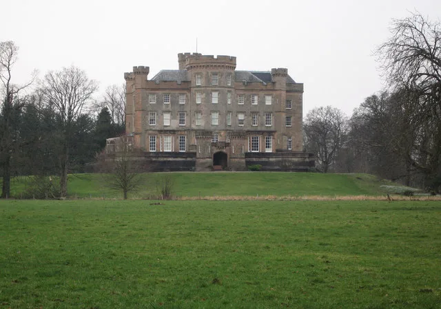
Caprington Castle in East Ayrshire
Caprington Castle in East Ayrshire is a castle (KA2 9AA). Caprington Castle is near Dundonald Road. Ⓦ.
- Postal Code
- KA2 9AA
- Building Type
- building
Image
Cafés
Interior decorators
Department stores
Car washes
Bus stops
Hotels
Convenience stores
Car dealerships
Fast food restaurants
Furniture shops
Car parts shops
Pubs
Roads nearby
Dundonald RoadSeaford Street
600 m
Glen Lyon Crescent650 m
Porter Drive700 m
Glenclova Gardens700 m
Brailsford Crescent700 m
Glen Orrin Avenue750 m
Glen Afton Court750 m
Smillie Place800 m
South Gargieston Drive800 m
Glen Affric Place800 m
Glen Orchy Place850 m
Glen Truim View850 m
North Gargieston Road850 m
Glen Shiel Crescent850 m
East Gargieston Avenue850 m
Holmes Park View900 m
Glen Nevis Place900 m
Holmes Park Avenue950 m
Glen Trool Walk950 m
Holmes Park Wynd950 m
Guthrie Terrace950 m
Woodside Avenue950 m
Glen Farrar Way1000 m
Holmes Park Gardens1000 m
Old Rome Drive1000 m
Mount Village1,0 km
Moorfield Avenue1,0 km
Holmes Park Crescent1,1 km
Ballochmyle Walk1,1 km
St Michael's Mount1,1 km
Lochlea1,1 km
Jean Armour Drive1,2 km
Mount AvenueKilmarnock, Mount Avenue / Mount Place
1,2 km
Lochlea Wynd1,2 km
Dumfries DriveAnnandale
1,2 km
Holmes RoadKilmarnock, Holmes Road / Blackwood Avenue, Kilmarnock, Holmes Road/ Mount Avenue, Kilmarnock, Holmes Road / Holmes Farm Road
1,2 km
Fern Place1,2 km
Walnut Road1,2 km
Abandoned railways nearby
Gatehead and Hurlford Branch700 m
Annandale Colliery850 m
Fairlie Branch1000 m
Caprington Colliery1,3 km
Buildings nearby
Damhead House1,1 km
Gardens nearby
Walled Garden350 m
Hotels nearby
Premier Inn1,1 km
Industrial areas nearby
Moorfield Industrial Estate750 m
Railway lines nearby
Barassie and Kilmarnock Line1000 m
Rivers nearby
River Irvine250 m
Streams nearby
Todrigs Burn100 m
| Heritage designation | category A listed building |
|---|---|
| Located in | East Ayrshire, Riccarton |
| Country | United Kingdom |
 Public transport map East Ayrshire Legend
| Railway | |
| Bus | |
| Tram |
 Cycling map East Ayrshire Legend
| Cycle path | |
| Cycle lane on road | |
| Cycling on bus lane | |
| Bicycle street | |
| Cyclists allowed | |
| Cyclists allowed, good surface | |
| No cycling | |
| Cobblestones |
| Long-distance cycle route | (depending on scale) | |
| Long-distance cycle route |
 Walking map East Ayrshire Legend
| Path |
| Long-distance hiking trail | (depending on scale) | |
| Long-distance hiking trail | ||
| No pedestrians |