
Dalrymple Parish Church in East Ayrshire
Dalrymple Parish Church in East Ayrshire is a church (KA6 6DQ). It is near Hillview and is also known as Dalrymple, Church Street, Parish Church And Churchyard.
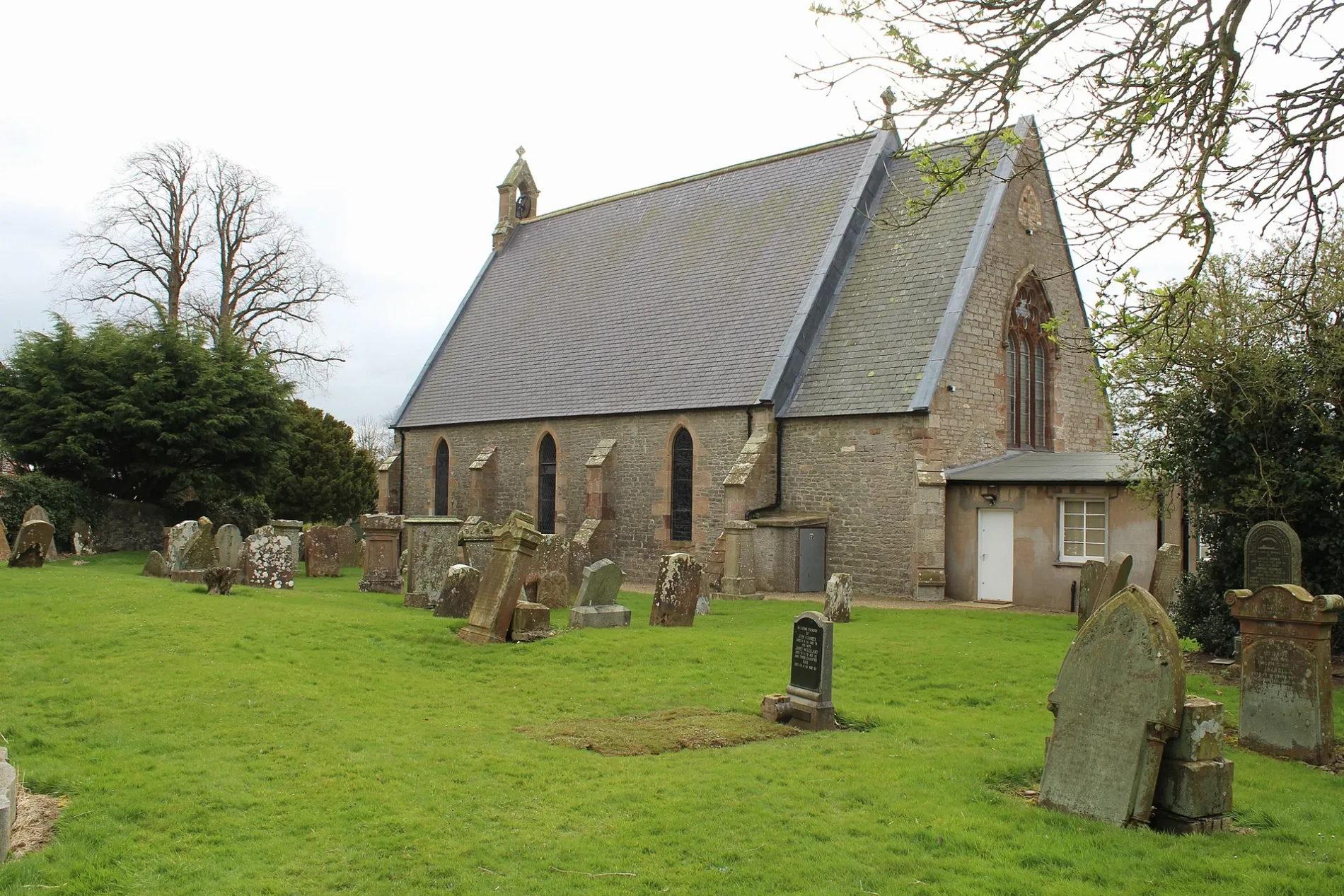
- Postal Code
- KA6 6DQ
- Amenity
- place of worship
- Building Type
- church
Bus stops
Colleges
Newsagent's
Fast food restaurants
Bakeries
Tourist information offices
Doctor's office
Pubs
Post offices
Convenience stores
Pharmacy
Car repair shops
Roads nearby
Glebe Avenue100 m
Church Street150 m
Riverside Terrace150 m
Main StreetDalrymple, Dunlop, Auld Hoose, Merito, Idle Hands Shop and Bakery, Dunlop Post Office, Stewarton, Joan Scott, Boots, Charlie's Gents Hairdresser, Headquarters, Co-op Food, Deli At One, Wm Allan & Son, Jan de Vries Healthcare, Your Home Store, The Coffee Pot, Stewarton Podiatry Practice Foot Care Centre, SPECIALLY FOR YOU, D. Bonellie Opticians, LOVELY, Woody's Ice Cream Parlour & Dessert Bar, Neilson Newsagent, JET, Patna, Muirkirk, Newmilns, Ochiltree, Gallowlee Avenue, Cafe@45, Ayr Road, Ochiltree Tyres, Shopsmart, Green Shutters Pharmacy, Mauchline Road, Auchinleck, Auchinleck Post Office, Sharlene's, Sorn, Sorn Inn
150 m
Garden Street200 m
Holms Farm Road250 m
Hillview400 m
Millbank Street450 m
Forglen Road450 m
Barbieston RoadDalrymple Community Education Centre, Barbieston Rd opp Burnton Rd, White Horse, Fryer Tucks, Stobbs the Baker, Kirkton Inn, Sizzle N’ Spice, Dalrymple Post Office, Barbieston Rd opp No. 20
500 m
Burnton Road500 m
Burnton Court600 m
Cedar Terrace600 m
Cassillis Court600 m
Primpton Avenue650 m
Mctaggart View700 m
Seath Drive750 m
Birch Avenue750 m
Skeldon Crescent750 m
Kirkton Avenue750 m
Portland Road750 m
Fulton Place750 m
Purclewan Crescent800 m
Doonvale Avenue800 m
Weir Terrace850 m
Morton Drive850 m
Burnside Drive850 m
Skeldon Drive850 m
Robertson Place950 m
Barbieston Terrace950 m
Merkland Drive1000 m
Viaduct View1,0 km
Body of waters nearby
Carcluie Loch1,9 km
Lindston Loch2,4 km
Buildings nearby
Dalrymple Telephone Exchange250 m
Convenience stores nearby
Spar400 m
Farmyards nearby
LKnockjarder750 m
Macmanniston900 m
Netherton1,7 km
Monkwood1,8 km
High Balsarroch2,0 km
Broomberry2,3 km
Railway lines nearby
Waterside Branch1,3 km
Stranraer Line2,0 km
Rivers nearby
River Doon1,1 km
Sports pitches nearby
Dalrymple Bowling Club200 m
Streams nearby
Purclewan Burn750 m
Primpton Burn1,3 km
Woodlands nearby
Balsarroch Belts1,4 km
| Located in | East Ayrshire, Dalrymple |
|---|---|
| Country | United Kingdom |
 Public transport map East Ayrshire Legend
| Railway | |
| Bus | |
| Tram |
 Cycling map East Ayrshire Legend
| Cycle path | |
| Cycle lane on road | |
| Cycling on bus lane | |
| Bicycle street | |
| Cyclists allowed | |
| Cyclists allowed, good surface | |
| No cycling | |
| Cobblestones |
| Long-distance cycle route | (depending on scale) | |
| Long-distance cycle route |
 Walking map East Ayrshire Legend
| Path |
| Long-distance hiking trail | (depending on scale) | |
| Long-distance hiking trail | ||
| No pedestrians |