
Dunstanhill Void in East Ayrshire
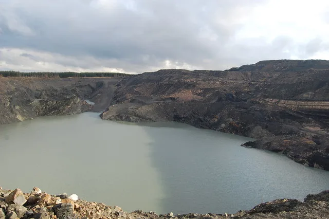
Dunstanhill Void in East Ayrshire is a body of water.
- Nature
- body of water
Image
Convenience stores
Bakeries
Pharmacy
Newsagent's
Bus stops
Pubs
Car repair shops
Fast food restaurants
Post offices
Tourist information offices
Doctor's office
Colleges
Roads nearby
Coyle Crescent1,9 km
Barnhill Place2,0 km
Kerse Terrace2,1 km
Ravenscroft Place2,1 km
Littlemill PlaceRankinston
2,3 km
Ayr RoadFenwick Interchange, Trinity Church, Riccarton: Campbell Street / Old Street, Elderslie Crescent, Cunninghame Drive, Stonyhill Avenue
2,9 km
River View3,0 km
Doonview Terrace3,1 km
Hillside3,1 km
Carskeoch Drive3,1 km
Blaney Avenue3,2 km
Main StreetPatna, Dunlop, Auld Hoose, Merito, Idle Hands Shop and Bakery, Dunlop Post Office, Stewarton, Joan Scott, Boots, Charlie's Gents Hairdresser, Headquarters, Co-op Food, Deli At One, Wm Allan & Son, Jan de Vries Healthcare, Your Home Store, The Coffee Pot, Stewarton Podiatry Practice Foot Care Centre, SPECIALLY FOR YOU, D. Bonellie Opticians, LOVELY, Woody's Ice Cream Parlour & Dessert Bar, Neilson Newsagent, JET, Dalrymple, Muirkirk, Newmilns, Ochiltree, Gallowlee Avenue, Cafe@45, Ayr Road, Ochiltree Tyres, Shopsmart, Green Shutters Pharmacy, Mauchline Road, Auchinleck, Auchinleck Post Office, Sharlene's, Sorn, Sorn Inn
3,2 km
Whitehill Drive3,2 km
Carnshalloch Avenue3,3 km
Jellieston TerraceThe River Doon Pearls
3,3 km
Whitehill Avenue3,3 km
Stewart Place3,3 km
Doonside Avenue3,3 km
Plantation Avenue3,4 km
Dalvennan Avenue3,5 km
Dallowie Road3,5 km
Doonbank Crescent3,5 km
Dalharco Avenue3,5 km
Downieston Place3,6 km
Lethan Hill View3,7 km
Clements Wynd3,7 km
Drumbuie Drive3,8 km
Barnshean Avenue3,8 km
Meikleholm Drive3,8 km
Netherhill Crescent3,8 km
Kilmein Avenue3,8 km
Dunaskin View3,9 km
Keirs Crescent3,9 km
Abandoned railways nearby
Holehouse Branch2,7 km
Body of waters nearby
Kerse Loch1,6 km
Buildings nearby
Patna Telephone Exchange2,9 km
Farmyards nearby
Knockshinnoch1,1 km
Kersepark2,0 km
Southcraig2,2 km
Dalmacaw2,3 km
Laurieston2,8 km
High Knockmurran3,2 km
Golf courses nearby
Doon Valley Golf Club3,1 km
Industrial areas nearby
Old pit2,4 km
Old pit bing3,0 km
Post offices nearby
Rankinston Mobile Service Post Office2,1 km
Railway lines nearby
Waterside Branch2,5 km
Residential areas nearby
Hillend3,8 km
Scrublands nearby
Old industrial site1,6 km
| Located in | East Ayrshire |
|---|---|
| Country | United Kingdom |
| Part of | Dunstanhill Mine |
 Public transport map East Ayrshire Legend
| Railway | |
| Bus | |
| Tram |
 Cycling map East Ayrshire Legend
| Cycle path | |
| Cycle lane on road | |
| Cycling on bus lane | |
| Bicycle street | |
| Cyclists allowed | |
| Cyclists allowed, good surface | |
| No cycling | |
| Cobblestones |
| Long-distance cycle route | (depending on scale) | |
| Long-distance cycle route |
 Walking map East Ayrshire Legend
| Path |
| Long-distance hiking trail | (depending on scale) | |
| Long-distance hiking trail | ||
| No pedestrians |