
HMP Kilmarnock in East Ayrshire
HMP Kilmarnock in East Ayrshire is a prison. HMP Kilmarnock is near Crossroads Roundabout. Ⓦ.
- Amenity
- prison
Image
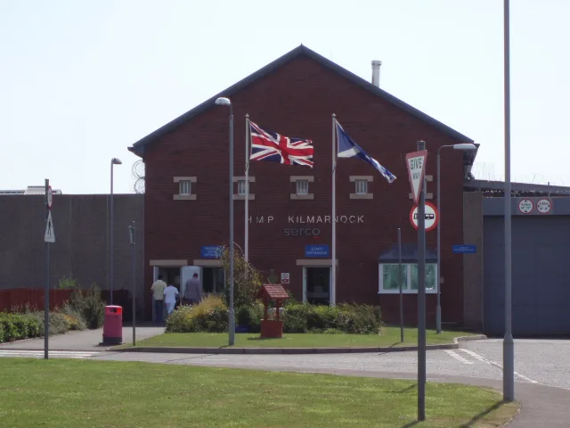
Library
Artwork
Places of worship
Butcher's
Pharmacy
Bus stops
Fast food restaurants
Petrol stations
Chalet
Hairdressers
Car washes
Roads nearby
Crossroads RoundaboutCrossroads
750 m
The Chris Hoy Cycle Way1,5 km
Mayfield Avenue1,6 km
Drumleyhill Drive1,7 km
Knowehead Road1,8 km
Craigie Road1,8 km
Cessnock Avenue1,8 km
Richardson Avenue1,8 km
Kerrmuir Avenue1,9 km
Cessnock Drive2,0 km
Dykehead Drive2,0 km
Bridgehouse Bridge2,1 km
Barleith Court2,1 km
Moss Court2,1 km
Sherwood Road2,1 km
Lifnock Avenue2,1 km
Galston RoadHurlford, Leven Drive
2,2 km
Cessnock Road2,2 km
Mauchline RoadPropeller
2,2 km
Abandoned railways nearby
Darvel and Strathaven Branch1,8 km
Mayfield Branch1,9 km
Buildings nearby
Fiveways Telephone Exchange1,1 km
Holmes2,0 km
Cafés nearby
Ayrshire Food Hub800 m
Constructions nearby
Kilmarnock South Battery Energy Storage System2,1 km
Farmyards nearby
Woodhead500 m
Purroch750 m
Newbyre1,1 km
Haining Mains1,2 km
Dallares Mains1,3 km
Low Dallars1,3 km
Aird1,4 km
Netherlands1,6 km
West Overland1,6 km
Knowehead1,7 km
Ashyard1,7 km
Barleith1,7 km
East Overland1,9 km
Bridgehouse2,0 km
Townhead Farm2,1 km
Clinchyard2,1 km
Skerrington Toll2,3 km
East Holmes2,4 km
Railway lines nearby
Glasgow South Western Line1,7 km
Razed railways nearby
Gatehead and Hurlford Branch2,3 km
Recreation grounds nearby
Richardson Park Recreation Ground2,1 km
Residential areas nearby
Dallars1,2 km
Rivers nearby
Cessnock Water1000 m
Other nearby
Kilmarnock South Substation2,0 km
| Inception | 1999 |
|---|---|
| Opening | 1999 |
| Operator | Serco Group |
| Located in | East Ayrshire |
| Country | United Kingdom |
| Location | Kilmarnock |
 Public transport map East Ayrshire Legend
| Railway | |
| Bus | |
| Tram |
 Cycling map East Ayrshire Legend
| Cycle path | |
| Cycle lane on road | |
| Cycling on bus lane | |
| Bicycle street | |
| Cyclists allowed | |
| Cyclists allowed, good surface | |
| No cycling | |
| Cobblestones |
| Long-distance cycle route | (depending on scale) | |
| Long-distance cycle route |
 Walking map East Ayrshire Legend
| Path |
| Long-distance hiking trail | (depending on scale) | |
| Long-distance hiking trail | ||
| No pedestrians |