
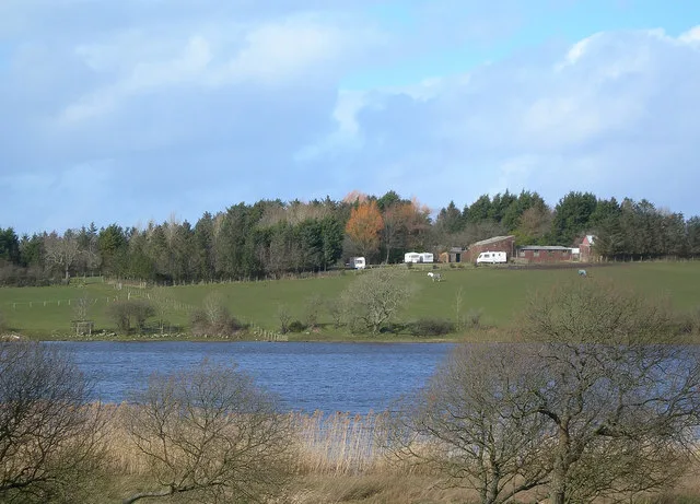
Martnaham Loch in East Ayrshire
Martnaham Loch in East Ayrshire is a body of water. Ⓦ.
- Nature
- body of water
Bus stops
Colleges
Newsagent's
Fast food restaurants
Post offices
Pharmacy
Doctor's office
Pubs
Bakeries
Convenience stores
Car repair shops
Roads nearby
Benston CrescentHollybush
2,4 km
Hollybush Terrace2,4 km
Lochfergus Crescent2,5 km
Lochfergus Drive2,6 km
Lochfergus Wynd2,6 km
Balgreen2,6 km
Lochfergus Place2,6 km
Hole Road2,6 km
Garvine Road2,7 km
Carnell Drive2,7 km
Drumsuy Court2,7 km
Dalrymple View2,7 km
Coats Place2,7 km
Douglas Brown Place2,7 km
Hamilton Place2,8 km
Douglas Road2,8 km
Fergus Way2,8 km
Ramseyston Avenue2,8 km
Barngore Drive2,8 km
Martnaham Drive2,8 km
Laighpark Court2,9 km
Laighpark Road2,9 km
Gadgirth Court2,9 km
Burgoyne Drive2,9 km
Laighpark View2,9 km
Ayr RoadAyr Rd at Kingscroft Rd, Jennifer's Beauty Salon, Sainsbury's, Ayr Rd/Marchfield Rd, Lilybank Road, Waterloo Road, Ayr Rd before Mansfield Rd, Brandon Gardens, Premier Toll, Toll Pharmacy, Ayr Rd/Pleasantfield Rd, Top Knots & Tails, Headstart, Bon Amis, Top Cut, Ayr Rd before Crandleyhill Rd, Graham Legget, Sunseekers, Jeri Richardson, Coylton
3,0 km
Barclaugh Drive3,0 km
Craigs Road3,1 km
Abandoned railways nearby
Coylton Branch1,2 km
Body of waters nearby
Snipe Loch650 m
Buildings nearby
Joppa Telephone Exchange2,8 km
Hollybush House2,8 km
Cafés nearby
Me's3,0 km
Convenience stores nearby
Spar3,0 km
Doctor's practice nearby
Coylton Health Clinic2,7 km
Farmyards nearby
Benston1,4 km
Raithhill2,0 km
Highpark2,1 km
Hole2,5 km
Laighpark2,5 km
Milreoch2,6 km
Yonderton3,3 km
Fast food restaurants nearby
The Coylton Fish And Chips3,0 km
Golf courses nearby
Roodlea Golf Course2,2 km
Industrial areas nearby
Mosshill1,8 km
Skeldon Mills3,2 km
Streams nearby
Purclewan Burn2,1 km
Woodlands nearby
Potterston Wood1,8 km
Milreoch Cross Wood2,9 km
| Located in | East Ayrshire, South Ayrshire |
|---|---|
| Country | United Kingdom |
 Public transport map East Ayrshire Legend
| Railway | |
| Bus | |
| Tram |
 Cycling map East Ayrshire Legend
| Cycle path | |
| Cycle lane on road | |
| Cycling on bus lane | |
| Bicycle street | |
| Cyclists allowed | |
| Cyclists allowed, good surface | |
| No cycling | |
| Cobblestones |
| Long-distance cycle route | (depending on scale) | |
| Long-distance cycle route |
 Walking map East Ayrshire Legend
| Path |
| Long-distance hiking trail | (depending on scale) | |
| Long-distance hiking trail | ||
| No pedestrians |