
Bankton House in East Lothian
Bankton House in East Lothian is a garden. Bankton House is near Johnnie Cope's Road. Ⓦ.
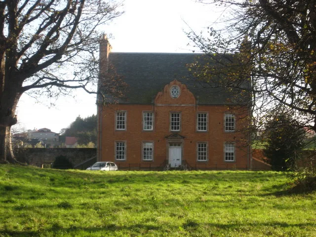
- Leisure
- garden
Bus stops
Petrol stations
Veterinary clinic
Charging stations
Supermarkets
Platforms
Stations
Fast food restaurants
Carpet shops
Window blind shops
Roads nearby
Johnnie Cope's RoadPrestonpans, East Coast Carpets, The Co-operative Food, Links Vet Group, Railway Station Journey Hub, Stone fired, East Lothian Council Journey Charger
350 m
Schaw RoadPreston Lodge, Preston Lodge High School, Gardiner Crescent
450 m
Brickworks Road500 m
Bankpark Grange550 m
Bankpark Brae550 m
Doo'cot PlaceJohn Hastie & Son Ltd
550 m
Station RoadDunbar, The Station Yard, Railway Station, Station Road, Company Bakery, Station Court
600 m
Gardiner Crescent600 m
Thorntree Crescent650 m
Stair Park650 m
Roupin' StairsJET
650 m
Birsley Brae650 m
Preston RoadNorthfield House, Preston, The Glebe, Health Centre, Polwarth Terrace
650 m
Polson Gardens700 m
Mid RoadForth Blinds
700 m
Polwarth TerracePolwarth Terrace
700 m
Hawthorn RoadBankton Pharmacy, Hawthorn Road Shops
700 m
Preston Cross Cottages700 m
Edinburgh RoadPolson Gardens, Polson Park, Preston Links, East Lorimer Place, School Lane, The Studio, Cockenzie News, D.D.s Garage, West Barns, School Brae, Caravan Park, Old Police Station, East Links Family Park, Maitland Park Road, Edinburgh Road, Riding of the Marches, Memory and Reflection, Links, Power Station, Standing Stone, The Brig Inn, Inn
700 m
Old Post Road750 m
Preston TerraceBankton Terrace
750 m
Turret Gardens750 m
Preston Avenue750 m
Gardiner Road750 m
West Loan Court750 m
Robert De Quincy Place750 m
Park ViewThe Olde Village Shop
800 m
East Loan800 m
Laburnum Arch Court800 m
South Crescent800 m
Buildings nearby
Pavilion550 m
Preston Cross600 m
Preston Tower700 m
Preston Tower Doocot800 m
Commercial buildings nearby
Northfield Retail Centre450 m
Community centres nearby
Prestonpans Community Centre700 m
Convenience stores nearby
Spar550 m
Disused railways nearby
Prestonlinks Colliery Siding750 m
Gardens nearby
Preston Tower Gardens750 m
Houses nearby
East House700 m
Sea-Far700 m
Industrial areas nearby
Mid Road Industrial Estate750 m
Parks nearby
Polson Public Park700 m
Railway lines nearby
East Coast Main Line400 m
Razed railways nearby
Prestonpans to Tranent Branch500 m
Recreation grounds nearby
Meadowmill Sports Centre650 m
Sports centres nearby
The Mercat Gait Centre550 m
Castle Park Bowling Club850 m
Sports pitches nearby
Preston Village Cricket Club450 m
| Heritage designation | category B listed building |
|---|---|
| Located in | East Lothian, Tranent |
| Country | United Kingdom |
 Public transport map East Lothian Legend
| Railway | |
| Bus | |
| Tram |
 Cycling map East Lothian Legend
| Cycle path | |
| Cycle lane on road | |
| Cycling on bus lane | |
| Bicycle street | |
| Cyclists allowed | |
| Cyclists allowed, good surface | |
| No cycling | |
| Cobblestones |
| Long-distance cycle route | (depending on scale) | |
| Long-distance cycle route |
 Walking map East Lothian Legend
| Path |
| Long-distance hiking trail | (depending on scale) | |
| Long-distance hiking trail | ||
| No pedestrians |