
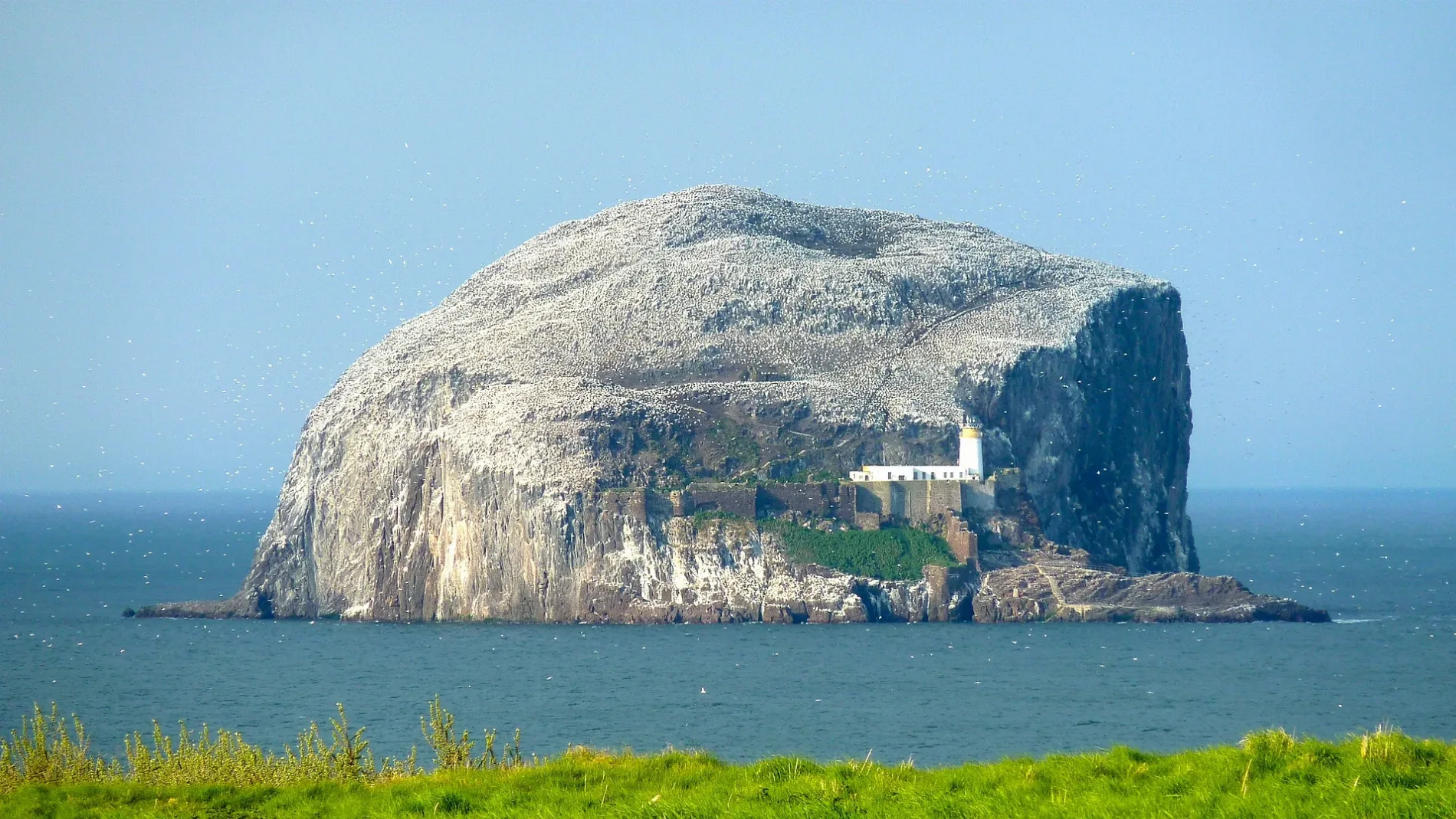
Bass Rock in East Lothian
Bass Rock in East Lothian is a Coastline. Bass Rock is also known as The Bass. Ⓦ.
- Alternative Name
- The Bass
- Nature
- coastline
Image
Tourist information offices
Bus stops
Roads nearby
Bass Rock ViewMay View
3,5 km
Rhodes HoldingsRhodes Holdings
4,1 km
Haugh Road4,3 km
Lime Grove4,5 km
Tantallon RoadTesco, Limegrove, Lime Grove Sculpture, North Berwick Bus Depot, Bus Depot, Tantallon Caravan Park, Rhodes Holdings
4,6 km
McLeod Green4,6 km
White Tees4,6 km
Rhodes Park4,6 km
Hobens Drive4,7 km
Anderson Fairway4,7 km
Ben Sayers Park4,8 km
Nature nearby
Saddle Rock2,4 km
Tapped Rock2,5 km
Great Car2,7 km
Ragged Rock2,9 km
Daisy Island3,6 km
Bare rocks nearby
Horseshoe Point3,1 km
Parton Craig4,0 km
Milsey Rock4,5 km
Beaches nearby
Quarrel Sands3,2 km
Buildings nearby
Dovecot2,7 km
Visitor's Centre2,8 km
Blackdykes4,3 km
Cafés nearby
Drift3,0 km
Campsite nearby
Tantallon Caravan & Camping Park4,4 km
Chapels nearby
St Baldred's Chapel300 m
Farmyards nearby
Castleton2,9 km
Auldhame3,3 km
Scoughall4,4 km
Blackdykes Farm4,5 km
New Mains4,8 km
Gardens nearby
Lime Grove Community Garden4,4 km
Golf courses nearby
Glen Golf Club3,2 km
Grass nearby
Outer close2,7 km
Residential areas nearby
New Mains Cottages4,6 km
Residential buildings nearby
The Pillars3,1 km
Rocks nearby
Podlie Craig2,4 km
Whale Rock2,5 km
Solan Craig2,8 km
Ruins nearby
Gun Tower2,7 km
Streams nearby
Pilmuir Burn4,0 km
Terraced houses nearby
Blackdykes Cottages4,3 km
Woodlands nearby
Crow Wood3,5 km
The Roundel3,6 km
Halfland Strip3,7 km
Blackdykes Strip4,5 km
The Glen4,6 km
Other nearby
Main ditch2,6 km
Outer ditch2,7 km
| Area | 0.1 km² |
|---|---|
| Elevation | 107 m |
| Located in | East Lothian, North Berwick, Whitekirk and Tyninghame |
| Country | United Kingdom |
| Body of water | Firth of Forth |
| Population | 0 |
| Described by source | Brockhaus and Efron Encyclopedic Dictionary, The Nuttall Encyclopædia, Encyclopædia Britannica 11th edition, The Encyclopedia Americana |
 Public transport map East Lothian Legend
| Railway | |
| Bus | |
| Tram |
 Cycling map East Lothian Legend
| Cycle path | |
| Cycle lane on road | |
| Cycling on bus lane | |
| Bicycle street | |
| Cyclists allowed | |
| Cyclists allowed, good surface | |
| No cycling | |
| Cobblestones |
| Long-distance cycle route | (depending on scale) | |
| Long-distance cycle route |
 Walking map East Lothian Legend
| Path |
| Long-distance hiking trail | (depending on scale) | |
| Long-distance hiking trail | ||
| No pedestrians |