
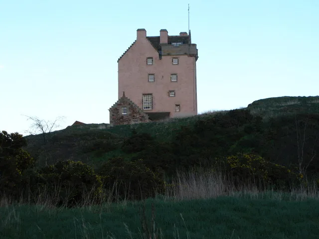
Fenton Tower in East Lothian
Fenton Tower in East Lothian is a castle. Fenton Tower is also known as Kingston, Fenton Tower. Fenton Tower is near Whitecross Bow. Ⓦ.
- Building Type
- building
Image
Restaurants
Bus stops
Roads nearby
Path to lake1,6 km
Lauder Rambling2,0 km
Haddington RoadLevenhall, Moir Crescent, The Veg Shed, Station Road, East Linton Surgery, Torness Motors, Veterinary Surgery, Kingston, Congalton Toll, Congalton, Orchardfield, Goshen (Haddington Road), Sports Centre Bus Stop, High School, Ballencrief Steadings, Ballencrieff Crossroads, East Fortune Sunday Market, Merryhatton Garden Centre, Merryhatton Nurseries, Kingston School, Harperdean, West Garleton, West Garlton, The Steading Caravan Park
2,1 km
Whitecross Bow2,1 km
Eeles Mount2,1 km
Sim Forth2,1 km
Tweedie Place2,2 km
Meikleham Nook2,2 km
Heriot Riding2,2 km
Douglas Marches2,2 km
Grieve Turn2,2 km
Farquharson Rest2,2 km
Gilsland Grange2,2 km
Stevenson Walk2,2 km
Macintyre Park2,3 km
Richardson Crescent2,3 km
Marr Way2,4 km
Milroy Avenue2,4 km
Wotherspoon Green2,4 km
Pilgrims Way2,4 km
Millar Gardens2,4 km
Dall Hollow2,4 km
Green Apron Park2,5 km
Gasworks Lane2,5 km
Marly Green2,5 km
Moffat Place2,6 km
Body of waters nearby
The Whisky Bottle2,0 km
john muir way pond2,1 km
Buildings nearby
Kingston House550 m
Kingston Cottages1,0 km
Pilmar Smith Pavilion2,4 km
Caravan site nearby
Gilsland Caravan Park1,9 km
Station Park Caravan Site2,5 km
Cliffs nearby
Rockville Heughs1,4 km
Farm shops nearby
Brand Larder Farm Shop2,7 km
Farmyards nearby
Kingston Farm850 m
Highfield900 m
Brownrigg1,6 km
Newhouse1,7 km
Congalton Gardens2,0 km
Grass nearby
The GreenSmithy
2,5 km
Houses nearby
Rockville Lodge1,6 km
Playgrounds nearby
Mains Farm playpark1,9 km
Railway lines nearby
North Berwick Line2,1 km
East Coast Main Line2,4 km
Residential buildings nearby
Newhouse Farm Cottages1,7 km
The Bungalow1,8 km
Streams nearby
Mill Burn2,0 km
Peffer Burn2,4 km
| Heritage designation | category A listed building |
|---|---|
| Located in | East Lothian, North Berwick |
| Country | United Kingdom |
 Public transport map East Lothian Legend
| Railway | |
| Bus | |
| Tram |
 Cycling map East Lothian Legend
| Cycle path | |
| Cycle lane on road | |
| Cycling on bus lane | |
| Bicycle street | |
| Cyclists allowed | |
| Cyclists allowed, good surface | |
| No cycling | |
| Cobblestones |
| Long-distance cycle route | (depending on scale) | |
| Long-distance cycle route |
 Walking map East Lothian Legend
| Path |
| Long-distance hiking trail | (depending on scale) | |
| Long-distance hiking trail | ||
| No pedestrians |