
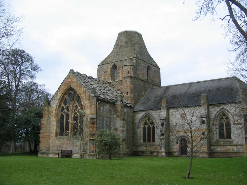
Seton Collegiate Church in East Lothian
Seton Collegiate Church in East Lothian is a historic church. Seton Collegiate Church is also known as Seton Chapel. Seton Collegiate Church is near The Belfry. Ⓦ.
- Building Type
- building
Image
Dentist
Bus stops
Roads nearby
Roxburgh Court450 m
Gleneagles450 m
The Belfry500 m
Roxburgh Place500 m
Fishergate RoadSeton East, Seton
500 m
Luftness550 m
Seton Court550 m
Royal Musselburgh Place550 m
Wentworth550 m
Royal Musselburgh Court600 m
Long CraigsSeton Wynd, Forth Wynd
600 m
Kingsbarns600 m
Muirfield650 m
St Andrews650 m
Forth Wynd650 m
Kilspindie650 m
Turnberry650 m
Seton View700 m
Seton Wynd700 m
The Glen700 m
Blairgowrie700 m
Forth Grove750 m
Gullane750 m
Forth View750 m
Troon750 m
Archerfield750 m
Seton SteadingMap of Seton Mains
800 m
Links Place800 m
Links RoadRoad End, Longniddry, Longniddry Post Office, Co-op Food, Fishers Road, Castle Terrace, Post Office, Harbour, Cockenzie Post Office, Well Pharmacy, East Coast Blooms, The Wemys Hotel, Ocean Side East, Links Road Dental Practice, Belle, Z & S Choudhry, Ramage, K&L Hair, Port Seton, Leith Coat of Arms, Links View
800 m
Forth Court800 m
Aberlady800 m
Links View800 m
Castle Walk800 m
Carnoustie Court850 m
The PaddockWhitekirk
850 m
Carnoustie Place850 m
Body of waters nearby
Seton Sands Fishing Lake400 m
Princes Loch900 m
Buildings nearby
Eagle's Lodge400 m
Seton Sands Main Facilities800 m
Caravan site nearby
Seton Sands750 m
Chalet nearby
Port Seton Holidays - Number Four450 m
Gardens nearby
Seton Castle150 m
Golf courses nearby
Seton Sands 9 Hole Golf Course500 m
Huts nearby
Golf Pavillion450 m
Parks nearby
The Seton Garden250 m
Railway lines nearby
East Coast Main Line250 m
Residential areas nearby
Seton Mains800 m
Sports centres nearby
Sports Activity Area700 m
| Heritage designation | category A listed building, scheduled monument |
|---|---|
| Located in | East Lothian, Tranent |
| Country | United Kingdom |
 Public transport map East Lothian Legend
| Railway | |
| Bus | |
| Tram |
 Cycling map East Lothian Legend
| Cycle path | |
| Cycle lane on road | |
| Cycling on bus lane | |
| Bicycle street | |
| Cyclists allowed | |
| Cyclists allowed, good surface | |
| No cycling | |
| Cobblestones |
| Long-distance cycle route | (depending on scale) | |
| Long-distance cycle route |
 Walking map East Lothian Legend
| Path |
| Long-distance hiking trail | (depending on scale) | |
| Long-distance hiking trail | ||
| No pedestrians |