
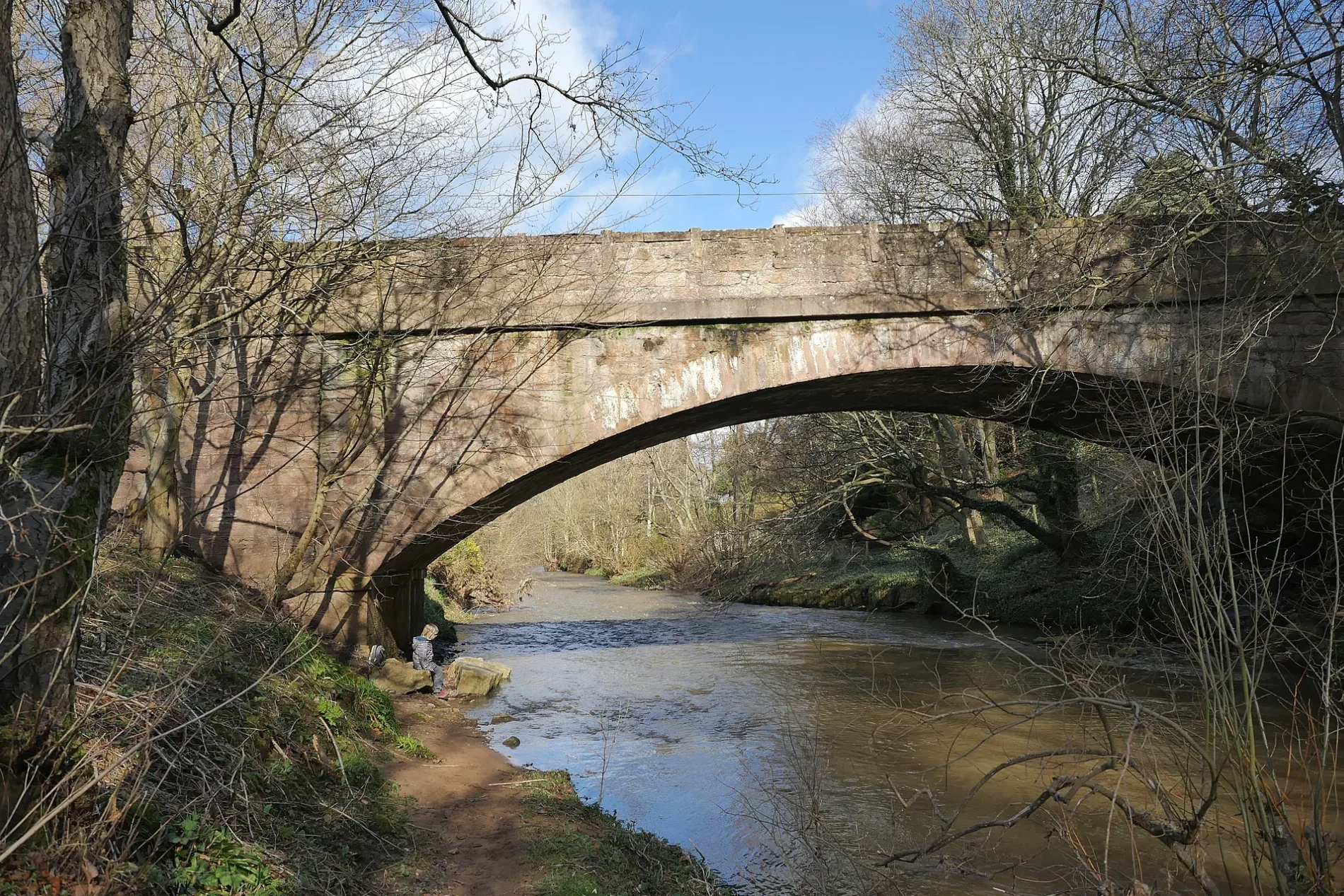
Spilmersford Bridge in East Lothian
Spilmersford Bridge in East Lothian is a single-lane, asphalted, unlit secondary road. It runs in an east-west direction and ends in a cul-de-sac. This road is part of the mountain bike route "Capital Trail".
- Road Type
- secondary road
- Lanes
- 1
- Speed Limit
- 60 mph
- Route
- east-west
Image
Convenience stores
Bus stops
Roads nearby
LimekilnsSpilmersford Mains
650 m
Tyne Park800 m
Spilmersford View800 m
VinefieldsVinefields
950 m
Millway950 m
Scholars CourtOld Smiddy Inn
1,1 km
The GreenSmithy
1,1 km
Park ViewThe Olde Village Shop
1,2 km
Smiddy Court1,3 km
The Glebe1,4 km
Lamberton Court1,7 km
Wester Tyne BraePringles Place
1,7 km
Main StreetFletcher Hall, East Saltoun Village Hall, Longniddry Inn, Goblin Ha`, Goblin Ha', The Goblin Ha, War Memorial, Joe's Kitchen, Tyninghame, Tyninghame Smithy, East Saltoun, Byre Court, The Village Store, The Bothy, Goose Green, Gannet's Deli, Cross, Ormiston Post Office, Maggie's Tea Room, Gullane, Maule Terrace, Lammermuir Court, Broadgait, Muirfield Park, Cherish Vintage Tearoom and Emporium, Ormiston, Main Street, Longniddry Station, The Filling Station, Longniddry Village Shop
1,8 km
Wester Tyne Place1,8 km
Pringles Place1,9 km
Pencaitland Railway WalkPencaitland Railway Walk, Station House, Kiloran, Rosearista Coffee Shop
1,9 km
West Crescent2,0 km
Burnett Crescent2,1 km
Buildings nearby
Saltoun Dovecot550 m
Saltoun Hall600 m
Saltoun House800 m
Pencaitland Telephone Exchange1,2 km
Tyneholm House1,3 km
The Carriage House1,5 km
Tyneholm Cottages1,7 km
Car repair shops nearby
East Saltoun Garage2,1 km
Community centres nearby
Boggs Community Hall1,9 km
Farmlands nearby
No 401,1 km
no 391,2 km
No 381,4 km
Farmyards nearby
Spilmersford Mains650 m
Saltoun Home Farm650 m
Middlemains1,1 km
Nisbet1,2 km
No 331,3 km
No 351,4 km
Greenhead1,6 km
Herdmanston Mains1,8 km
Jerusalem Farm2,2 km
Forests nearby
Strawberry Woods1,9 km
Gardens nearby
Walled Garden1,2 km
Places of worship nearby
Herdmanston Chapel1,5 km
Pencaitland Parish Church1,6 km
East Saltoun Parish Church1,9 km
Pubs nearby
Winton Arms1,3 km
Rivers nearby
Tyne Water1,2 km
Birns Water1,7 km
Sports pitches nearby
Winton Bowling Club1,1 km
Streams nearby
Cock Burn1,6 km
| Heritage designation | category C listed building |
|---|---|
| Located in | East Lothian, Saltoun |
| Country | United Kingdom |
| Crosses | River Tyne |
| Carries thoroughfare | B6355 road |
 Public transport map East Lothian Legend
| Railway | |
| Bus | |
| Tram |
 Cycling map East Lothian Legend
| Cycle path | |
| Cycle lane on road | |
| Cycling on bus lane | |
| Bicycle street | |
| Cyclists allowed | |
| Cyclists allowed, good surface | |
| No cycling | |
| Cobblestones |
| Long-distance cycle route | (depending on scale) | |
| Long-distance cycle route |
 Walking map East Lothian Legend
| Path |
| Long-distance hiking trail | (depending on scale) | |
| Long-distance hiking trail | ||
| No pedestrians |