
Scotland's Secret Bunker in Fife
Scotland's Secret Bunker in Fife is an attraction (KY16 8QH). Scotland's Secret Bunker is also known as Anstruther nuclear bunker. Scotland's Secret Bunker is near Pitkerie Lane. Ⓦ.
- Postal Code
- KY16 8QH
- Land Use
- grass
- Tourism
- attraction
- Website
- https://secretbunker.co.uk/
- Wheelchair Access
- no
Image
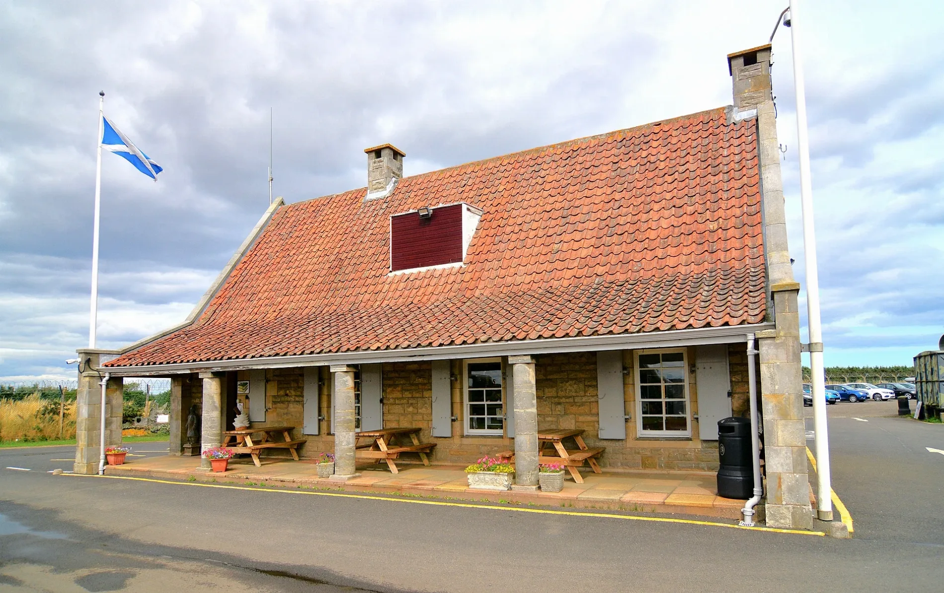
Roads nearby
Pitkerie Lane2,6 km
Station RoadSt Andrews Bus Station, St Andrews Bus Station (Stance 1), St Andrews Bus Station (Stance 2), St Andrews Bus Station (Stance 3), St Andrews Bus Station (Stance 4), Bowhill Club, School Lane, KeyStore, Cupar, Cupar Railway Station (opp.), Cupar Railway Station (adj.), Cupar Railway Station (Car Park), Cupar Heritage Centre, Leuchars, ScotRail, Springfield, Kincardine Senior Citizens Centre, Debbie's Takeaway, Thornton North Junction, Cowdenbeath, Central Bar, Kincardine Level Crossing, Lochgelly High School, Station Inn, Leuchars Station Road, The Kings, War Memorial, Cross Church, North Road, Muirton Terrace, Cardenden, Orebank Road, Kirk Andrews, Tony's Fish Bar, Grafters Grub, King Kebab & Pizza House, Cardenden Community Shop, Caspian, Vip Traditional Turkish Barber, The Salon, Beautello, Revive, Gibson's Barber Shop, John Gilfillan Funeral Directors, Bubbles Hand Carwash, Gammie Place, Kingsbarns, Glen Moriston Drive, Stance 5, Hillview, Nisa, Inzievar Primary School, Blairwood Cottages, Montgomery's Quality Butchers, Cut & Style, Oakley Café, Garden Bar, True Colours, Giddy Gannet, Railway Station, High School, Leuchars Junction, Sheila's Dog & Cat Beautician, Colin Sneddon Funeral Directors, The Card Shop, Deals on Reels, Diamonds Bar & Grill, Lilly's Cafe, Lochgelly Centre, Hugh Place, Launcherhead Road, St Patricks Primary, Lochgelly, Leuchars Rail Station
3,3 km
Carvenom RoadCarnenom
3,6 km
Body of waters nearby
Balmonth Reservoir3,5 km
Buildings nearby
Frithfield Farm Cottage East1,7 km
Frithfield Farm Cottage West2,0 km
Bunkers nearby
Troy Wood, Regional Government, North Zone Headquarters150 m
Farmyards nearby
Airdrie550 m
Muirhead900 m
Carhurly1,0 km
Hilleraye1,1 km
Toldrie1,4 km
Burnbrae1,6 km
Kippo1,7 km
Lochton1,7 km
Swinkie1,8 km
Frithfield1,9 km
Leys2,0 km
North Quarter2,4 km
Cabbagehall2,4 km
Summerfield2,7 km
Drumrack2,7 km
Bonerbo2,8 km
West Newhall3,0 km
Backfields3,0 km
Balkaithly3,1 km
Balhouffie3,1 km
East Pitkierie3,1 km
Forests nearby
Pitkerie Wood2,6 km
Houses nearby
Hillraye Farm1,1 km
West Pitcorthie2,0 km
Places of worship nearby
Dunino Parish Church3,5 km
Residential areas nearby
Airdrie Farm Cottages650 m
Airdrie Lodge1,7 km
Blacklaws Steading2,6 km
Blacklaws2,6 km
Ribbonfield2,6 km
Rivers nearby
Kenly Water3,7 km
Streams nearby
Kippo Burn1,0 km
Carhurly Burn1,3 km
Kilduncan Burn2,5 km
Kilrenny Burn2,8 km
Millpark Burn3,3 km
Denett Burn3,3 km
Balmonth Burn3,5 km
Woodlands nearby
Kippo Plantation1,7 km
Laverlock Law1,8 km
Bonerbo Wood2,9 km
Innergellie Wood3,3 km
| Inception | 1953 |
|---|---|
| Located in | Fife, Kilrenny |
| Country | United Kingdom |
| Described by source | Subterranea Britannica, Subterranea |
| Part of | ROTOR, Regional Seats of Government |
 Public transport map Fife Legend
| Railway | |
| Bus | |
| Tram |
 Cycling map Fife Legend
| Cycle path | |
| Cycle lane on road | |
| Cycling on bus lane | |
| Bicycle street | |
| Cyclists allowed | |
| Cyclists allowed, good surface | |
| No cycling | |
| Cobblestones |
| Long-distance cycle route | (depending on scale) | |
| Long-distance cycle route |
 Walking map Fife Legend
| Path |
| Long-distance hiking trail | (depending on scale) | |
| Long-distance hiking trail | ||
| No pedestrians |